Port Hope Simpson
| Port Hope Simpson | ||
|---|---|---|
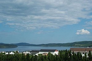
 View across Port Hope Simpson to Alexis Bay |
||
| Location in Newfoundland and Labrador | ||
|
|
||
| State : |
|
|
| Province : | Newfoundland and Labrador | |
| Region: | Census Division No. 10 | |
| Coordinates : | 52 ° 33 ′ N , 56 ° 18 ′ W | |
| Height : | 10 m | |
| Area : | 32.52 km² | |
| Residents : | 412 (as of 2016) | |
| Population density : | 12.7 inhabitants / km² | |
Port Hope Simpson is a municipality ( town ) in the Canadian province of Newfoundland and Labrador . Port Hope Simpson was founded in 1932. The parish was named after John Hope Simpson , a British politician and member of the Dominion Newfoundland government between 1934 and 1936.
location
The community is located on the south shore of Alexis Bay , an elongated narrow bay over 40 km from the sea in southeast Labrador .
Port Hope Simpson has a small airfield ( IATA : YHA). The Trans-Labrador Highway passes Port Hope Simpson and crosses Alexis Bay. There is also a ferry connection to William's Harbor, 35 km further east .
population
In the 2016 census, the community had a population of 412. Five years earlier it was 441. Thus, the population has decreased in recent years. The population consists mainly of Métis .
Web links
- Port Hope Simpson at Natural Resources Canada
Individual evidence
- ↑ a b c Port Hope Simpson, Census 2016 . Statistics Canada. Accessed December 1, 2018.
