Puente de la Integración de Acre
Coordinates: 10 ° 56 ′ 29 ″ S , 69 ° 34 ′ 37 ″ W.
| Puente de la Integración de Acre | ||
|---|---|---|
| The Puente de la Integración de Acre | ||
| use | Road traffic | |
| Crossing of | Rio Acre | |
| place |
Iñapari , Peru Assis Brasil , Brazil San Pedro de Bolpebra Bolivia |
|
| overall length | 240 meters | |
| start of building | 2004 | |
| opening | 2006 | |
| location | ||
|
|
||
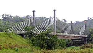
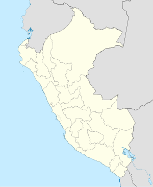
The Puente de la Integración de Acre (in Portuguese Ponte da Integração ) is a bridge over the Rio Acre on the border between Peru and Brazil , over which the Carretera Transoceánica leads. It is located near the border triangle Peru-Brazil-Bolivia. The closest cities are Iñapari in Peru, Assis Brasil in Brazil and San Pedro de Bolpebra in Bolivia.
Construction of the bridge began in August 2004 and totaled over $ 10 million. In January 2006 the bridge was inaugurated by Presidents Alejandro Toledo and Luiz Inácio Lula da Silva .
Web links
Commons : Ponte Internacional Brasil e Peru - Collection of images
Individual evidence
- ^ Puente une a Perú y Brasil. In: La República. January 21, 2006, Retrieved April 14, 2019 (Spanish).


