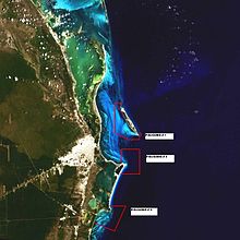
Punta Nizuc
|
Costa Occidental de Isla Mujeres, Punta Cancun y Punta Nizuc
|
||
| location |
|
|
| surface | 8,673.06 ha (of which 0.61 ha land area) | |
| Geographical location | 21 ° 1 ' N , 86 ° 46' W | |
|
|
||
| Setup date | July 19, 1996 | |
Punta Nizuc in the Mexican state of Quintana Roo is a sandy promontory at the southernmost end of Isla Cancun .
location
The area is part of the main reef that runs parallel to the coastline on the Yucatán Peninsula . It is home to numerous coral formations and has been part of the Costa Occidental de Isla Mujeres, Punta Cancún y Punta Nizuc National Park since 1996 .
Puntas
On the Yucatán Peninsula, the term Punta is used to denote formations that are connected to the coastline.
art
- La Jardinera del la Esperanza (The Garden of Hope) , in 4 m water depth in front of Punta Nizuc, underwater sculpture by Jason deCaires Taylor
literature
- Yucatán en el tiempo . Enciclopedia Alfabética. México 1998. ISBN 970-9071-04-1
Individual evidence
- ↑ Ficha SIMEC | Comisión Nacional de Áreas Naturales Protegidas | Gobierno | gob.mx. Retrieved October 1, 2018 .
- ↑ Ficha SIMEC | Comisión Nacional de Áreas Naturales Protegidas | Gobierno | gob.mx. Retrieved October 1, 2018 .

