Quarterdeck Ridge
| Quarterdeck Ridge | ||
|---|---|---|
|
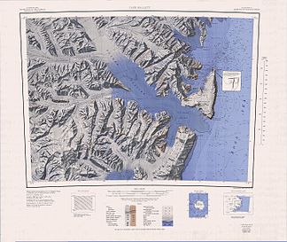
Topographic map of the Hallett Peninsula (center right) with Quarterdeck Ridge |
||
| Highest peak | Mount Geoffrey Markham ( 1770 m ) | |
| location | Victoria Land , East Antarctica | |
| part of | Transantarctic Mountains | |
|
|
||
| Coordinates | 72 ° 27 ′ S , 170 ° 16 ′ E | |
Quarterdeck Ridge (English for Achterdeckgrat is) an undulating and icy ridge on the Borchgrevink Coast of the East Antarctic Victoria Land . It rises in a north-south orientation immediately west of the Cotter cliffs on the Hallett Peninsula .
Scientists from a 1957 to 1958 campaign as part of the New Zealand Geological Survey Antarctic Expedition named it because it reminded them of the aft deck of a ship when they inspected it .
Web links
- Quarterdeck Ridge in the Geographic Names Information System of the United States Geological Survey (English)
- Quarterdeck Ridge on geographic.org (English)

