Ecological Reserve of the Matamec
|
Ecological Reserve of the Matamec
|
||
| location | Sept-Îles , Quebec, Canada | |
| surface | 186 km² | |
| WDPA ID | 23119 | |
| Geographical location | 50 ° 22 ' N , 65 ° 54' W | |
|
|
||
| Setup date | 1995 | |
| administration | MDDEP | |
The Réserve écologique de la Matamec is a 186 km² protected area in the Canadian province of Québec , which represents an ecoregion that is typical of the Côte-Nord region . The government has remained open to expanding the protected area to an area of 546 km².
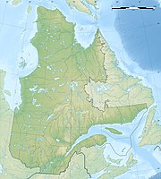
It borders the northern bank of the Saint Lawrence River about 25 km east of Sept-Îles and includes the area around the eponymous Lac Matamec .
In the south of the reserve are the oldest rocks from ancient times. They are made of gneiss and granite . The area can be subdivided into the coastal fringes, the hilly surrounding landscape and the Laurentine plateau from south to north. The former consists of deposits from the time when the Goldthwait Sea retreated. The hinterland is a result of the ice ages , which is mainly reflected in lakes and a sandy landscape. This is where the forest stands are most dense, while on the coast they are more threatened by settlement and mining, but also by erosion. In the north, the rocky character and the more extreme weather situation have an adverse effect on dense forests. Firs, spruces and aspens are predominant. There are numerous raised bogs ; the less nutrient-poor are called bogs , and the more mineral-rich fens .
The number of vascular plants is estimated at 325, plus more than 100 mosses and lichens. About 25 species find their northernmost range here.
Mammals include otters, foxes, muskrats, black bears, moose and beavers. Salmon and brook trout are protected here, with the reserve expressly serving the conservation of Atlantic salmon .
Web links
- Réserve écologique de la Matamec , government website
