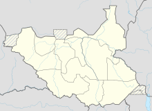
Raja (South Sudan)
Raja ( Arabic راجا Radscha , DMG Rāǧā , alternative spelling Raga ) is a small town in South Sudan . Since 2015 it has been the capital of the newly founded state of Lol .
The widespread spelling raga despite the pronunciation “rajah” is due to the fact that Sudanese place names were initially transferred into the Latin script using an Egyptian transcription system that is adapted to the Egyptian-Arabic pronunciation.
population
Raja is located in the area of various smaller ethnic groups that are grouped together under the name Fertit and are influenced by Arabic and Islamic to different degrees.
According to the 1973 census, Raja had 2,446 inhabitants, in 1983 this figure was 3377. In 2005, according to the International Rescue Committee, 18,970 people lived in Raja.
history
In 1906 Raja became the capital of the Western District of Bahr al-Ghazal in the Anglo-Egyptian Sudan . With the reorganization of the administrative structure, it was reduced to a police post in 1936, but again in 1941 as the district capital.
As part of the Southern Policy from 1930 to 1946, which tried to curb the Arab-Islamic influence from northern Sudan in South Sudan, various ethnic groups that were assigned to the south were resettled on the road from Wau via Raja to Boro Medina in order to have northern influences revoke. The place of Raja was moved slightly and traders were banned from selling "Arab" clothing. The colonial administration also asked Catholic missionaries of the Verona Fathers to open a station nearby to counter the influence of Islam.
During the Second Civil War in South Sudan 1983-2005 Raja was for most of the time as a garrison town under the control of the Sudanese government. Because of the road connection from the north to Wau, it was of strategic importance and was also able to profit economically at times. In 1985 the SPLA rebels attacked Raja for the first time, further attacks followed in 1986 and 1987. In the course of the fighting, the ethnic groups of the Feroghe and Njagulgule were largely expelled to Raja. In 1991 the SPLA tried to penetrate into Darfur via Raja .
The heaviest fighting occurred in 2001 when the SPLA captured Raja in June and managed to keep it under control during the rainy season until October. About 30,000 people then fled north to Darfur; after the government retook Raja and the surrounding areas, tens of thousands more moved to other parts of Bahr al-Ghazal or south to the SPLA-controlled Tambura . The taking of Raja was perceived as a sign of the SPLA's strength.
In 2004, the SPLA built a road from Tambura to Deim Zubeir so that displaced people from Raja could return there directly instead of via Wau. This was to ensure that Fertit loyal to the SPLA settled back in Raja and not in Wau.
Under the South Sudanese autonomous government, the road to Aweil was repaired in 2008 , and a connection to Wau with four steel bridges was under construction in 2010.
swell
- ^ Edward Thomas: The Kafia Kingi Enclave. People, politics and history in the north-south boundary zone of western Sudan. ( Memento of the original from December 27, 2010 in the Internet Archive ) Info: The archive link was inserted automatically and has not yet been checked. Please check the original and archive link according to the instructions and then remove this notice. 2010 (PDF; 2.52 MB), p. 5.
- ↑ Page no longer available , search in web archives: Sudan: The most important places with statistics on their population , In: World Gazetteer.
- ↑ Sudan Transition & Recovery Database: Raja County, Version 3, December 2005 (PDF file; 575 kB), p. 2.
- ↑ Ahmad Alawad Sikainga: The western Bahr al-Ghazal under British rule, 1898-1956. Ohio University Center for International Studies, 1991, ISBN 0-89680-161-6 , pp. 26, 89f., 95.
- ^ Edward Thomas: The Kafia Kingi Enclave. People ... 2010, pp. 61-68, 85-87.
- ^ Robert O. Collins: The Southern Sudan in Historical Perspective. New Jersey 2006, ISBN 1-4128-0585-6 , p. 54. (First edition 1975)
- ^ Edward Thomas: The Kafia Kingi Enclave. People ... 2010, pp. 90-93, 117.
- ^ Edward Thomas: The Kafia Kingi Enclave. People ... 2010, pp. 80, 89f., 116f., 160, 164.
- ^ Edward Thomas: The Kafia Kingi Enclave. People ... 2010, pp. 80, 93f.
- ^ Douglas H. Johnson: The Root Causes of Sudan's Civil Wars. James Currey Publishers, 2003, ISBN 0-85255-392-7 , pp. 108, 217f.
- ^ WFP back helping war-affected in Raga. In: IRIN News. April 4, 2002.
- ↑ Special report on war-related displacement from Raga. In: IRIN News. January 22, 2002.
- ^ Charles Omondi: Why the US is giving Sudan a fresh look. In: The Nation. October 23, 2003.
- ^ Edward Thomas: The Kafia Kingi Enclave. People ... 2010, p. 94.
- ^ Edward Thomas: The Kafia Kingi Enclave. People ... 2010, p. 99.
Coordinates: 8 ° 28 ' N , 25 ° 41' E
