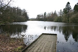
Ratherheath Tarn
| Ratherheath Tarn | ||
|---|---|---|

|
||
| The Ratherheath Tarn | ||
| Geographical location | Lake District , Cumbria , England | |
| Tributaries | no recognizable | |
| Drain | no recognizable | |
| Data | ||
| Coordinates | 54 ° 21 '24 " N , 2 ° 47' 37" W | |
|
|
||
| Altitude above sea level | 108 m ASL | |
| length | 330 m | |
| width | 150 m | |
| Maximum depth | 12 m | |
The Ratherheath Tarn is a lake in the Lake District , Cumbria , England .
The lake is west of Burneside . The lake was created artificially and has no recognizable inflow or outflow. The lake serves as a fishing pond.
See also
Web links
Commons : Ratherheath Tarn - Collection of images, videos and audio files
