
Reitscheider cross

The Reitscheider Kreuz is a crossroads in the municipality of Namborn , east of the Furschweiler district.
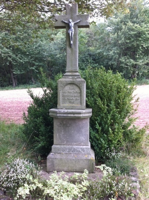
The cross made of gray stone, the bar ends of which are designed in the shape of dovetail pinnacles, has a fully plastic crucifix and stands on a three-tiered base, also made of gray stone.
Historical background
When the Franco-Prussian War broke out in 1870/71 , a threatening cattle epidemic spread in St. Wendeler Land. The Reitscheider farmers made a vow to erect a cross at the confluence of the Gehweiler Weg and the Römerstraße when the cattle disease stopped. The cross stands high above the village of Furschweiler on an ancient Celtic grave . Its inscription reads See the Lamb of God, which takes away the sin of the world .
On the location and historical significance of the location of the cross
In the course of the conquest of Gaul by Julius Caesar (58 - 51 BC), Roman legionaries also came to the Namborn area. Fighting broke out on (today) Alte Trierer Strasse. The Treverer carried their dead to the level where now riding Scheider cross at the intersection Roman road - is Gehweiler way and buried in mass graves with 30 polls, was scattered over the other ashes, and 10 minutes north from the riding Scheider Cross, according Roschberg to , at the height on the left on the path their dead . This mass grave was uncovered when a quarry was expanded.
Local researchers discovered during their research that Furschweiler was integrated into the traffic routes of the Roman Empire . For example, a Roman road from Tholey ran along the slope of the Metzelberg to Mainz . A traffic junction appears to have been at the location of the Reitscheider Cross. Another Roman road is said to have come from the Grauen Dorn ( Baltersweiler ) via Bornerhof (district Hofeld) through today's Hiemesstrasse to the Roman road Tholey – Mainz and thus reached the connecting road to Mainz.
literature
- Crosses on the wayside. In: Heimatbuch Furschweiler 1971. On behalf of the community Furschweiler edited by Johann Engel, Schulrat a. D., Baltersweiler 1971.
Web links
Individual evidence
- ↑ Heimatbuch Furschweiler: Kreuze am Wegrand , p. 132, from 1971.
- ↑ Home book of the St. Wendel district, Dr. Kolling, from 1967/68.
Coordinates: 49 ° 31 ′ 6 ″ N , 7 ° 11 ′ 7 ″ E