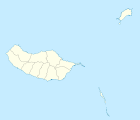
Ribeira da Janela
| Ribeira da Janela | ||||||
|---|---|---|---|---|---|---|
|
||||||
| Basic data | ||||||
| Autonomous Region : | Madeira | |||||
| Concelho : | Porto Moniz | |||||
| Coordinates : | 32 ° 51 ′ N , 17 ° 9 ′ W | |||||
| Residents: | 228 (as of June 30, 2011) | |||||
| Surface: | 18.48 km² (as of January 1, 2010) | |||||
| Population density : | 12 inhabitants per km² | |||||
Ribeira da Janela is a Portuguese parish ( freguesia ) in the Porto Moniz district . 228 inhabitants live in it (as of June 30, 2011).
location
The small and beautiful village of Ribeira da Janela is 2 km away from Porto Moniz. It is located at the mouth of the homonymous river, which is 12 km long on the island. Due to the three rocky cliffs in front of it, the place is a popular destination.
Sweet potatoes, potatoes and grapes will be grown here. A new hydropower plant was built in 1965 to cover the electricity needs.
Individual evidence
- ↑ a b www.ine.pt - indicator resident population by place of residence and sex; Decennial in the database of the Instituto Nacional de Estatística
- ↑ Overview of code assignments from Freguesias on epp.eurostat.ec.europa.eu


