Richmond – San Rafael Bridge
Coordinates: 37 ° 56 '7 " N , 122 ° 26' 52" W.
| Richmond – San Rafael Bridge | ||
|---|---|---|
| Official name | John F. McCarthy Memorial Bridge | |
| use | Motor vehicles: I-580 , 4 lanes
|
|
| Crossing of | San Francisco Bay | |
| place | San Francisco | |
| construction | Double deck bridge | |
| overall length | 8851 m | |
| building-costs | $ 66 million | |
| opening | September 1, 1956 | |
| toll | 4 US $ | |
| location | ||
|
|
||
| map | ||
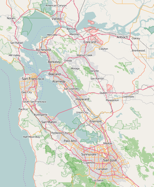
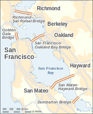
| The Richmond – San Rafael Bridge connects Richmond with San Rafael | ||
The Richmond – San Rafael Bridge (officially: John F. McCarthy Memorial Bridge) is the northeasternmost of the east-west connections over the San Francisco Bay in California , USA , it connects Richmond in the east with San Rafael in the west. It was opened in 1956.
description
The bridge measures 8.9 km. When it was built, it was one of the longest bridges in the world. The bridge crosses two dredged shipping canals, which it spans as a cantilever bridge. In order to increase the stability of the bridge against earthquakes, the middle section has been lowered. This gives the bridge the look of a roller coaster . After completion, there was disappointment with the appearance of the bridge, which was built at a relatively low cost, especially because of the structural and aesthetic elegance of the neighboring Golden Gate Bridge .
Each deck has two lanes, with the traffic going west on the top and east traffic running down. The bridge cost (around 619.8 million in today's purchasing power 66 million US $ USD ).
Coming from the east side, one passes through the port of Richmond, one of the largest ocean ports in the United States. On the west side you pass the San Quentin State Prison . There is a toll of US $ 6 going west.
history
The bridge construction was triggered by two ferry strikes in 1952, which had a major impact on transport in the bay. It was originally part of California State Route 17 , but was later incorporated into Interstate 580 . When it opened, it was the last bridge in San Francisco Bay to replace a ferry .
The bridge was rebuilt from 1999 to 2005 for US $ 540 million earthquake-proof . The bridge is an earthquake of intensity 7.4 on the Hayward Fault and 8.3 on the San Andreas Fault can survive.
Use of the third lane
The bridge is wide enough in both directions to expand it to a third lane, but the third lane is only used as a hard shoulder.
When one of the largest droughts in Marin County ruled in 1977 , a 10 km long, temporary water line was laid on the hard shoulder, which carried 30,000 m³ of water daily from Richmond to Marin to supply the 170,000 residents. In 1978 this line was dismantled.
After the Loma Prieta earthquake in 1989, in which the Bay Bridge collapsed, Caltrans used the hard shoulder as a lane. Many drivers from San Francisco drove over the Golden Gate Bridge to Marin and then over the Richmond – San Rafael Bridge to get to Oakland. When the Bay Bridge was rebuilt, the third lane became the hard shoulder again.
Closings
On the morning of January 4, 2008, the bridge was closed after strong winds of 110 km / h shook the roadway. Four trucks on the lower lane and one truck on the upper lane overturned. The bridge remained closed for six hours until the wind dropped in the afternoon.
The bridge in pop culture
Jerry García , singer of the band Grateful Dead , came up with the idea for Terrapin Station when he drove over the bridge.
Individual evidence
- ↑ a b lib.berkeley.edu UC Berkeley: BRIDGING THE BAY: Bridging the Campus
- ↑ a b bata.mtc.ca.gov ( Memento of the original from April 12, 2008 in the Internet Archive ) Info: The archive link was inserted automatically and has not yet been checked. Please check the original and archive link according to the instructions and then remove this notice. Bay Area Toll Authority, Bridge Facts: Richmond – San Rafael Bridge
- ↑ marinij.com Marin Independent Journal, September 1, 2006: With little fanfare ...
- ↑ DOT California: Richmond – San Rafael Bridge ( Memento from November 5, 2009 in the Internet Archive )
- ^ Npr.org Dennis McNally, A Long Strange Trip: The Inside History of the Grateful Dead.
Web links
- With Little Fanfare ... Marin IJ article on the 50th anniversary of the bridge (English)
- Richmond-San Rafael Bridge Retrofit Completed (English)
- Caltrans Seismic Retrofit overview (English)
- Univ. of California, Berkeley: Bridging the Bay: Richmond – San Rafael Bridge (English)
- Decades of Struggle for Bicycle Access (English)
|
North (San Pablo Bay) |
Crossings of the San Francisco Bay Richmond – San Rafael Bridge |
South of Transbay Tube |


