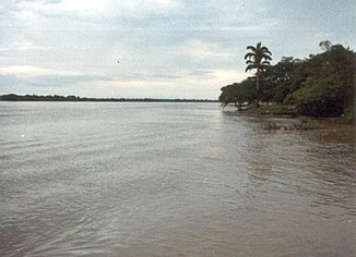
Río Apure
| Río Apure | ||
|
Río Apure |
||
| Data | ||
| location |
|
|
| River system | Orinoco | |
| Drain over | Orinoco → Atlantic Ocean | |
| Confluence of |
Río Sarare and Río Uribante in the state of Apure 7 ° 17 ′ 56 ″ N , 70 ° 41 ′ 30 ″ W |
|
| muzzle | in the state of Guárico in the Orinoco coordinates: 7 ° 37 ′ 5 ″ N , 66 ° 24 ′ 12 ″ W 7 ° 37 ′ 5 ″ N , 66 ° 24 ′ 12 ″ W.
|
|
| length | 819 km | |
| Navigable | approx. 480 km | |
The Río Apure is a river in western Venezuela . It arises from the confluence of the Río Sarare and Río Uribante in the Cordillera of Mérida and then flows east through flat land ( Llanos ) and flows into the Orinoco after about 819 kilometers . It is navigable for 480 km. Amazon dolphins , piranhas and turtles live in the river . Anacondas , capybaras and anteaters can be seen on the riverbank .
Web links
Commons : Río Apure - collection of images, videos and audio files
