Robertville Dam
| Robertville Dam | |||||||||||
|---|---|---|---|---|---|---|---|---|---|---|---|
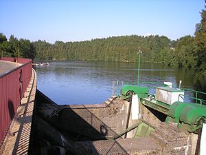
| Robertville dam with overflow | |||||||||||
|
|||||||||||
|
|
|||||||||||
| Coordinates | 50 ° 26 '45 " N , 6 ° 7' 15" E | ||||||||||
| Data on the structure | |||||||||||
| Construction time: | 1925-1929 | ||||||||||
| Height of the barrier structure : | 54.5 m | ||||||||||
| Crown length: | 182 m | ||||||||||
| Crown width: | 4 m | ||||||||||
| Base width: | 38 m | ||||||||||
| Power plant output: | 21,500,000 kWh / year | ||||||||||
| Data on the reservoir | |||||||||||
| Altitude (at congestion destination ) | 500 m OP | ||||||||||
| Water surface | 67 ha | ||||||||||
| Total storage space : | 7,676,000 m³ | ||||||||||
| Particularities: |
The Bévercé power station receives the water from a pressure tunnel |
||||||||||
| Map of the dam | |||||||||||
The Robertville dam dams the waters of the Warche. The dam and its water-hydraulic and electro-hydraulic installations were built on the basis of a state decree of the Kingdom of Belgium from 1924.
The location
The dam lies on the floor of the municipality of Weismes below Ovifat and Robertville . Reinhardstein Castle is on a hill down the Warch , 800 meters from the dam .
The construction
The construction was only started in December 1925 by the energy distribution company SERMA (later Electrabel ). The construction time was three years. During this time the dam was completed. A 4.5 kilometer long tunnel was also built during this time with a gradient of 53 meters, followed by a one kilometer pressure pipe. Here, at a height of 443 meters, there is an expansion tank that can be seen from afar, from which the water falls in a pressure pipe 100 meters deep to the Bévercé power station.
The reservoir has an area of 67 hectares and a volume of 7,676,000 cubic meters. The dam has a height of 54.50 and a length of 182 meters. The road from Robertville to Malmedy leads over the dam. The width of the dam wall at the crown is 4 meters, the width at the foot of the wall 38 meters, which means that the wall can be classified as a gravity dam . An overflow has been set up on the south bank.
The N 676 connects the districts of Robertville and Bruyères in the municipality of Weismes over the Haelen bridge. At the beginning of the lake, a single-lane bridge connects the districts of Outrewarche and Champagne.
Extensive renovation work has been taking place on the dam wall since autumn 2006 with temporary emptying of the reservoir.
Economic use
The main purpose is to supply the city of Malmedy with drinking water . Electricity is only generated sporadically in Bervercé.
The Bévercé hydropower plant has a Francis turbine with a horizontal axis. The average annual production of 21,500,000 kilowatt hours is achieved with three alternating current generators.
Tourist use
A tourist facility with a swimming pool and a campsite is located on a headland south of the center of Robertville. Next to the dam is a boat rental. Since the reservoir is used to produce drinking water, no motor boats are permitted.
The hiking trails around the reservoir are integrated into the dense network of trails in East Belgium. In 2007, the new Warche Tour hiking trail to the Bütgenbach reservoir was set up.
swell
- Website of the community of Weismes and the Robertville Advertising Committee
- Electrabel display boards on the dam


