Rocky flats
Coordinates: 39 ° 53 ′ 24 ″ N , 105 ° 12 ′ 0 ″ W.

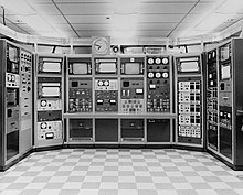
Rocky Flats was a nuclear facility of the US nuclear weapons program in the state of Colorado about 30 kilometers from Denver . Here components were manufactured nuclear weapons, especially plutonium - trigger for ignition of the incomparably more powerful hydrogen bomb , the final assembly to the Pantex Plant were delivered. Around 70,000 of these Pu cores were produced between 1953 and 1989 , with the remains of radioactive dust containing plutonium in the area.
Accidents & Contamination
On September 11, 1957 , the year of the Mayak and Windscale accidents, the most serious accident in the history of the plant occurred in Rocky Flats due to the spontaneous combustion of an encapsulated plutonium warehouse in building 771. The fire brigade tried the fire first with carbon dioxide , then with it Extinguishing water - initially in vain, the fire raged for almost four hours. It penetrated the ventilation ducts and burned a filter bank, which contaminated the vicinity of the plant. It is estimated that between 40 g to 500 g of plutonium (median 300 g) were emitted.
A similar fire occurred on May 11, 1969. Here, too, the fire started from a glove box that ate from building 776 along the boxes connected to a conveyor belt to neighboring building 777. In contrast to the fire of 1957, the air filter banks were no longer cellulose-based and therefore flammable, but made of fiberglass and largely withstood the fire. Therefore, the estimate of the plutonium emission was significantly lower: 0.14 g to 0.9 g (median 0.3 g).
A major PU contamination took place in 1968/1969 due to improper handling of liquid waste. Cooling lubricants and solvents from the production process that were contaminated with plutonium were stored in steel drums on an area under the open sky (pad 903). Around 5000 of these barrels corroded and leaked over time. The uppermost soil layers were contaminated in this way, this affected an area of approx. 2.5 hectares. Even if the barrels were removed in 1967/68, the ground was churned and radioactive dust was carried into the area by storms. In mid-1969, the area was paved to reduce wind-carried contamination. Estimates are between 25 g and 200 g plutonium (median 52 g) that ended up in the vicinity of Rocky Flats in this way.
In addition to the above-mentioned Pu exposure, the residents also deal with the solvent carbon tetrachloride , which is no longer used for degreasing components due to its toxicity and carcinogenic potential as well as its ozone damage. It is estimated that between 1,100 t and 5,400 t were released during the active period from 1953 to 1989.
Closure and dismantling
After about two years of undercover investigations by the FBI and EPA into violations of environmental protection laws, the investigators obtained a search warrant and carried out a raid on June 6, 1989 ( Operation Desert Glow , approx. 75 officers).
After that, the production of plutonium cores (e.g. for the W88 warhead ) was stopped and Rocky Flats was permanently closed in 1992. The decontamination and dismantling of the complex lasted until October 2005 and cost 7 billion US dollars. Today the area is part of the Rocky Flats National Wildlife Refuge , whereby a core area, the so-called Central Operable Unit with contamination residues in the ground, is under the supervision of the Department of Energy.
literature
- Shut down the Mühleberg campaign : three-page report on Rocky Flats; Bern 2001 ( digitized version )
- Ellen Mangione et al .: Historical Public Exposure Studies on Rocky Flats - Summary on Findings. Colorado Department of Public Health and Environment, August 1999, accessed August 18, 2019 .

