Ruppertsberg (Hallungen)
| Ruppertsberg | ||
|---|---|---|
|
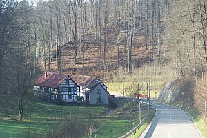
The lower mill of Heyerode, in the background the wooded northeast slope of the Ruppertsberg |
||
| height | 371.6 m above sea level NN | |
| location | Thuringia ( Germany ) | |
| Mountains | Hainich | |
| Coordinates | 51 ° 9 '1 " N , 10 ° 18' 55" E | |
|
|
||
| particularities | Desolation, landmarks | |
The Ruppertsberg has a summit height of 371.6 m above sea level. NN . It is located in the municipality of Hallungen and is the northernmost elevation in the Wartburg district in Thuringia .
The Ruppertsberg is located on the western edge of the Hainich and the border to the Südeichsfeld . In the Middle Ages there was a village on the eastern flank of the mountain - the desert of Bärenfeld. The Ruppertsberg is used for agriculture and forestry. On its northern flank there is a fishing pond with weekend houses in the west.
Individual evidence
- ↑ Official topographic maps of Thuringia 1: 10,000. Wartburgkreis, district of Gotha, district-free city of Eisenach . In: Thuringian Land Survey Office (Hrsg.): CD-ROM series Top10 . CD 2. Erfurt 1999.

