Sainoa Islands
| Sainoa Islands | ||
|---|---|---|
| Waters | Gulf of Tolo | |
| Geographical location | 3 ° 7 ′ S , 122 ° 35 ′ E | |
|
|
||
| Residents | 1690 (2010) | |
The Sainoa ( Indonesian Kepulauan Sainoa ) are an Indonesian group of islands on the coast of Sulawesi . It forms the east of the Salabangka Islands .
geography
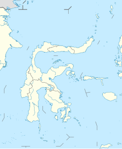
The Sainoa Islands are located on the coast of the southern tip of the province of Central Sulawesi (Sulawesi Tengah), in the Gulf of Tolo . The islands belong to the district ( Indonesian Kecematan ) Südbungku ( Indonesian Bungku Selatan ) in the administrative district ( Indonesian Kabupaten ) Morowali .
The largest island is Mitende in the east, the second largest Olohatu in the west. In between are the islets of Tukoh Bobagei , Tukoh Torohluko , Tukoh Co , Tukoh Mbosembah , Tukoh Matingga , Tukoh Kallo , Tukoh Parindang and Tukoh Palupasang . The islets of Tukoh Manyulodiana , Tukoh Keebuaya and Tukoh Ambau are located off the southeast coast of Mitende . Further out there are Tukoh Pancoh , Tukoh Piteang , Tukoh Belle , Tukoh Ngeang , Tukoh Mboanggo , Tukoh Bubulang and Tukoh Ngeatang . In the south there is Bungintende with a large offshore coral reef in the east, as there are several in the Salabangka Islands.
The place Sainoa occupies the western quarter of the island of Olohatu. The settlement of Mitende is located on the west coast of the island of the same name. The island of Bungintende is populated on the entire area.
All the islands of the Sainoa Islands belong to the administrative village ( Desa ) Sainoa in which 1021 people live (2010 census). Only Bungintende, with 669 inhabitants, has its own Desa. The Sainoa Islands have a total of 1,690 inhabitants.
Individual evidence
- ↑ a b Map of Kendari , accessed November 19, 2016.
- ↑ Penduduk Indonesia menurut desa 2010 ( Memento from March 27, 2014 in the Internet Archive ) (Indonesian; PDF; 6.0 MB), accessed on January 26, 2013.
