Salaca
| Salaca | ||
| Data | ||
| location | Livonia , Latvia | |
| River system | Salaca | |
| Source lake |
Burtnieker See 57 ° 47 ′ 0 ″ N , 25 ° 10 ′ 54 ″ E |
|
| muzzle | at Salacgrīva in the Riga Bay Coordinates: 57 ° 45 ′ 15 ″ N , 24 ° 20 ′ 35 ″ E 57 ° 45 ′ 15 ″ N , 24 ° 20 ′ 35 ″ E |
|
| Height difference | 42 m | |
| Bottom slope | 0.44 ‰ | |
| length | 95 km | |
| Drain |
MQ |
31.3 m³ / s |
|
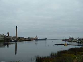
Estuary of the Salaca |
||
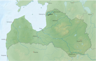
The Salaca [ˈsalat͡sa] (German: Salis ) is a river in the North Vidzeme Biosphere Reserve in northern Latvia . It flows from the Burtnieker See towards the west, where it flows into the Riga Bay at Salacgrīva (German: Salismünde ) .
Dimensions
- Length (total): 95 km
- Difference in altitude: 42 m (0.44 m / km)
- Average amount of water in the mouth area: 31.3 m³ / s
- maximum amount of water in the mouth area: 184 m³ / s
- minimum amount of water in the mouth area: 4.4 m³ / s
Cities
Like Salacgrīva at the mouth, the inland city Mazsalaca (German: Salisburg ) got its name from the river. The city of Staicele is also located on the Salaca.
Buildings
The castle Salis is named after the river.

