San Esteban (island)
| San Esteban | ||
|---|---|---|
| Gulf of California island map | ||
| Waters | Gulf of California | |
| Geographical location | 28 ° 42 ′ 6 ″ N , 112 ° 34 ′ 29 ″ W | |
|
|
||
| length | 7.4 km | |
| width | 7 km | |
| surface | 39.773 km² | |
| Highest elevation | 540 m | |
| Residents | uninhabited | |
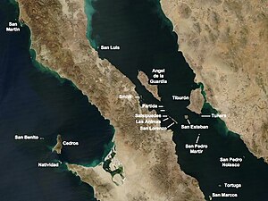
The Isla San Esteban , also Isla Turón called, is a Mexican island in the Gulf of California between Tiburón Island and the archipelago of San Lorenzo .
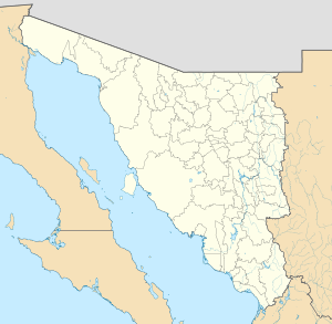
San Esteban belongs to the municipality of Hermosillo in the state of Sonora and is 39.773 km² in size. The island was formerly inhabited by a group of the Seri . In their Seri language it is called Coftéecöl / koɸˈtɛːkʷɬ / .
There are some endemic species on San Esteban such as the San Esteban chuckwalla ( Sauromalus varius ), the spiny giant chuckwalla ( Sauromalus hispidus ) and the San Esteban black iguana ( Ctenosaura conspicuosa ).
Since 2005, the island has been a UNESCO World Heritage Site along with 243 others in the Gulf of California .
swell
- Unknown island: Seri Indians, Europeans, and San Esteban Island in the Gulf of California, University of New Mexico, Albuquerque
- Mary B. Moser, Stephen A. Marlett, ed .: Comcáac quih yaza quih hant ihíip hac: Diccionario seri-español-inglés, http://lengamer.org/admin/language_folders/seri/user_uploaded_files/links/File/DiccionarioSeri2005. pdf , Universidad de Sonora y Plaza y Valdés Editores, Hermosillo, Sonora


