San Francisco Coacalco
| San Francisco Coacalco | ||
|---|---|---|
|
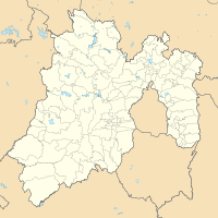
Coordinates: 19 ° 38 ′ N , 99 ° 6 ′ W San Francisco Coacalco on the map of Mexico
|
||
| Basic data | ||
| Country | Mexico | |
| State | México | |
| Municipio | Coacalco de Berriozábal | |
| Residents | 307,800 (2019) | |
| Detailed data | ||
| surface | 22.1 km² | |
| height | 2250 m | |
San Francisco Coacalco is a city in Mexico and the capital of the Municipio Coacalco de Berriozábal in the state of México . It is located in the northeast part of the state, north of the Federal District in the area of the Zona Metropolitana del Valle de México .
The name Coacalco comes from the Nahuatl language and means "place of the snake house". Coacalco was first mentioned in 1320. In the 1970s, Coacalco grew together with the ever-expanding city of Mexico City.
population
At the 2010 census, the city had a population of 277,959. The literacy (reading ability) was 99% of the population. 85.0% of the population were Catholics , 9.0% were Protestants and 5.7% had no religion.
Population development
| year | population |
|---|---|
| 1990 | 151.255 |
| 2000 | 252.291 |
| 2005 | 285,822 |
| 2010 | 277,959 |
| 2015 | 295.200 |
economy
Coacalco's economy has changed over the past thirty years. The region went from being primarily an agricultural and rural area to an urban industrial area. The municipality and the city are currently one of the most important business locations in the north of the Mexico City metropolitan area. According to Mexico's 2005 Human Development Index (HDI), Coacalco was ranked among the top 10 places to live in the country.
Individual evidence
- ↑ México (Mexico): State & Cities - Population Statistics, Maps, Charts, Weather, and Web Information. Retrieved February 8, 2020 .
- ↑ Lot 10 mejores lugares para vivir. July 30, 2008, Retrieved February 8, 2020 (Spanish).
