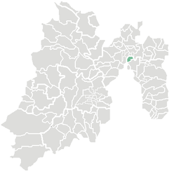
Municipio Coacalco de Berriozábal
| Coacalco de Berriozábal | ||
|---|---|---|

|
||
| Symbols | ||
|
||
| Basic data | ||
| Country | Mexico | |
| State | México | |
| Seat | San Francisco Coacalco | |
| surface | 35.2 km² | |
| Residents | 278,064 (2010) | |
| density | 7900 inhabitants per km² | |
| founding | February 12, 1862 | |
| Website | coacalco.gob.mx | |
| INEGI no. | 15020 | |
| politics | ||
| Presidente municipal | David Sánchez Isidoro | |
| Palacio Municipal | ||
Coordinates: 19 ° 38 ′ 0 ″ N , 99 ° 6 ′ 0 ″ W.
Coacalco de Berriozábal , also Coacalco for short , is a municipality in the Mexican state of México . It belongs to the Zona Metropolitana del Valle de México , the metropolitan region around Mexico City . The administrative seat and only major settlement of the municipality is the city of San Francisco Coacalco . The administrative district had 278,064 inhabitants in 2010, its area is 35.2 km² .
geography
Coacalco de Berriozábal is located in the north of the state of México, a few kilometers north of Mexico City .
The municipality borders on the municipalities Tultepec , Tultitlán , Jaltenango and Ecatepec de Morelos in the state of México as well as on the Federal District .
Web links
Commons : Coacalco de Berriozábal - Collection of images, videos and audio files
- Enciclopedia de los Municipios y Delegaciones de México: Municipio Coacalco de Berriozábal (Spanish)
- INEGI : Datos Geográficos: Municipio Coacalco de Berriozábal (Spanish; PDF)
- Official website


