Municipio Ixtapaluca
| Ixtapaluca | ||
|---|---|---|

|
||
| Symbols | ||
|
||
| Basic data | ||
| Country | Mexico | |
| State | México | |
| Seat | Ixtapaluca | |
| surface | 328.1 km² | |
| Residents | 467,361 (2010) | |
| density | 1,424.5 inhabitants per km² | |
| founding | October 16, 1820 | |
| Website | www.ixtapaluca.gob.mx | |
| INEGI no. | 15039 | |
| politics | ||
| Presidente municipal | Marisela Serrano Hernández | |
| Ixtapaluca | ||
Coordinates: 19 ° 18 ′ N , 98 ° 53 ′ W
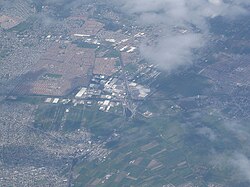
Ixtapaluca is a municipality founded in 1820 in the Mexican state of México . It belongs to the Zona Metropolitana del Valle de México , the metropolitan area around Mexico City , and has an area of 328.1 km². The seat of the municipality with 467,361 inhabitants (2010) is the city of Ixtapaluca , which is also the largest place in the municipality. Other larger towns are San Buenaventura , San Jerónimo Cuatro Vientos , San Francisco Acuautla and Jorge Jiménez Cantú .
Toponym
The name Ixtapaluca comes from Nahuatl : iztapalli means salts , and -locan means "place, place", thus roughly "place where there is salt". The original name was Iztapayucan .
geography
Ixtapaluca is located in the southeast of the state of Méxixo, about 30 km southeast of Mexico City.
The municipality of Ixtapaluca borders the municipalities Texcoco , Chicoloapan , Tlalmanalco , Chalco , Valle de Chalco Solidaridad and La Paz as well as the state of Puebla .
Attractions
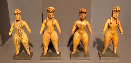
The main attraction of the municipality is the Aztec ruined city of Acozac . From the largely disappeared site of Tlapacoya come some clay figurines whose faces and body treatments may betray Olmec influences and whose age dates back to around 1500 BC. Is estimated. In 1987 another site was discovered in Tlalpizáhuac , but it has not yet been explored.
Web links
- Official website
- Enciclopedia de los Municipios y Delegaciones de México: Municipio Ixtapaluca (Spanish)
- INEGI : Datos Geográficos: Municipio Ixtapaluca (Spanish; PDF)


