Municipio Teoloyucan
| Teoloyucan | ||
|---|---|---|
| Symbols | ||
|
||
| Basic data | ||
| Country | Mexico | |
| State | México | |
| Seat | Teoloyucan | |
| surface | 53.8 km² | |
| Residents | 63,115 (2010) | |
| density | 1174 inhabitants per km² | |
| founding | 1825 | |
| Website | www.teoloyucan.gob.mx/ | |
| INEGI no. | 15091 | |
| politics | ||
| Presidente municipal | Juan Salvador Montoya Moya | |
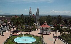
| Center of Teoloyucan | ||
Coordinates: 19 ° 45 ′ 0 ″ N , 99 ° 10 ′ 30 ″ W.
Teoloyucan is a municipality in the Mexican state of México . It belongs to the Zona Metropolitana del Valle de México , the metropolitan region around Mexico City . The seat of the municipality is the eponymous Teoloyucan . The community had 63,115 inhabitants in 2010, its area is 53.8 km² .
geography
Teoloyucan is located in the north of the state of México, about 25 km north of Mexico City at an altitude of about 2250 m . More than 70% of the community area is used for agriculture.
The municipality of Teoloyucan borders on the municipalities of Coyotepec , Zumpango , Nextlalpan , Melchor Ocampo , Cuautitlán , Cuautitlán Izcalli and Tepotzotlán .
places
The municipality of Teoloyucan comprises six towns with a total of 14,467 households. With 51,255 inhabitants by far the largest town is the main town Teoloyucan . The towns of San Bartolo , Colonia Santo Tomás and San Sebastián also have over 1,000 inhabitants, while El Ramal and Santa María Caliacac have around 500 inhabitants .
Web links
- Enciclopedia de los Municipios y Delegaciones de México: Municipio Teoloyucan (Spanish)
- INEGI : Datos Geográficos: Municipio Teoloyucan (Spanish; PDF)


