Municipio Joquicingo
| Joquicingo | ||
|---|---|---|

|
||
| Symbols | ||
|
||
| Basic data | ||
| Country | Mexico | |
| State | México | |
| Seat | Joquicingo de León Guzmán | |
| surface | 63.2 km² | |
| Residents | 12,840 (2010) | |
| density | 203.1 inhabitants per km² | |
| founding | 1826 | |
| Website | www.joquicingo.gob.mx/ | |
| INEGI no. | 15049 | |
| politics | ||
| Presidente municipal | Augusto González Pérez | |
| Joquicingo | ||
Coordinates: 19 ° 3 ′ 0 ″ N , 99 ° 31 ′ 48 ″ W.
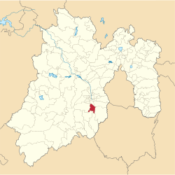
Joquicingo is a municipality in the Mexican state of México . The municipality had 12,840 inhabitants in 2010, its area is 63.2 km² .
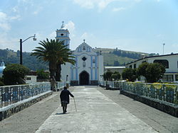
The administrative seat of the municipality is Joquicingo de Díaz , while the largest of the ten places in the municipality is Techuchulco de Allende .
geography
Joquicingo is located in the south of the state of Mexico, about 30 km southeast of Toluca de Lerdo .
The Municipio Joquicingo borders the Municipios Tenancingo , Malinalco , Ocuilan , Tianguistenco , Texcalyacac and Tenango del Valle .
Web links
Commons : Municipio Joquicingo - collection of images, videos and audio files
- Enciclopedia de los Municipios y Delegaciones de México: Municipio Joquicingo (Spanish)
- INEGI : Datos Geográficos: Municipio Joquicingo (Spanish; PDF)


