Sandhills
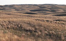
The Sandhills , sometimes also spelled Sand Hills or Nebraska Sandhills , are a prairie region in the US state of Nebraska that consists exclusively of sand dunes . What is unusual about these sand dunes is that they are almost completely stabilized by low vegetation. The Sandhills are the largest contiguous area of such sand dunes in the western hemisphere and make up almost a quarter of the area of Nebraska. Since 1984 they have been one of the United States' National Natural Landmarks .
The Sandhills received special attention because the original route of the Keystone XL Pipeline from 2005 from the Canadian oil sands areas to the US oil terminal Cushing , Oklahoma was planned through the Sandhills. A new application with a modified route from 2013 bypasses the Sandhills.
features
The area of the Sandhills is delimited differently from the adjacent prairie regions by individual institutions. Depending on the definition used, the Sandhills cover 59,760 or 61,100 square kilometers. The dunes reach a height of up to 100 meters and the altitude ranges from 550 meters above sea level in the east to 1100 meters above sea level. in the West. The predominantly north-westerly winds have contributed to the fact that the dunes and valleys are generally oriented south-west to north-east. The individual dune ridges reach a length of up to 32 kilometers.
The sandhills lie above the very large Ogallala aquifer and have no barriers between the surface and the groundwater. Therefore, there are marshes, lakes and swamps between the individual dunes, although the rainfall in this region is not very high. Because of this feature, the sandhills are a stopover for many bird species on their migration to the wintering areas. Parts of the area belong to the catchment area of the Loup River and the Niobrara River . One of the characteristic breeding birds of this region is accordingly also a species dependent on wetlands, namely the curlew .
At the same time, this permeability of the soil makes the Ogallala aquifer, with its inestimable importance for agriculture in the entire Great Plains in the Sandhills particularly at risk. The route of the Keystone XL pipeline originally envisaged a crossing of the Sandhills and therefore drew massive protests from environmentalists.
The World Wide Fund for Nature classifies the Sandhills as an ecoregion that differs significantly from other regions of the Great Plains . 85% of the region is still considered an original habitat. This is largely due to the fact that most of the Sandhills have never been used for agriculture. The Niobrara Valley Preserve , another nature reserve, borders the Sandhills .
literature
- Bryan L. Jones: North of the Platte South of the Niobrara: A Little Further into the Nebraska Sand Hills. Stephen F. Austin State University Press, Nacogdoches 2019, ISBN 978-1-936205-83-7 .
- Paul A. Johnsgard : Great Wildlife of the Great Plains . University Press of Kansas, 2003, ISBN 0-7006-1224-6
- Gail Lorna DiDonato: Cattle, Environment, and Economic Change: A History of Cherry County, Nebraska's Cattle Industry, from Earliest Times times to 1940. Lincoln 1998 (Dissertation) ( online)
Web links
Single receipts
- ^ Paul A. Johnsgard: Great Wildlife of the Great Plains . University Press of Kansas, 2003, p. 79
- ^ National Park Service : Nebraska Sand Hills. nps.gov, accessed May 21, 2013 .
- ^ US Fish and Wildlife Service : The Sandhills "Building Partnerships for an Ecosystem". fws.gov, accessed May 21, 2013 .
- ^ Paul A. Johnsgard: Great Wildlife of the Great Plains . University Press of Kansas, 2003, p. 80
- ^ Paul A. Johnsgard: Great Wildlife of the Great Plains . University Press of Kansas, 2003, p. 83
- ↑ Nebraska Sand Hills mixed grasslands. worldwildlife.org, accessed May 19, 2013 .
Coordinates: 42 ° 5 ′ N , 101 ° 2 ′ W


