Santa Maria da Feira (Beja)
| Santa Maria da Feira | ||||||
|---|---|---|---|---|---|---|
|
||||||
| Basic data | ||||||
| Region : | Alentejo | |||||
| Sub-region : | Baixo Alentejo | |||||
| District : | Be yes | |||||
| Concelho : | Be yes | |||||
| Freguesia : | União das Freguesias de Beja (Salvador e Santa Maria da Feira) | |||||
| Coordinates : | 38 ° 0 ′ N , 7 ° 52 ′ W | |||||
| Postal code : | 7800-XXX | |||||
Santa Maria da Feira is a place and a former municipality ( Freguesia ) in Portugal within the city of Beja , with 16.1 km² area with 4597 inhabitants (as of June 30, 2011). This results in a population density of 286 inhabitants / km².
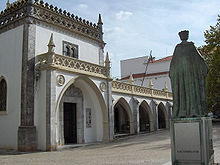
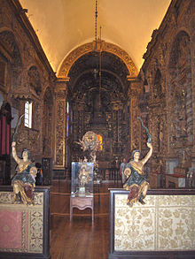
The municipality is one of the oldest parts of Beja. The church and monastery complex Igreja de Nossa Senhora da Conceição , which dates back to a church from 1282 and was built from 1453 , in whose monastery part the Museu Rainha Dona Leonor is housed, is one of the most famous sights of the community. In addition, there are Roman excavations and buildings, fountains and houses of various architectural styles under monument protection, such as Art Deco house No. 10 on Largo de Santa Maria .
On September 29, 2013, the municipalities of Beja (Santa Maria da Feira) and Beja (Salvador) were merged to form the new municipality of União das Freguesias de Beja (Salvador e Santa Maria da Feira) .
Web links
Individual evidence
- ↑ www.monumentos.pt , accessed on January 4, 2012
- ↑ ditto
- ^ Publication of the administrative reorganization in the Diário da República gazette of January 28, 2013, accessed on October 1, 2014


