Saugos
| Saugos | ||
|
||
| State : |
|
|
| District : | Klaipeda | |
| Rajong municipality : | Šilutė | |
| Office : | Saugos | |
| Coordinates : | 55 ° 28 ′ N , 21 ° 28 ′ E | |
| Inhabitants (place) : | 763 (2011) | |
| Time zone : | EET (UTC + 2) | |
| Status: | Village | |
|
|
||
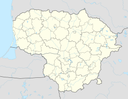
Saugos ( German sucking ) is a village in the Lithuanian district of Klaipėda . The place is the center of the administrative district (Seniūnija) Saugos and belongs to the Rajongemeinde Šilutė .
Geographical location
Saugos is located in the southwest of Lithuania , in the former Memelland , about twelve kilometers northwest of the municipality seat Šilutė . The national road 141 , which connects Kaunas with Klaipėda , leads through Saugos , from which the national road 193 branches off to Kvėdarna . Immediately to the west is the village of Kukorai , which has a stop on the Sovetsk – Klaipėda railway line . However, passenger train traffic was discontinued on this route in 2011.
history
In 1874, Saugen (apparently) became the seat of an administrative district in the Heydekrug district .
After incorporation into the Lithuanian Soviet Socialist Republic , Saugos (apparently) was the seat of a municipality (lit. valsčius) until 1950 and was the seat of a district (lit. apylinkė) from 1950 to 1995. Since 1995, Saugos has been the seat of an administrative district. As such, the place got a coat of arms in 2008.
Population development
| year | Residents |
|---|---|
| 1910 | 274 |
| 1989 | 921 |
| 2001 | 945 |
| 2011 | 763 |
school
There is a secondary school in Saugos. It is named after Jurgis Mikšas (Georg Mikschas) , an employee of the Aušra magazine .
church
There is an Evangelical Lutheran church in Saugos, which was built in 1857, and a Roman Catholic church from 1947.
Personalities
Sons and daughters of the place
- Reinhard Wenskus (1916–2002), German historian
District of Saugos
The Saugų seniūnija, which belongs to the Rajong municipality of Šilutė , has existed since 1995 . In the district there are 33 villages with a total of 3,419 inhabitants on an area of 190 km² (status 2011). The county is divided since 2009 into the eleven subdistricts (lit. Seniūnaitija) Aisėnų seniūnaitija, Berciškės seniūnaitija, Kukorų seniūnaitija, Lankupių seniūnaitija, Lapynų seniūnaitija, Petrelių seniūnaitija, Sakūtėlių seniūnaitija, Saugų seniūnaitija, Vilkyčių seniūnaitija, Vilkmedžių seniūnaitija and Žemaitkiemio seniūnaitija. The district includes:
| Place name | German name | Subdistrict | Place name | German name | Subdistrict | |
|---|---|---|---|---|---|---|
| Aisėnai | Ay tendons | Aisėnai | Mantvydai | Mantwieden | Kukorai | |
| Alka | Alc | Petreliai | Medaliai | Medellas | Lapynai | |
| Barvai | Great Barwen | Lapynai | Miestaliai | Mestellen | Lapynai | |
| Begėdžiai | Affirmative | Vilkmedžiai | Norkaičiai | Norkaiten [OV] | Berciškė | |
| Berciškė | Berzischken | Berciškė | Pangiriai | Pangirren | Vilkyčiai | |
| Bružai | Bruises | Lapynai | Petreliai | Petrellen | Petreliai | |
| Bundalai | Bundle up | Lankupiai | Rudynai | Rudienes | Žemaitkiemis | |
| Čiūteliai | C to provide | Sakūtėliai | Sakūtėliai | (Peter) Sakuten | Sakūtėliai | |
| Diegliai | Deegeln | Aisėnai | Saugos | Suck | Berciškė and Saugos | |
| Grynaičiai | Grünheide | Vilkmedžiai | Stankaičiai | Stabilities | Aisėnai | |
| Grumbliai | Grumble | Lankupiai | Stonaičiai | Stoneiten | Aisėnai | |
| Kebeliai | Jiggling | Vilkmedžiai | Šilininkai | to Schilleningken | Aisėnai | |
| Kukorai | Kuko riding | Kukorai | Vilkyčiai | Wilkieten | Vilkyčiai | |
| Lankupiai | Lankuppen | Lankupiai | Vilkmedžiai | Wilkomeden | Vilkmedžiai | |
| Lapaliai | Lapallen | Žemaitkiemis | Vytuliai | Wietullen | Žemaitkiemis | |
| Lapynai | Lapienen | Lapynai | Žemaitkiemis | Szameitkehmen | Žemaitkiemis | |
| Lašai | Tabs | Lapynai |


