Sault Ste. Marie International Bridge
Coordinates: 46 ° 30 ′ 25 " N , 84 ° 21 ′ 41" W.
| Sault Ste. Marie International Bridge | ||
|---|---|---|
| Aerial view of Sault Ste. Marie International Bridge and the Soo Locks | ||
| use | Road bridge, 2-lane | |
| Crossing of | Saint Marys River | |
| place | Sault Ste. Marie , Michigan - Sault Ste. Marie , Ontario | |
| Entertained by | International Bridge Administration (IBA) | |
| construction | Truss - arch bridge | |
| overall length | 4.5 km | |
| width | 8.5 m | |
| Clear height | 38 m | |
| vehicles per day | 7-10,000 vehicles | |
| start of building | 1960 | |
| opening | October 31, 1962 | |
| toll | $ 3.00 (USD), $ 3.00 (CAD) | |
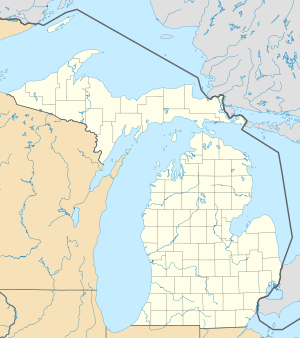
| location | ||
|
|
||
The International Bridge or more precisely Sault Ste. Marie International Bridge crosses the Saint Marys River and connects the twin cities of Sault Ste. Marie , Michigan and Sault Ste. Marie , Ontario , crossing the border between the United States and Canada . It is the northern terminus of Interstate 75 . Construction of the international bridge began in 1960 and traffic was opened on October 31, 1962.
The structure is a steel truss - arched bridge with a suspended track. It consists of two independent bridge parts. On the US side, two arches bridge the Soo Locks and on the Canadian side, a single large arch spans the smaller Canadian locks. The two parts are connected by a girder bridge construction. In Sault Ste. Marie connects a bridge field from the street to the city center. The total length of the structure is around 4.5 km.
On June 6, 2005 the provincial government of Ontario announced a project to bypass the inner city by trucks in order to connect the heavy traffic via a bypass road directly to Highway 17 in the north of the city. The city had been campaigning for this solution for some time, because many residents saw the routing of traffic into the city center as a safety problem. The bridgehead could not be relocated easily because of the already heavily populated shore on the Ontario side. This truck bypass route, named Carmen's Way in honor of former MP Carmen Provenzano , was officially opened in September 2006.
swell
- Bridge Facts & Trivia . Michigan Department of Transportation. Retrieved October 7, 2012.


