Silesian dam
| Silesian dam | |||||||
|---|---|---|---|---|---|---|---|
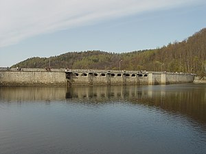
| The dam with the overflows and the reservoir | |||||||
|
|||||||
|
|
|||||||
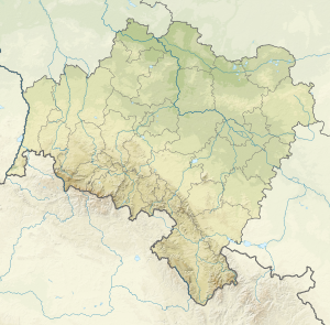
| Coordinates | 50 ° 45 '13 " N , 16 ° 26' 3" E | ||||||
| Data on the structure | |||||||
| Construction time: | 1912-1917 | ||||||
| Height above valley floor: | 41 m | ||||||
| Height above foundation level : | 44 m | ||||||
| Building volume: | 83,000 m³ | ||||||
| Crown length: | 225 m | ||||||
| Crown width: | 3.5 m | ||||||
| Radius of curvature : | 250 m | ||||||
| Data on the reservoir | |||||||
| Altitude (at congestion destination ) | 350 m | ||||||
| Water surface | 50 ha | ||||||
| Storage space | 8 million m³ | ||||||
| View from the Schlesiertalsperre to the reservoir | |||||||
| View from the Silesian Dam on part of Lubachów | |||||||
The Schlesiertalsperre , also Weistritz-Talsperre or Breitenhain-Talsperre (Polish Jezioro Bystrzyckie also Jezioro Lubachowskie ), is a dam on the Schweidnitzer Weistritz in the Owl Mountains in the Lower Silesian Voivodeship in Poland. It was built between 1912 and 1917 and has a storage volume of 8 million m³.
It is primarily used for flood protection, at the same time it generates around 4 million kWh of electrical energy from hydropower every year . The barrier structure is a curved gravity dam made of quarry stone masonry according to the Intze principle , which is based on gneiss . According to Kelen in 1933, it cost 2.11 million RM , which corresponds to an inflation-adjusted equivalent of around 9.7 million euros .
The dam is located between Lubachów ( Breitenhain ) and Zagórze Śląskie ( Kynau ), and the Kynsburg is located above the deep valley cut .
literature
- N. Kelen: Gravity dams and massive weirs , Julius Springer, Berlin 1933


