Schnoröm
|
Schnoröm
City of Wuppertal
Coordinates: 51 ° 16 ′ 7 ″ N , 7 ° 10 ′ 13 ″ E
|
||
|---|---|---|
| Height : | 192 m above sea level NHN | |
|
Location of Schnoröm in Wuppertal |
||
Schnoröm was a free-standing location in the middle of the Bergisch city of Wuppertal near the former train station Wuppertal-Loh . The development was removed around 1879 to make way for the route of the now disused Wuppertal Northern Railway and is now part of the dense inner-city development of Wuppertal.
Location and description
The location was at an altitude of 191 m above sea level. NHN on today's Rudolfstrasse , which was named Osterbaumer Strasse in 1865 , in the west of the Clausen residential area in the Barmen district . Neighboring locations are the settlement core of Clausen, Vor der Hardt , the settlement core of Ostersbaum , Siepken , Schönebeck and the settlement core of Loh .
history

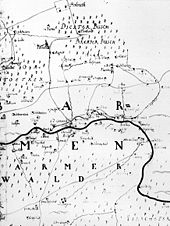
The location arose from a courtyard that is recorded as Schnorisch on the Topographia Ducatus Montani by Erich Philipp Ploennies from 1715. In 1815/16 three residents lived in the village.
In 1832 the place belonged to Section 1 of the rural foreign citizenship of the city of Barmen . The place, categorized as single houses according to the statistics and topography of the administrative district of Düsseldorf , was called Schnorum and at that time owned a residential house and an agricultural building. At that time, 14 residents lived in the village, all of whom were Protestant.
Individual evidence
- ↑ a b Johann Georg von Viebahn : Statistics and Topography of the Administrative District of Düsseldorf , 1836
