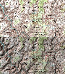
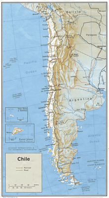
Hillshade
A shading is a surface tinting with which a spatial impression of the relative height differences of the terrain is created in cartography . The shades are usually created by lighting with an imaginary light source.
species
Depending on the position of the light source, a distinction is made between slope, oblique and combination hill shading.
In the case of hill shading (including incident light shading, shading with vertical lighting), the light comes vertically from above. Heavily sloping slopes are then darker than flat areas. The impression of brightness is comparable to that of hatching .
With oblique light shading , the imaginary light source is usually in the northwest (as preferred by right-handers). An elevation appears light on the north-west slope and dark on the south-east slope. Layers are uniformly colored with medium brightness (layer tone). The differences are shown exaggerated for reinforcement . In the case of hillshading, no shadow casting ( drop shadow ) is usually simulated. It is only expressed how much the surface is facing the light source. In order to highlight terrain structures that extend in a north-west-south-east direction, the position of the light source within a map can be varied with manual shading.
The combination hill shading combines slope shading and oblique shading. Here slopes facing the light are shown in light shadows and slopes facing away from the light are shown in strong shadows. Horizontal planes remain white. The combination hillshade is clearer than the slope hillshade and avoids the map-burdening layer tone of the oblique light shading. According to Mokronowski , only the shading with combined lighting provides a vivid and unadulterated image.

Above: Map without shading;
Below: Map with oblique light shading (screenshot from NASA World Wind Software)
Methods
Shading can be created manually, photomechanically or digitally.
literature
- Jürgen Bollmann, Wolf Günther Koch (ed.): Lexicon of cartography and geomatics in 2 volumes . Volume 2, pp. 288, 289. Spektrum Akad. Publisher: Berlin 2002.
- Egon Breetz: What are the characteristics and functions of the relief shading on physical maps? Zt.fdErdkundeunterricht, H. 5/1974, S. 196–201.
- Günter Hake, Dietmar Grünreich, Liqui Meng: Cartography . 8th edition, pp. 430, 431. De Gruyter: Berlin 2002.
- Günther Mokronowski: The techniques of the cartography specialist. P. 46, 47. Haack: Gotha 1974.
- Ogrissek, Rudi (Ed.): Brockhaus ABC Kartenkunde , p. 514, 512.Brockhaus: Leipzig 1983.
See also
Individual evidence
- ^ Günther Mokronowski: The techniques of the cartography skilled worker. P. 46, 47. Haack, Gotha 1974.
