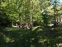
Schwedenschanze (Oberhaag)
The Schwedenschanze at Oberhaag is located northeast of Aigen-Schlägl in the Mühlkreis and protected against invasions by the Hussites, Swedes and Turks. Like many late medieval protective walls, this complex was given its current name after it was expanded during the Thirty Years' War . Close to the Haagerhof there is a beating path leading through the entrenchment.
history
This late medieval fortification was built in 1469 as part of the Bohemian-Austrian border feuds.
In 1610 the area around Aigen-Schlägl suffered from looting by the imperial troops. In order to become their master, a land contingent was made, with Aigen providing 24 men. Then entrenchments were thrown at the border, the largest of which was the facility on the Oberhaag.
In 1618 and 1628, during the Second Peasants' War, the hill was repaired and reoccupied.
1641–1648 the strong fortification bars of the fortifications even deterred the Swedes from advancing under the leadership of General Bittenberg, who held Budweis and Krumau. (In 1641 the landlord Konrad Balthasar von Starhemberg also built the Schwedenschanze near Bad Leonfelden , further east in the Mühlviertel, on the orders of the Governor of Austria on the Enns .
During the plague, a guard stood guard on the hill to stop the spread of the deadly disease.
description
Excavations brought this defensive structure to light. In some places it still reaches a height of about 3½ meters. It could accommodate up to 4,000 men. The ramparts comprised four sub-areas. Three of these defense areas, the Große Schanze, the Sternschanze and the Wall-Graben-System, are located directly on the Oberhaag. The Viereckschanze has been moved about 2 km to the north as a road barrier (towards the border).
The small Sternschanze (number 2 on the map) was to the east of the important traffic route between the upper Mühlviertel and Bohemia, which is now called the "Old Way to Wulda", whereby Wulda means the Vltava (today's Krumauer Straße was built later). Archaeological investigations in 1989/90 brought ceramic fragments from the 12th to 15th centuries to light. In the inner area of this building there were several heated log huts as accommodation for the guards. The slightly recessed hearths were set with wedge stones and served both as cooking areas and as sources of heat. The remaining inner area was probably used as a tent camp in times of war. These are not archaeologically verifiable because no changes were made to the soil. But there are reports from contemporary observers and images on military maps.
The wall (number 4 on the map) lies between the small and large jump across the "road to Wulda". It consists of an older and a younger embankment. A longer period of time must have passed between the two phases, as the humus formation from the first wall shows. The excavation from the trench in front was used for the embankments themselves. The younger wall was secured on the inside by a stone packing to prevent the earth material from sliding off. In the archaeological investigations, however, neither pallisade structures nor ramps for the riflemen could be detected. Probable bulwarks were used to fasten the wall crown . These densely woven wicker baskets filled with earth and stones were easy to manufacture and provided excellent protection against enemy fire.
The large hill (number 5 on the map) forms the western end of the defense system on the Oberhaag. At the four corners it was through lanceolate bastions . Due to its shape, it was extremely effective from a defensive point of view, as every point of the wall could be covered by the use of firearms during attacks. Not far from Oberhaag there were comparable systems near Passau to protect the Danube bridge or in Prachatice .
literature
A contemporary source describes the facility as a "double, star-shaped jump, a covered corridor on it, called Rennhaus, a guard hut, for the commandant a second one, furnished with an oven, windows, completely conform, across the street gate, a gate, a mooring chain, Beat up, dug the road sideways, with pitfalls ”.
See also
- Schwedenschanze
- Schwedenschanze (Achatzberg) near Klam , Upper Austria
- Schwedenschanze (Bad Leonfelden) near Bad Leonfelden , Upper Austria
Web links
Coordinates: 48 ° 39 ′ 19.7 ″ N , 14 ° 0 ′ 27.9 ″ E


