
Klam
|
market community Klam
|
||
|---|---|---|
| coat of arms | Austria map | |
 |
|
|
| Basic data | ||
| Country: | Austria | |
| State : | Upper Austria | |
| Political District : | Perg | |
| License plate : | PE | |
| Surface: | 8.35 km² | |
| Coordinates : | 48 ° 13 ' N , 14 ° 47' E | |
| Height : | 284 m above sea level A. | |
| Residents : | 940 (January 1, 2020) | |
| Population density : | 113 inhabitants per km² | |
| Postal code : | 4352 | |
| Area code : | 07269 | |
| Community code : | 4 11 07 | |
| NUTS region | AT313 | |
| Address of the municipal administration: |
Klam 43 4352 Klam |
|
| Website: | ||
| politics | ||
| Mayor : | Johannes Achleitner ( ÖVP ) | |
|
Municipal Council : (2015) (13 members) |
||
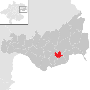
| Location of Klam in the Perg district | ||
  |
||
 Market fountain and church on the market square |
||
| Source: Municipal data from Statistics Austria | ||

Klam is a market town in Upper Austria in the Perg district in the Mühlviertel with 940 inhabitants (as of January 1, 2020). Since January 1, 2003, the municipality has belonged to the judicial district of Perg with the responsible district court in Perg .
geography
Geology, municipality, climate
Klam is 284 m above sea level. A. in the Mühlviertel on the edge of the Bohemian massif . From a geological and geomorphological point of view, Klam belongs mainly to the Upper Austrian spatial unit, southern Mühlviertel's peripheral areas . Klam is the main town in the Klamer Basin . Such subsidence was created along geological fault lines and partially filled with deposits. The extension of the municipality is 4.5 kilometers from north to south and 3.7 kilometers from west to east. The total area is 8.36 square kilometers. 24.7 percent of the area is forested, 63.5 percent of the area is used for agriculture.
The climate in the Klamer basin is more favorable compared to the rather harsh climatic zone of the eastern Mühlviertel. The annual average temperature is between 8 and 9 degrees Celsius. The average annual rainfall is between 800 and 900 millimeters. According to long-term measurements, there is a closed snow cover 46 days a year. The pool position often favors fog and frost.
Bodies of water, natural monuments
Klam by the water network for flowing Naarn (flow) belonging Klambach , between Klam and Saxen the Klamschlucht forms. The tributaries of the Klambach in the municipality are the Eichbach and the Bäckerbachl. At the beginning of the Klam Gorge is the Leonstein natural monument , a typical weathering of wool sack in the region . Other natural monuments registered in the nature conservation book of the Upper Austrian provincial government are the church linden tree on the market square in Klam and the castle oak of Clam .
Localities and neighboring communities
|
structure
|
||||||
|
Legend for the breakdown table
|
The municipality includes the following localities (population in brackets as of January 1, 2020):
- Achatzberg (158)
- Gauning (9)
- Klam (288)
- Latvians (8)
- Linden (113)
- Niederkalmberg (44)
- Oberhornbach (55)
- Sperken (202)
- Unterhörnbach (63)
The municipality of Münzbach borders to the northwest and the municipality of Bad Kreuzen to the northeast . In the east, the municipality of Grein reaches that of Klam, in the south Klam is bordered by Saxen and in the west by Baumgartenberg .
population
| Population development | |||||||||||||||||||||||||||||||||||||
|---|---|---|---|---|---|---|---|---|---|---|---|---|---|---|---|---|---|---|---|---|---|---|---|---|---|---|---|---|---|---|---|---|---|---|---|---|---|
|
|
||||||||||||||||||||||||||||||||||||
Population development
The population of Klam initially rose from 1869 and reached a value of 770 in 1890, which was only exceeded again in 2001 after a sharp decline in development that began with a low of 614 in 1951. In 2011 the market had 931 inhabitants.
Population structure by gender, age and education
On January 1, 2011, the market town of Klam had 931 inhabitants, 480 men and 451 women. The rough age structure of the Klamer population as of January 1, 2011 shows that 66.4% of Klamer are over 15 and under 65 years old. At 21.2%, more than a fifth of the population is younger and, at 12.5%, an eighth of the population is older.
Of the 608 staples who were over 15 years old in 2001, 307 or 50.5% are women. 18 students, that is 2.9% of those over fifteen, have graduated from a university , technical college or academy , the proportion of women is 55.5%. Another 55 Klamer, that is 9.1% of the relevant population group, have the Matura , here the proportion of women at 41.8% is significantly below that of the population group concerned. 312 Klamers, at 51.4% more than half of those over the age of fifteen, have completed an apprenticeship or vocational middle school , with 39.4% women. 223 or 36.7% of Klamer only have a compulsory school certificate . More than two thirds of them are women.
Origin and language
97.9% of Klamer are Austrian citizens and 95.5% were born in Austria. 1.5% of Klamer come from other EU countries, 0.2% from non-EU countries.
The Middle or Danube Bavarian dialect is a Bavarian dialect form that is widespread throughout Upper Austria . The ostösterreichische branch of the middle Bairischen goes to the dialect of the created by the Bavarian Ostsiedlung Babenberg dominion Ostarrichi back.
In the 2001 census, 785 people (99.5%) stated German as a colloquial language, 3 (0.4%) Croatian , 1 (0.1%) another language.
religion
In the 2001 census, 758 people (96.1%) stated Roman Catholic as their religious denomination, 3 (0.4%) Islamic , 8 (1.0%) Protestant , 1 (0.1%) Orthodox and 16 (0 , 4%) other faiths. 19 (2.4%) of the Klamer have not professed any religion. The residents of Klam are looked after by the Roman Catholic parish of Klam , which is one of the parishes of the Grein deanery .
history
In the valley of the Klambach there were traces of ancient and neolithic settlement such as a flint blade and several stone axes.
During Roman times , the area around Klam was only a few kilometers north of the border of the Noricum province , which was formed in this area by the Limes and the Danube , just within the 7.5 kilometers wide buffer zone between Romans and barbarians . The Roman fort Adiuvense ( Wallsee ) were within sight. There are no traces of settlement from this time in the area of the municipality of Klam.
The linguistic influence of the Slavic and Baier settlement activity in the 7th and 8th centuries has been preserved in the names of farms and places. The area around Klam was originally located in the eastern part of the Duchy of Bavaria and belonged to the Avarsmark from the 9th century .
At the time of the Babenbergs Klam were in the margraviate and later in the Duchy of Austria in the Machlandviertel and in the area of the Lords of Perg . Clam Castle was first mentioned in 1149 as the property of Otto von Machland . At this time the development of the market below the castle began. The place names Letten, Achatzberg and Kalmberg also appeared for the first time at this time.
In a document dated March 7, 1365, “the village is located under Clamm, called the Markcht”. The Klam market experienced its heyday in the 13th and 14th centuries, at which time it already had 60 houses. The oldest surviving license ( market right ) comes from Duke Albrecht III. (Austria) from the year 1384. The castle was attacked several times, but could never be taken. Neither the Hussites , who devastated the village below the castle in 1422, nor the Hungarians in 1487 under Matthias Corvinus succeeded .
In 1531 the market burned down to 10 houses due to a lightning strike. Many citizens and craftsmen then left the market and settled elsewhere. In 1636 a market chronicle was created by the new lord of the castle, Johann Gottfried Perger zu Clam, and in 1637 the old market rights from 1384 were confirmed by Emperor Ferdinand. In 1646, the lord of the castle established a hospital foundation and had the poor house or St. Anna house built. In 1654 the lord of the castle made the Creuzpöckhischen Luss available for the cultivation of cabbage, which was divided into 31 parts and divided among the residents of the market. Perger finally had the church built from 1659 to 1664 before he died in 1673.
During the reign of Empress Maria Theresa and her co-regent Joseph II , the villages with house numbers were introduced in 1771 as a supplement to the houses that had previously only been designated by house names. The cadastral parishes were described in detail in the Josephine situation book and used as a basis for taxation.
In 1848 the lordship was dissolved and the community of Klam was formed, which at that time included the villages of Achatsberg, Gauning, Linden Ober- and Unterhörnbach and Sperken. Niederkalmberg did not join Klam until January 14, 1877. Between 1869 and 1908 the owner of Burg Clam bought 36 houses and had them razed for the most part to create a zoo . The zoo was closed again at the end of the First World War . Since 1918 the place belongs to the federal state of Upper Austria.
The two world wars claimed 40 dead and 14 missing in Klam. After the annexation of Austria to the German Reich on March 13, 1938, the place belonged to the Gau Oberdonau . After 1945 the restoration of Upper Austria took place. In 1945, Klam was briefly in the American zone and from May 9, 1945 to 1955 in the Soviet zone .
From 1956 the economic upturn began in Klam, combined with numerous public and private investments in the local infrastructure and in the building fabric of the houses.
The place gained national fame from the 1990s onwards through open-air concerts in the context of clam concerts with internationally known personalities on the castle grounds.
politics
Johannes Achleitner of the ÖVP has been the mayor since October 17, 2013, after Josef Fraundorfer resigned as mayor for health reasons. Achleitner was the only candidate because the SPÖ and FPÖ waived a candidate. He was elected by the local council with 8 votes (5 abstentions).
Mayor of Klam
- Ignaz Achleitner (July 28, 1850 to March 7, 1861)
- Michael Eder (March 7, 1861 to July 13, 1873)
- Franz Achleitner (July 13, 1873 to August 16, 1879)
- Michael Eder (August 16, 1879 to August 22, 1882)
- Ignaz Achleitner (August 22, 1882 to July 15, 1894)
- Friedrich Pappel (July 15, 1894 to October 30, 1900)
- Ignaz Achleitner (October 30, 1900 to January 16, 1908)
- Johann Hölzl (January 16, 1908 to January 1, 1913)
- Karl Weber (January 1, 1913 to July 8, 1919)
- Ignaz Brandstätter (July 8, 1919 to January 1, 1929)
- Ignaz Brandstetter (January 1, 1929 to January 1, 1942)
- Franz Robl (January 1, 1942 to November 25, 1945)
- Michael Hochgatterer (November 25, 1945 to October 22, 1961)
- Franz Robl (January 22, 1961 to October 7, 1979)
- Ing.Josef Achleitner (October 7, 1979 to October 16, 1990)
- Franz Prinz (October 16, 1990 to January 28, 1997)
- Josef Fraundorfer (January 28, 1997 to October 17, 2013)
- Johannes Achleitner (October 17, 2013 to date)
Municipal council
The municipal council and mayoral elections take place every six years together with the state elections. In 1945 the ÖVP achieved an absolute majority with 77.2% of the votes, followed by the SPÖ with 20.3% and the KPÖ with 2.5% of the votes. Since then, the ÖVP's share of the vote has ranged between 82.7% in 1955 and 45.5% in 2009. The SPÖ's share of the vote was between 12.9% in 1985 and 34.6% in 2009. WdU and FW achieved, as far as they stood, between 12.5% in 2003 and 32.5% in 1979. Other parties did not stand for election in local council elections in Klam.
The municipal council consists of 13 members and the last municipal council election in 2015 resulted in the following distribution of mandates:
coat of arms
Official description of the municipal coat of arms : In gold, a gorge (gorge) formed from two natural-colored (gray-green) jagged rocks with a silver, undulating brook flowing down at an angle to the base of the shield, overlaid by a sign with the Upper Austrian coat of arms. The community colors are red and yellow.
Population development
| Population development | |||||||||||||||||||||||||||||||||||||
|---|---|---|---|---|---|---|---|---|---|---|---|---|---|---|---|---|---|---|---|---|---|---|---|---|---|---|---|---|---|---|---|---|---|---|---|---|---|
|
|
||||||||||||||||||||||||||||||||||||
The number of inhabitants increased only slightly in the second half of the 19th century and then fell significantly due to a resettlement campaign. The population decline lasted until 1951, only in the second half of the 20th century a significant increase in population was recorded.
Culture and sights
- Parish Church of Klam
- Castle Clam
- The sgraffito by Ernst Graner on the hammer forge (today electricity works ) in the Klamschlucht shows Kastler at his work
- Leonstein natural monument in the Klamschlucht
Economy and Infrastructure
The market town of Klam is one of 18 municipalities in the LEADER Region Strudengau .
Employment and income
The number of workplaces in Klam rose between the last two censuses in 1991 and 2001 by 15.0% to 23. The number of jobs fell by 8.2% to 67 in the same period.
In 2001, Klam provided jobs for 32 people living outside the community, while 268 Klam worked outside the community. The majority of in-commuters come from the Perg district, and the majority of out-commuters remain within the boundaries of the district.
In 2001, 26.3% of those employed in Klam were employed in agriculture and forestry . 18.9% employed in industry , trade and construction goods in 2001. The share of agriculture has decreased significantly compared to 1991 and 1981, as has that of industry, trade and construction, while the share of people working in the service sector has increased significantly.
traffic
The Donauuferbahn and the Donau Straße B3 open up the Perg district in a west-east direction. The connections to these two traffic routes in the neighboring communities Baumgartenberg, Saxen and Grein are only a few kilometers away from Klam.
The closest junctions to the Westautobahn are in the west at St. Valentin , Enns and Asten , in the south in Oed and Amstetten West , and in the east in Ybbs on the Danube , whereby the journey time in all directions takes an average of 30 minutes. Klam is crossed by the L 1423 state road coming from Münzbach in a north-south direction, which continues to Saxen. A municipal road branches off from this in the village of Sperken, which joins the Donau Straße (B3) in the village of Untergassolding in the market town of Baumgartenberg . In the municipality of Klam there are several stops for national bus services.
Personalities
- The Lords of Perg and Machland
- August Strindberg , Swedish writer and artist, lived temporarily in the town in the mid-1890s
- Ernst Graner , a watercolorist from Vienna , was married to Maria Kastler, the daughter of the hammer smith Kastler.
- The Clam-Martinic family with important representatives such as Heinrich Clam-Martinic and Georg Clam Martinic
- Hans Kastler (* 1931 in Klam), Austrian sculptor
Honorary citizen of the market town of Klam
- Karl Fischer, long-time primary school director (1955)
- Ignaz Brandstetter, long-time mayor (1955)
- Georg Clam Martinic (1955)
- Felix Kern , Deputy Governor (1955)
- Ferdinand Fürthauer, pastor of Klam from 1958 to 1996 (1979)
- Franz Robl, long-time mayor and deputy mayor (1982)
literature
- Josef Lettner: 600 years market, 200 years Klam parish, Small home book of the market community Klam 1984 , market community Klam (publisher), Freistadt, 1984.
- Josef Fraundorfer: Klam, portrait of a community , in: Our home - The district of Perg, association for the publication of a district home book Perg and communities of the district of Perg (publisher), Linz 1995, p. 230-237.
Web links
- Entry on Klam in the Austria Forum (in the AEIOU Austria Lexicon )
- Map in the Digital Upper Austrian Room Information System ( DORIS )
- Further information about the municipality of Klam can be found on the geographic information system of the federal state of Upper Austria .
- 41107 - Klam. Community data, Statistics Austria .
- Homepage of the market town of Klam
Individual evidence
- ↑ Klaus Berg, Clemens Gumpinger, Simonetta Siligato: Defense register of the Naarn and its tributaries. Water protection report 42nd Office of the Upper Austrian Provincial Government, Directorate Environment and Water Management, Department Surface Water Management, Linz 2009, p. 54 and other mentions ( PDF; 2.8 MB on land-oberoesterreich.gv.at).
- ↑ Natural monuments in Klam
- ↑ Statistics Austria: Population on January 1st, 2020 by locality (area status on January 1st, 2020) , ( CSV )
- ↑ a b c Statistics Austria: A look at the municipality of Klam. Population development (PDF, 34 KB)
- ↑ a b Statistics Austria: Municipality of Klam. Population status and structure (PDF, 8 KB)
- ↑ Statistics Austria: Census of May 15, 2001. Resident population by education; Families and households (PDF, 10 KB)
- ↑ a b Statistics Austria table: A look at the municipality of Klam Demographic data (PDF)
- ↑ Exchange letter, because of the strength of which the Duke of Austria's Hauser exchanged the village called the market under Klamm for the fish woad on the Saxen . In: Upper Austrian document book . Volume 8, No. CCIX, Vienna, March 7, 1365, p. 213 (“the village located under Clamm called the Markcht”).
- ↑ Johannes Achleitner is the new mayor. In: Bezirksrundschau Perg. October 18, 2013, accessed on April 10, 2014 .
- ↑ Elections in Klam ( Memento of the original from April 13, 2014 in the Internet Archive ) Info: The archive link was inserted automatically and has not yet been checked. Please check the original and archive link according to the instructions and then remove this notice. (1945–2009), website of the Province of Upper Austria
- ^ Workplace census from May 15, 2001. Workplaces and employees compared to 1991 (PDF), accessed on April 11, 2012
- ↑ Statistics Austria: View of the municipality of Perg commuters by commuting destination (PDF; 7 kB).
- ↑ State of Upper Austria, regional database, basic statistical data and key figures: Employed persons by economic sector ( page no longer available , search in web archives ) Info: The link was automatically marked as defective. Please check the link according to the instructions and then remove this notice. Accessed April 11, 2012

All Saints' Day in the Mühlkreis | Arbing | Bad Kreuzen | Baumgartenberg | Dimbach | Grein | Katsdorf | Klam | Langenstein | Luftenberg on the Danube | Mauthausen | Mitterkirchen im Machland | Münzbach | Naarn im Machlande | Pabneukirchen | Perg | Rechberg | Ried in der Riedmark | St. Georgen am Walde | St. Georgen an der Gusen | St. Nikola on the Danube | St. Thomas on the bladder stone | Saxen | Schwertberg | Waldhausen im Strudengau | Windhaag near Perg
Cadastral parish: Clam
Market place: Klam | Villages: Achatzberg • Oberhörnbach | Rotten: Linden • Sperken • Unterhörnbach | Scattered houses: Gauning • Niederkalmberg | Other locations: Latvians
Counting group: Klam

All Saints' Day | Arbing | Bad Kreuzen | Baumgartenberg | Dimbach | Grein | Klam | Mitterkirchen | Münzbach | Naarn Pabneukirchen | Perg | Rechberg | Saxen | St. Nikola | St. Thomas | Waldhausen | Windhaag