
St. Valentin (Lower Austria)
|
Borough Saint Valentine
|
||
|---|---|---|
| coat of arms | Austria map | |
 |
|
|
| Basic data | ||
| Country: | Austria | |
| State : | Lower Austria | |
| Political District : | Amstetten | |
| License plate : | AT THE | |
| Surface: | 45.72 km² | |
| Coordinates : | 48 ° 10 ' N , 14 ° 32' E | |
| Height : | 272 m above sea level A. | |
| Residents : | 9,306 (January 1, 2020) | |
| Postcodes : | 3350, 4300, 4482 | |
| Area code : | 07435 | |
| Community code : | 3 05 31 | |
| NUTS region | AT121 | |
| Address of the municipal administration: |
Hauptplatz 7 4300 St. Valentin |
|
| Website: | ||
| politics | ||
| Mayoress : | Kerstin Suchan-Mayr ( SPÖ ) | |
|
Municipal Council : ( 2020 ) (33 members) |
||
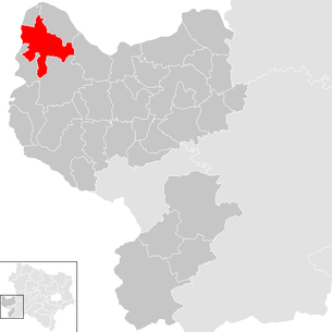
| Location of Sankt Valentin in the district of Amstetten | ||
  |
||
| Source: Municipal data from Statistics Austria | ||

St. Valentin (also Sankt Valentin ) is the westernmost municipality in the federal state of Lower Austria in the Republic of Austria . The municipality with 9,306 inhabitants (as of January 1, 2020) is located in the Mostviertel , more precisely in the Enns-Donau-Winkel and is the second largest city in the Amstetten district.
geography
The municipalities of Ennsdorf, St. Pantaleon / Erla, Strengberg, Stadt Haag and Ernsthofen border the municipal area of St. Valentin in Lower Austria. Enns and Kronstorf border on the Upper Austrian side, as the municipality is located directly on the state border. The center is at an altitude of 272 m. The eastern urban area is occupied by the Rohrberg, which is 400 m high. The western border of the municipality runs along the Enns River, from which the Enns-Danube Canal branches off to feed the Pyburg power station. There is a dam in Thurnsdorf.
Community structure
The municipality includes a single village, the districts are:
- Altenhofen - (Altenhofen, Dollberg, Holzerhäuser, Walling)
- Endholz - (Aichberg, Geibling, Hamet, Happmannsberg, Larnhaus, Raad, Safrat, Steinlacken, Stocket, Stritzel, Ströbitz)
- Hofkirchen - (Hofkirchen, Harold, Kleesdorf, Lembach, Pumenöd, Rittmannsberg, Seggau , Unterhaben, Zain)
- Rems - (Rems, Raad, Viehart )
- St. Valentin - (St. Valentin, Gutenhofen, Kirchdorf, Windberg)
- Thurnsdorf - (Aichet, Gollensdorf, Herzograd, Kötting, Langenhart, Neu-Rubring, Neu-Thurnsdorf, Thurnsdorf, Viehdorf, Wimm)
The community consists of six cadastral communities (area: as of December 31, 2017):
- Altenhofen (611.29 ha)
- Endwood (846.91 ha)
- Hofkirchen (621.56 ha)
- Rems (507.27 ha)
- St. Valentin (673.37 ha)
- Thurnsdorf (1,303.28 ha)
Neighboring communities
Two of the seven neighboring communities are in the Upper Austrian district of Linz-Land (LL).
| Ennsdorf | Sankt Pantaleon-Erla | |
|
Enns (LL) Kronstorf (LL) |
.svg)
|
Strengberg |
| Ernsthofen | Hague |
history
The name of Saint Valentin comes from Saint Valentin of Raetia . The municipality was first settled by Bavaria in the 6th century. Around 700 Avars devastated the settlements around Enns. The church and place appear for the first time in the deed of foundation of the nearby Erla monastery in 1050 - so the settlement and church are much older. The first church / chapel was probably built in late Roman times, as Roman gravestones are walled up in the outside walls of the church. Fires in 1683 and 1736 destroyed a large part of the town center. In 1938 Ernsthofen was spun off from the parish of St. Valentins.

St. Valentin has had a train station since November 21, 1858, located on the Westbahn Vienna – Salzburg line. Other railway lines that were opened later are the railway line via Steyr into the Ennstal (originally called Kronprinz-Rudolf-Bahn - KRB ) and the Danube shore line . Around 1900 the increasing number of inhabitants led to a housing shortage in the community. The St. Valentineer Josef Stöckler founded the first dairy in Lower Austria in 1903 and the Lower Austrian Farmers' Association in 1906. The receipt of the white Lipizzaners for Austria was thanks to him in 1918.
From 1939 this was the location of the Nibelungenwerk (Ni-Werk), for the production of tanks for the front. About half of the standard tanks ( Pz IV ) of the German Reich were manufactured here. The armor plates came from the associated iron works of the Upper Danube . In August 1944, the workforce was reinforced by around 10,000 concentration camp prisoners from Mauthausen . From 1944 the community was the target of bombing raids. On August 20, 1944, the bombs missed the Ni plant, and on March 23, 1945, 609 high-explosive bombs were dropped on St. Valentin, severely damaging the tank factory . On May 7, 1945, the Americans took the community. On May 8, 1945, the Russians took command in St. Valentin and on May 11, 1945 established a military command. Before the Enns Bridge was closed, many citizens fled to the US occupation zone in Upper Austria.
After 1955 St. Valentin production site was Steyr - Tractors . In 1983 the community was raised to the status of a township, which a few years later was able to establish a new large company with Engel injection molding machines.
Since 2006, St. Valentin has been the seat of the European headquarters of the Case IH tractor group .
Community partnerships
- since 1988 with the 276 inhabitant village of Saint-Valentin in the French department of Indre
- since 1993 with the Czech town of Pelhřimov (German Pilgrams ).
- since 1993 with the Japanese city of Sakutō which rose in 2005 in the new city of Mimasaka , so that it took over the function as a twin city .
Population development

politics
The municipal council has 33 members.
- With the municipal council elections in Lower Austria in 1990, the municipal council had the following distribution: 19 SPÖ, 9 ÖVP, 3 FPÖ and 2 others.
- With the municipal council elections in Lower Austria in 1995, the municipal council had the following distribution: 17 SPÖ, 9 ÖVP, 3 Greens, 3 FPÖ and 1 LIF.
- With the municipal council elections in Lower Austria in 2000, the municipal council had the following distribution: 19 SPÖ, 9 ÖVP, 3 Greens and 2 FPÖ.
- With the municipal council elections in Lower Austria in 2005 , the municipal council had the following distribution: 19 SPÖ, 9 ÖVP, 4 Greens and 1 FPÖ.
- With the municipal council elections in Lower Austria 2010 , the municipal council had the following distribution: 21 SPÖ, 9 ÖVP, 2 FPÖ and 1 Greens.
- With the municipal council elections in Lower Austria in 2015 , the municipal council had the following distribution: 21 SPÖ, 8 ÖVP, 2 FPÖ and 2 Greens.
- With the municipal council elections in Lower Austria 2020 , the municipal council has the following distribution: 18 SPÖ, 9 ÖVP, 3 Greens and 3 FPÖ.
- mayor
- until 2010 Manfred Mießner (SPÖ)
- since 2010 Kerstin Suchan-Mayr (SPÖ)
Culture and sights


In today's parish of St. Valentins there are two parishes and four churches, two of which are subsidiary churches of St. Valentine.
- Catholic parish church of St. Valentin St. Valentin : The most famous is today's parish church of St. Valentin. The chancel of today's parish church was probably built in 1476, and a wedge-shaped roof dominated the church tower until 1887. Between 1867 and 1880 the church was rebuilt in a neo-Gothic style by the Linz cathedral architect Otto Schiemer . The equipment was renovated in 2002 and is very worth seeing.
- Filial church of St. Mary Magdalene in Rems: The church, which dates back to the second quarter of the 13th century, was probably the chapel of an older castle. The church was redesigned in baroque style around 1730 . The current interior of the church dates from around 1900.
- Filial church of St. Andrew in Hofkirchen: was probably built in the late Gothic around 1500. A crucifix on the south side of the nave is from the time it was built. The rest of the church is neo-Gothic.
- Parish Church of St. Mary of Perpetual Help : was built between 1955 and 1957 in the Langenhart district.
- History Museum St. Valentin: The History Museum St. Valentin places a special focus on the areas of agriculture, handicrafts and the local history of St. Valentine. In addition, because of St. Valentine's position as a railway junction, the museum has its own section on the history of the railway. Special exhibitions on a wide variety of topics are held at regular intervals.
- Statue of St. Valentine of Raetia: In the main square there is a statue of the city's namesake.

Hofkirchen branch church

Branch church Rems


economy
The Nibelungenwerk , the largest tank factory of the Axis powers, later parts of the Steyr Daimler Puch conglomerate, and in 2012 the automotive supplier Magna and the agricultural machinery manufacturer CNH Global were located in the municipality .
In 2001 there were 412 non-agricultural workplaces, agricultural and forestry holdings according to the 1999 survey 132. The number of people in work in the place of residence was 3,991 according to the 2001 census. The employment rate was 46 percent in 2001, there were 46 people unemployed on average in 2003.
traffic

In St. Valentin, the Danube bank and Rudolfsbahn meet the Westbahn , which is why the local train station is an important traffic junction. Since 2002 the Westbahn has been running in the direction of Vienna through the Sieberg tunnel, which runs past the city of Haag. The A 1 western motorway runs through the municipality from east to west; there is a truck stop and a rest stop in the Rems district.
Personalities
- Sons and daughters of the church
- Josef Stöckler (1866–1936), politician ( CSP )
- Heinrich Maria Hunger (1907–1994), painter
- Wilhelm Kindl (1917–1998), politician ( FPÖ )
- Anna Strasser (1921–2010), resistance fighter against National Socialism
- Eckehard Bamberger (* 1931), writer
- Charlotte Dürnberger (* 1936), graphic artist and civil servant
- Gotthard Schafelner (* 1938), Abbot of Lambach Monastery 1986–2008
- Ryszard Krynicki (* 1943), Polish poet, translator of German poetry and publisher
- Helmut Zenker (1949–2003), writer, songwriter and screenwriter
- Walter Ebenhofer (* 1952), photographer
- Gabriele Binder-Maier (* 1956), politician ( SPÖ )
- Karin Mayr-Krifka (* 1971), track and field athlete
- People related to the community
- Heinz Ferlesch (* 1971), choir director and conductor
- Andreas Pum (* 1971), farmer and politician ( ÖVP )
- Xaver Schlager (* 1997), footballer
- Kerstin Suchan-Mayr (* 1975), politician ( SPÖ ), mayor of St. Valentin since 2010
Web links
- 30531 - St. Valentine. Community data, Statistics Austria .
- www.st-valentin.at Website of the city of St. Valentin
Individual evidence
- ↑ The official spelling is specified or represented in the law on the division of the State of Lower Austria into municipalities, LGBl.No. 1030–94 of December 9, 2011 and on Statistics Austria: A look at the municipality
- ↑ Regionalinformation.zip (Excel file, 1,210 KB); accessed on January 4, 2018
- ^ Austrian-Japanese relations. Japanese Embassy Austria, accessed June 13, 2013 .
- ^ Result of the local council election 1995 in St. Valentin. Office of the Lower Austrian State Government, March 30, 2000, accessed October 17, 2019 .
- ^ Election result of the municipal council election 2000 in St. Valentin. Office of the Lower Austrian State Government, February 4, 2005, accessed on October 17, 2019 .
- ^ Election result of the municipal council election 2005 in St. Valentin. Office of the Lower Austrian State Government, March 4, 2005, accessed on October 17, 2019 .
- ^ Election result of the municipal council election 2010 in St. Valentin. Office of the Lower Austrian State Government, October 8, 2010, accessed on October 17, 2019 .
- ^ Election result of the 2015 municipal council election in St. Valentin. Office of the Lower Austrian State Government, December 1, 2015, accessed on October 17, 2019 .
- ↑ Results of the municipal council election 2020 in St. Valentin. Office of the Lower Austrian State Government, January 26, 2020, accessed on March 1, 2020 .
- ↑ Bundesdenkmalamt Department for Inventory and Monument Research (Ed.): Lower Austria south of the Danube, Part 2 (MZ) (= Dehio-Handbuch. Die Kunstdenkmäler Österreichs ). Verlag Berger, Horn / Vienna 2003, ISBN 3-85028-365-8 , p. 2058-2059 .

Allhartsberg | Amstetten | Ardagger | Aschbach Market | Behamberg | Biberbach | Ennsdorf | Ernsthofen | Ertl | Euratsfeld | Ferschnitz | Hague | Haidershofen | Hollenstein an der Ybbs | Kematen on the Ybbs | Neuhofen an der Ybbs | Neustadtl an der Donau | Oed-Oehling | Opponitz | Seitenstetten | Sonntagberg | St. Georgen am Reith | St. Georgen am Ybbsfelde | St. Pantaleon-Erla | St. Peter in der Au | St. Valentin | Strengberg | Viehdorf | Wallsee-Sindelburg | Weistrach | Winklarn | Wolfsbach | Ybbsitz | Zeillern
Cadastral communities: Altenhofen Endholz | Hofkirchen | Rems | St. Valentin | Thurnstorf
Location: Altenhofen Endholz | Hofkirchen | Rems | St. Valentin | Thurnsdorf
City: St. Valentin Districts: Kirchdorf | Langenhart villages: Altenhofen | Gutenhofen | Gollensdorf | Hofkirchen | Kötting | Rems | Thurnsdorf | Viehdorf | Wimm settlements: Aichet | Herzograd | New Rubring | Neu-Thurnsdorf Weiler: Gaibling | Raad | Windberg Rotten: Dollberg | Happmannsberg | Wooden houses | Klessdorf | Larnhaus | Lembach | Raad | Rittmannsberg | Safrat | Stone lacquers | Stritzl | Ströbitz | Winding under | Cattle species | Walling Scattered Houses: Endholz | Seggau | Zain Other locations: ÖMV tank farm | Nibelungenwerk Steyr-Daimler-Puch | Aichet gravel pit
Counting district: St.Valentin-Bahnhof | St.Valentine's place | Langenhart settlement | Langenhart place | Herzograd | Thurnsdorf | Rems | Altenhofen | Endholz-Hofkirchen