
Baumgartenberg
|
market community Baumgartenberg
|
||
|---|---|---|
| coat of arms | Austria map | |
 |
|
|
| Basic data | ||
| Country: | Austria | |
| State : | Upper Austria | |
| Political District : | Perg | |
| License plate : | PE | |
| Surface: | 15.71 km² | |
| Coordinates : | 48 ° 13 ' N , 14 ° 45' E | |
| Height : | 237 m above sea level A. | |
| Residents : | 1,789 (January 1, 2020) | |
| Population density : | 114 inhabitants per km² | |
| Postal code : | 4342 | |
| Area code : | 07269 | |
| Community code : | 4 11 03 | |
| NUTS region | AT313 | |
| UN / LOCODE | AT BGT | |
| Address of the municipal administration: |
Baumgartenberg 85 4342 Baumgartenberg |
|
| Website: | ||
| politics | ||
| Mayor : | Erwin Kastner ( ÖVP ) | |
|
Municipal Council : (2015) (19 members) |
||
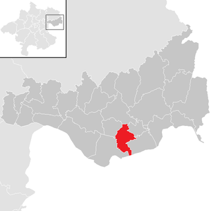
| Location of Baumgartenberg in the Perg district | ||
  |
||
| Source: Municipal data from Statistics Austria | ||

Baumgartenberg is an Upper Austrian market town in the Perg district in the lower Mühlviertel in the eastern part of Machland with 1789 inhabitants (as of January 1, 2020).
The municipality belongs to the judicial district of Perg .
Baumgartenberg consists of the cadastral communities Baumgartenberg and Puchberg in Machland II , whereby the community area only reached its current size in 1955 and 1956 through incorporations. The center is located about twelve kilometers southeast of the district capital Perg , where the seat of the responsible district court is also located, and about three kilometers north of the Danube at about 237 m above sea level. A. The municipality borders on the Danube for about half a kilometer.
In the 11th and 12th centuries, Machland Castle was located in the area of Baumgartenberg as the seat of the Lords of Machland , whose most important representative Otto von Machland founded, together with his wife, Jutta von Peilstein, Baumgartenberg Monastery and Waldhausen Monastery. The former - a Cistercian monastery - existed until it was abolished in 1782, then it was a male penal institution and has belonged to the Good Shepherd Sisters since 1865 . Since then u. a. repeatedly used to house schools. The last time the European High School opened in 1996 and a three-year technical school in 1997.
The development of a village was promoted in 1784 by the creation of the Baumgartenberg parish with the former collegiate church as a parish church . The Donauuferbahn has been running through the town center since 1896 , and the town has a train station . The heavily on the agriculture dominated market town was from 1930 to the 1990s location of the Berglandmilch risen dairy cooperative Baumgartenberg. Through a targeted company settlement policy, Baumgartenberg became the headquarters or production site of several supraregional companies (Hueck Folien, slaughterhouse group Herbert Handlbauer, Baumann Glas 1886 ). With the construction of the bypass for the Donau Straße , the town center was relieved of through traffic.
In the past, the municipality was repeatedly affected by flood disasters, most recently by the Danube flood in 2002 . After several villages and farmsteads had been relocated, the Machland dam was used to protect against hundred-year floods between 2008 and 2011 .
geography
Location and surroundings: Baumgartenberg lies in the Machland plain at an altitude of 237 m. The extension is 4.5 km from north to south and 6.8 km from west to east. 23.6% of the total area of 15.7 km² is forested, 63.7% is used for agriculture.
The provincial capital Linz is around 50 kilometers to the west, the federal capital Vienna around 140 kilometers to the east from Baumgartenberg. The next border crossing to the Czech Republic, Wullowitz in the municipality of Leopoldschlag , is located north of Baumgartenberg just under 70 kilometers away. In the east, the border between Upper and Lower Austria is 28 kilometers away from Hirschenau in the municipality of St. Nikola an der Donau . In a southerly direction, the route to Lower Austria leads over the Danube bridges in Mauthausen and Grein as well as the restricted traffic road of the Wallsee-Mitterkirchen power station .
Geology: The municipality is mainly located in the fertile Machland plain and to a lesser extent in the Untermühlviertel Schollenland, an extension of the granite and gneiss plateau .
From a geological and geomorphological point of view as well as aspects of the use of space, the municipality of Baumgartenberg belongs to two of the 41 spatial units of the federal state of Upper Austria . All localities and parts of the municipality in the plain are in the Machland spatial unit . A small part of the Baumgartenberg municipal area belongs to the southern Mühlviertel peripheral areas .
The area of the market town located in the Danube plain of the Machland lies in the plain at 230 to 240 m and is one of the lowest-lying areas of the Mühlviertel . The gradual drop to the Danube along clear erosion margins results in corresponding ecological differences that depend on the surface layers and their soils, the frequency of flooding and the depth of the almost closed groundwater body.
Waters: The notable waters of the market town include the Danube, the Klambach on the border with Klam and Saxen, and the Naarn oxbow lake, the Schwemmnaarn , into which the Mettensdorfer Mühlbach and Gassoldingerbach flow in the municipal area . The Deimingerbach flows into the Mettensdorfer Mühlbach .
Local breakdown: The current municipality of Baumgartenberg was created by the dissolution of the municipality of Puchberg at the end of 1955, whereby some localities (cadastral municipality Puchberg I) become Arbing and others (Baumgartenberg West, Deiming, Steindl, Kolbing, Hehenberg with the exception of house no.17 and the homestead Amesbach 14) came to Baumgartenberg. In this context, the cadastral communities of Baumgartenberg were reorganized and given the names Puchberg II and Baumgartenberg. The localities Mettensdorf, Pitzing, Kühofen and the house fief 1 zu Baumgartenberg came from the municipality of Mitterkirchen in 1956 and were assigned to the cadastral municipality of Baumgartenberg.
|
structure
|
||||||
|
Legend for the breakdown table
|
The municipality includes the following 16 localities (population in brackets as of January 1, 2020):
- Amesbach (70)
- Au (43)
- Baumgartenberg (598)
- Deiming (88)
- Hehenberg (58)
- High field (20)
- Kolbing (163)
- Kuhofen (38)
- Fiefdom (7)
- Mettensdorf (72)
- Muhlberg (143)
- Obergassolding (209)
- Puchberg (3)
- Schneckenreitstal (56)
- Steindl (111)
- Untergassolding (110)
The two cadastral communities include the following localities:
- Baumgartenberg cadastral community : Amesbach, Au, Baumgartenberg, Kühofen, Lehen, Mettensdorf, Obergassolding, Schneckenreitsberg, Schneckenreitstal, Steindl and Untergassolding;
- Cadastral municipality Puchberg im Machlande II : Deiming, Hehenberg and Kolbing;
Neighboring communities
| Arbing | Münzbach | Klam |
| Mitterkirchen |
.svg)
|
Saxen |
| Ardagger (Lower Austria) |
Population development (1869–2009)
| Population development
(Baumgartenberg overall) |
||
|---|---|---|
| year | number | index |
| 1869 | 1227 | 100 |
| 1880 | 1336 | 109 |
| 1890 | 1391 | 113 |
| 1900 | 1519 | 124 |
| 1910 | 1399 | 114 |
| 1923 | 1385 | 113 |
| 1934 | 1429 | 116 |
| 1939 | 1364 | 111 |
| 1951 | 1165 | 95 |
| 1961 | 1121 | 91 |
| 1971 | 1295 | 101 |
| 1981 | 1402 | 114 |
| 1991 | 1442 | 116 |
| 2001 | 1399 | 114 |
| 2009 | 1548 | 126 |
Population development: In the last decades of the 19th century, the resident population rose significantly by around a quarter from 1227 in 1869 to 1519 in 1900. In the first half of the 20th century, mostly between 1,300 and 1,400 people lived in Baumgartenberg. After the Second World War and in the 1950s, the number of inhabitants fell, so that in 1961 only 1121 people lived in Baumgartenberg. A significant increase in the resident population can be observed from the 1960s.
Population structure according to gender, age and education: Baumgartenberg had 1,595 inhabitants on January 1, 2011, of which 800 were men and 795 women.
The rough age structure of the Perger population as of January 1, 2011 shows that 68.9% of Baumgartenbergers are over 15 and under 65 years old. Around a sixth of the population is younger (16.2%) and around a seventh of the population is older (14.9%). While the proportion of women in the main group and among the younger population is approximately the same as the proportion of the total population, with 59.9% of the older population it is significantly higher than the proportion of the total population.
Of the 1133 Baumgartenbergers who were over 15 years old in 2001, 581 or 51.3% are women. 53 Baumgartenbergers, that is 4.6% of those over fifteen, have graduated from a university , technical college or academy ; the proportion of women, at 50.9%, is only slightly below that of the population group as a whole. Another 92 Baumgartenbergers, that is 8.1% of the relevant population group, have the Matura , with 44.6% of women also being significantly below that of the population group concerned. 544 Baumgartenbergers, with 48.0% almost half of those over fifteen, have completed an apprenticeship or vocational secondary school , with 39.5% women. 444 or 39.2% of Baumgartenbergers only have a compulsory school certificate . More than two thirds of them are women.
Origin and language: 96.2% of the Baumgartenberg residents were Austrian citizens on January 1st, 2011 and 94.9% were born in Austria. 2.3% of Baumgartenbergers come from other EU countries, 1.4% from non-EU countries.
The Middle or Danube Bavarian dialect is a Bavarian dialect form that is widespread throughout Upper Austria . The ostösterreichische branch of the middle Bairischen goes to the dialect of the created by the Bavarian Ostsiedlung Babenberg dominion Ostarrichi back.
In the 2001 census, 1,365 people (97.6%) stated German as a colloquial language, 12 (0.9%) Turkish , 22 (1.6%) another language.
religion
In the 2001 census, 1,342 people (95.9%) stated Roman Catholic as their religious denomination, 12 (0.9%) Islamic , 10 (0.7%) Protestant , 9 (0.6%) Orthodox and 3 (0 , 2%) other faiths. 23 (1.6%) Baumgartenbergers have not professed any religion.
The Baumgartenberg parish, which belongs to the dean's office Perg and the pastoral care area Machland, essentially comprises the municipality of Baumgartenberg, there are overlaps on the border with Klam and Münzbach.
history
Prehistoric times and antiquity: The presence of humans in the Neolithic is proven by various finds from the time between the 5th and 1st millennium BC.
During Roman times , the area around Baumgartenberg was north of the border of the Noricum province on the Limes of the Roman Empire - which was then formed in this area by the Danube - within a 7.5 kilometer wide buffer zone between Romans and barbarians . The Roman fort Adiuvense ( Wallsee ) was within sight. There are no traces of settlement from this time in the area of the market town of Baumgartenberg.
Middle Ages: After the Migration Period, Bavarians and Slavs settled in the area around Baumgartenberg at the same time . Both peoples left traces in the names of places and houses. Deiming and Gassolding are among the oldest settlement areas in Baumgartenberg.
From the 9th century the area belonged to the Avarmark . In the second half of the 10th century, the Babenbergs were entrusted with pacifying the Danube march. The Machland was part of this mark, which is considered the heartland of Austria and extended from the Erlabach east of the Enns on both sides of the Danube to west of the Vienna Woods. Leopold I became margrave in 976, and in 996 the name Ostarrichi (Austria) was first mentioned for this area.
The history of Baumgartenberg, which can be documented in writing, began with the appearance of the Lords of Perg and Machland around 1050. In 1141, Otto von Machland and his wife Jutta von Peilstein wrote a letter of foundation for the Baumgartenberg monastery. a. several villages in Baumgartenberg are also named for the first time.
The coat of arms of Otto von Machland is now considered a model for the Upper Austrian state coat of arms. In the Baumgartenberg Urbar from 1335, more than 900 properties in Upper and Lower Austria are listed as the property of Baumgartenberg Monastery. The collection with the name “formularius de modo prosandi” is also known. Since 1490 the place has been assigned to the Principality of Austria ob der Enns .
Modern times: From the beginning of the 16th century, the newly built Hauderer-Straße led through Baumgartenberg. The construction of a canal from the Naarn to the Klostermühle in 1560 and the failure flood on the Naarn from 1758 led to the Perger Au swamp . The drainage carried out under Empress Maria Theresa was only successful for a short time. After several attempts, Naarn regulation took place after the construction of the Wallsee-Mitterkirchen power plant in the late 1960s and early 1970s.
Baumgartenberg Abbey was one of the centers of the Counter Reformation in the 17th century . From 1624 the parishes of Altenburg , Münzbach and Windhaag were given to the abbot for re-Catholicization . In 1658 a separate regional court was created in Baumgartenberg .
In 1784 Emperor Joseph II had the monastery closed and handed over the collegiate church as a parish church to the new Baumgartenberg parish . The monastery served as a male penal institution for several decades.
The Baumgartenberg cadastral community, established in 1784, was established as an independent local community in 1849. In 1865 the Sisters of the Good Shepherd acquired the monastery, who, with the approval of public authorities, set up a home for girls with behavioral problems and from 1878 to 1938 also ran the elementary school and from 1912 to 1938 a private middle school (secondary school). The parish was looked after by Franciscans from 1889 to 2008 .
In 1896 the Donauuferbahn was built.
20th and 21st centuries: Since 1918 the place has belonged to the newly founded federal state of Upper Austria. In 1930 Adolf Lind founded the Baumgartenberg dairy cooperative and was its first chairman. After the annexation of Austria to the German Reich on March 13, 1938, the place belonged to the Gau Oberdonau . During and after the Second World War , refugees were housed in the monastery. In 1945 Baumgartenberg was in the Soviet occupation zone . The immediate post-war period was marked by the dissolution of the Mauthausen concentration camp and the associated flows of refugees, insufficient supplies and the subsequent normalization with the first free elections in Austria.
From 1947 the sisters ran a one-year housekeeping school. In 1957, a two-year technical school for economic professions and apprenticeship training for women’s dressmakers and laundry sewers were set up in the monastery. In 1996 the Europagymnasium opened and in 1997 the technical school for business professions “Health and Social Affairs”.
In 1955 the eastern half of the former municipality of Puchberg in Machland was incorporated with Baumgartenberg West, Deiming, Kolbing, Hehenberg and Steindl. In 1956 Mettensdorf, Pitzing and Kühofen were detached from the municipality of Mitterkirchen im Machland and incorporated into Baumgartenberg. Since then, the boundaries of the market town correspond to the boundaries of the Baumgartenberg parish with a few overlaps.
In 1970 the company set up with a location for the Hueck Folien company . This was followed by glass Baumann and the slaughterhouse Amstler . The community received its own coat of arms in 1978 and was made a market in 2000. From 2008 to 2011, after the settlement of localities and individual farmsteads in the area of the market town, the longest section of the Machland dam (13.5 kilometers) was built, which will protect the residents of Baumgartenberg from hundred-year floods in the future.
politics
Mayor is Erwin Kastner (ÖVP).
Mayors and municipal councils: The municipal council and mayoral elections take place every six years together with the state elections. In 1945 the ÖVP achieved an absolute majority, followed by the SPÖ and far behind the KPÖ . Since then, the ÖVP in Baumgartenberg has always had an absolute majority of the votes, with the proportion of votes gradually falling from 81.6% in 1945 and only 51.2% in 2009. As the second strongest party, the SPÖ achieved between 18.0 and 37.6% of the vote, and the Freedom Party, if it stood, between 4.0 and 28.8%.
The Baumgartenberger municipal council consists of 19 members. The council elected from the ranks of the local councils is composed of five people, including the mayor and the vice mayor. The mayor is Erwin Kastner (ÖVP), who was confirmed in his office in the 2009 direct mayor election with almost 64.6% of the votes. Vice Mayor is Karl Gusenbauer (ÖVP). The ÖVP, SPÖ and FPÖ each have a community board.
Former mayors of Baumgartenberg:
- Georg Naarnleitner (1850 to 1860)
- Engelbert Tremesberger (1860 to 1861)
- Michael Baretschneider (1861 to 1870)
- August Naarnleitner (1870 to 1876)
- Franz Poizat (1876 to 1882)
- Johann Lehbrunner (1882 to 1882)
- Karl Paredschneider (1882 to 1894)
- Karl Kastner (1894 to 1898)
- Franz Kastner (1898 to 1898)
- Ferdinand Schweiger (1898 to 1910)
- Karl Kern (1910 to 1919)
- Sebastian Pühringer (1919 to 1919)
- Josef Hochgatterer (1919 to 1929)
- Franz Mayrhofer (1929 to 1929)
- Josef Hochgatterer (1929 to 1936)
- Josef Bleimer (1936 to 1938)
- Siegfried Decker (1938 to 1944)
- Karl Strondl (1944 to 1945)
- Karl Kaindl (1945 to 1947)
- Johann Steininger (1947 to 1949)
- Franz Freinhofer (1949 to 1956)
- Karl Strondl (1956 to 1961)
- Franz Gusenbauer (1961 to 1990)
- Erwin Kastner (since 1990)
Municipal finances: In 2010 the market town of Baumgartenberg had total income of 5.4 million euros and total expenditure of 5.3 million euros. The largest sources of income were the income shares from the financial equalization with 0.9 million euros and the municipal tax with 0.6 million euros. Baumgartenberg had the third largest financial strength per capita in the Perg district with 1052 euros and was 65th out of 444 municipalities in Upper Austria. The municipal debt per capita was 3326 euros; Baumgartenberg ranked 7th out of 26 municipalities in the district and 69th out of 444 municipalities in Upper Austria = yes (link not available)
coat of arms
Official description of the municipal coat of arms : Split; on the right a blue heraldic lily in silver , the middle part of which ends at the top as a Latin cross; on the left a silver eagle in red. The community colors are blue and white.
A defining element of the municipal coat of arms is the symbolization of the dominant Cistercian monastery with the architecturally important collegiate church and today's parish church, founded in 1141 by Otto von Machland and his wife Jutta von Peilstein. The blue lily with a cross-shaped central leaf refers to the patronage and titular feast of the Assumption of Mary .
The silver eagle in red is taken from the coat of arms ascribed to the Lords of Machland and attributed to the Lords of Machland on two miniatures in a land register of the Baumgartenberg monastery laid out under Abbot Konrad II around 1335, which was carried by the pen - in partly different colors - and also as a template is considered for the Upper Austrian coat of arms.
Attractions
- Parish Church of the Assumption of Mary (former Cistercian Abbey Church) : Abbot Friedrich I laid the foundation stone for the construction of the church in 1142. After more than a hundred years of construction, the church was consecrated in 1243. Inside the former collegiate church there is a three-aisled, cross-vaulted vestibule ( Paradise , around 1310) with a Romanesque portal. The church was made Baroque around 1697 and goes back to the Carlone workshop . The hall choir, also redesigned in Baroque style, was consecrated in 1443. A ambulatory was laid around the chancel, which on the outside consists of nine sides of a sixteenth corner.
- Nearby castle stable of Machland Castle owned by the Lords of Perg and Machland on the Ulrichsberg.
- Nearby Burgstall Waseneck in the village of Amesbach.
- Nearby Außenstein Castle in the village of Puchberg. Privately owned.
Culture
- Kulturglashaus: The Palmhaus factory of Baumann Glas 1886 is available several times a year as a culture glass house for the implementation of cultural events and also serves as a location for events of FM5 and for events of the Donaufestwochen
Economy and Infrastructure
The market town of Baumgartenberg is one of eighteen municipalities in the LEADER Region Strudengau .
Employment:
The number of workplaces rose by 51.4% to 53 between the last two censuses in 1991 and 2001. The number of workplaces increased by 61.5% to 693 in the same period.
In 2001, Baumgartenberg provided jobs for 495 people living outside the community, while 358 Baumgartenbergers worked outside the community. The greater part of the in-commuters come from the district of Perg, likewise the majority of the out-commuters remain within the boundaries of the district.
For commuters, the expansion of the road network and the expansion of regional rail traffic in recent years means a significant improvement. Examples of the measures implemented in recent years are the expansion of the Donau Straße as well as the construction of the Ennsdorf loop and the use of modern train sets between the Perg district and the state capital.
In 2001, 6.4% of the employed persons in Baumgartenberg were employed in agriculture and forestry . In 2001 59.9% were employed in industry , trade and construction . The proportion in agriculture and the service sector has decreased significantly compared to 1991 and 1981, respectively, while the proportion of people working in industry, trade and construction increased sharply in 1991 compared to 1981 and remained at the high level in 2001.
Infrastructure:
Baumgartenberg has a modern infrastructure with regard to the transport network, water, sewer and natural gas network. A corresponding spatial planning enables further business settlements. A club fire brigade has existed in the market town since 1905.
Euregio Bavarian Forest - Bohemian Forest , Regional Transport Donauraum Perg , the district waste association Perg with a waste material collection center in Perg, the cleanliness associations and the long-distance water association are involved in the supraregional cooperation for the provision of infrastructure .
Company: Baumgartenberg has established itself as a business location since the 1970s and companies such as B. a film manufacturer, Palmhaus-Werk Baumann Glas in 1886 and a slaughterhouse as supraregional companies. Associated with this was the creation of several hundred jobs.
In 2009, the mayors of the communities of Perg, Arbing and Baumgartenberg, with the involvement of INKOBA, created the Machland Perg business park, which has a potential of 100 on non-contiguous areas along the Danube Street and the Danube Bank Railway in the area from Perg west of the technology center to Baumgartenberg east of the existing industrial companies Hectare is to create around a thousand new jobs in large companies over the next ten years. All municipalities in the district are to be involved in the project.
Agriculture and Forestry:
In 1999 there were 74 agricultural and forestry operations in Baumgartenberg, cultivating an area of 1163 hectares. Of these, 30 were full-time farms with 802 hectares and 44 part-time farms with 361 hectares.
As everywhere at the district and state level, both the number of farms and the cultivated agricultural and forestry areas have decreased compared to the previous survey time in 1995. The number of full-time farms and the areas cultivated by them have increased at the expense of the part-time farms. In 1999, 234 people were employed in agriculture and forestry in Perg, of which 229 were family workers, of which 30 were full-time. 134 worked in agriculture with less than 25% of their working time, the remaining 65 between 25 and 99% .http: //www2.land-oberoesterreich.gv.at/statlandwirtschaft/LANDErresult.jsp? GemNr = 41103 & kat = GEM & Gemeindeauswahl = ja & agr = Ground (link not available)
traffic
Road: The Donauuferbahn and the Donau Straße B3 open up the Perg district in a west-east direction. State roads lead to the surrounding towns and the neighboring districts and regions.
The next connection points to the West Autobahn are in the west at St. Valentin , Enns and Asten , in the south in Oed and Amstetten West and in the east in Ybbs on the Danube , whereby the journey in each direction takes an average of 30 minutes.
Train:
- Donauuferbahn : Baumgartenberg is located on the Donauuferbahn from Mauthausen to Grein, which was built in 1896 and opened in 1898, and has a train station in the town center. Trains run to the east to Grein Stadt, St. Nikola-Struden and Sarmingstein, and to the west to St. Valentin or Linz Hauptbahnhof. There is a connection to the long-distance train network via the St. Valentin and Linz Hauptbahnhof stations . The new Ennsdorfer Loop has been in operation since December 11, 2005. It is used daily by several trains on the Linz Hauptbahnhof – Sarmingstein route, which only stop at selected stations and stops. There are also trains to St. Valentin.
Bus: There are bus connections to Enns and Linz as well as to places in the districts of Perg and Freistadt from several stops in the Baumgartenberg municipality .
education
Baumgartenberg has developed into the second largest school location in the Perg district:
- Community kindergarten, since 1995, with connection to a crèche
- Elementary school
- public secondary school, since 1972
- Business School, by the Sisters of the Good Shepherd
- three-year technical school for economic professions, also by the Sisters of the Good Shepherd
- Europagymnasium opened in 1995 on the premises of the monastery
- State special school
Personalities
Honorary citizen:
- Sr. M. Benedicta Freilassner, Vienna
Honorary Ring Bearer:
- Josef Gusenbauer
- Hans-Robert Thomas, D-Weiden
People in connection with Baumgartenberg:
- Otto von Machland , founder of Baumgartenberg Abbey
- Lords of Machland lived in Baumgartenberg
- Reginbert von Hagenau , founder of Baumgartenberg Abbey
- Antonie Baumberg , writer, grew up in Baumgartenberg and named herself after the place
- Adolf Lind , founder of the Baumgartenberg dairy cooperative, National Socialist functionary
societies
- Musikverein Baumgartenberg
- Union Baumgartenberg
- Leisure & bowling club of the cone princes in Baumgartenberg
- Archery Club Baumgartenberg
literature
- Karl Gusenbauer: Baumgartenberg - economy and culture in harmony. In: Our homeland - The district of Perg, association for the publisher of a district homeland book Perg - Communities of the district of Perg (publisher), Linz 1995, p. 198 ff
Individual evidence
- ↑ Hermann Kohl: The lifeless nature. In: Land Oberösterreich (Ed.): The Mühlviertel, nature-culture-life, contributions to the state exhibition in 1988 in Weinberg Castle near Kefermarkt. Linz 1988, p. 41 ff
- ↑ Hermann Kohl: The lifeless nature . Upper Austrian provincial exhibition <1988, Kefermarkt>; Upper Austria. In: Helga Litschel, Province of Upper Austria, Office of Upper Austria. State government, culture department. (Ed.): The Mühlviertel: Nature, Culture, Life / Upper Austrian State Exhibition 1988, May 21 to October 30, 1988 in Weinberg Castle near Kefermarkt. Event from the state of Upper Austria. tape 2 . Province of Upper Austria, Office of Upper Austria. State government, Culture Department , Linz, DNB 551827696 , p. 41 ff .
- ↑ Statistics Austria: Population on January 1st, 2020 by locality (area status on January 1st, 2020) , ( CSV )
- ↑ Statistics Austria: A look at the community of Baumgartenberg PDF
- ↑ Statistics Austria: A look at the community of Baumgartenberg population development (PDF)
- ↑ Statistics Austria: A look at the Baumgartenberg community, population status and structure PDF
- ↑ Statistics Austria: A look at the community Baumgartenberg Education PDF
- ↑ a b c Statistics Austria table: A look at the community Demographic data PDF
- ^ Franz Stroh: New Latin Age finds in Upper Danube. In: Yearbook of the Association for Regional Studies and Homeland Care in the Upper Danube Gau (formerly the yearbook of the Upper Austrian Museum Association). 91st year, Linz 1944, online (PDF) in the forum OoeGeschichte.at
- ^ Baumgartenberg community history ( Memento from August 15, 2011 in the Internet Archive )
- ^ Wolfgang Lehmann: Between hope and fear, the days of upheaval in 1945 . In: Heimatbuch der Stadt Perg 2009. Editor: Heimatverein Perg and Stadtgemeinde Perg, Linz 2009, p. 309 ff
- ↑ http://www2.land-oberoesterreich.gv.at/statwahlen/WahlenErgebnis.jsp?GemNr=41103&wahlnr=4&strGemeindeauswahlart=Formular&txtResultPage=WahlenErgebnis.jsp?strThema=OOE&darstellung=Tabelle&such=Baumgartenberg&kat=GEM&strThema=OOE&txtRegionNr=&txtRegionVar=GemNr (Link not available)
- ↑ Accessed December 29, 2011 (PDF; 8 kB)
- ↑ Statistics Austria: View of the community of Baumgartenberg commuters by commuting destination (PDF; 7 kB)
- ↑ Province of Upper Austria, regional database, basic statistical data and key figures: General measures ( Memento from December 15, 2012 in the web archive archive.today )
- ↑ Statistics Austria: A look at the municipality of Baumgartenberg, agriculture and forestry businesses by type of employment PDF
Web links
- Entry on Baumgartenberg in the Austria Forum (in the AEIOU Austria Lexicon )
- Map in the Digital Upper Austrian Room Information System ( DORIS )
- 41103 - Baumgartenberg. Community data, Statistics Austria .
- Further information about the municipality of Baumgartenberg can be found on the geographic information system of the federal state of Upper Austria .
- Homepage of the market town of Baumgartenberg

All Saints' Day in the Mühlkreis | Arbing | Bad Kreuzen | Baumgartenberg | Dimbach | Grein | Katsdorf | Klam | Langenstein | Luftenberg on the Danube | Mauthausen | Mitterkirchen im Machland | Münzbach | Naarn im Machlande | Pabneukirchen | Perg | Rechberg | Ried in der Riedmark | St. Georgen am Walde | St. Georgen an der Gusen | St. Nikola on the Danube | St. Thomas on the bladder stone | Saxen | Schwertberg | Waldhausen im Strudengau | Windhaag near Perg

All Saints' Day | Arbing | Bad Kreuzen | Baumgartenberg | Dimbach | Grein | Klam | Mitterkirchen | Münzbach | Naarn Pabneukirchen | Perg | Rechberg | Saxen | St. Nikola | St. Thomas | Waldhausen | Windhaag