
All Saints' Day in the Mühlkreis
|
All Saints' Day in the Mühlkreis
|
||
|---|---|---|
| coat of arms | Austria map | |
 |
|
|
| Basic data | ||
| Country: | Austria | |
| State : | Upper Austria | |
| Political District : | Perg | |
| License plate : | PE | |
| Surface: | 20.23 km² | |
| Coordinates : | 48 ° 18 ' N , 14 ° 39' E | |
| Height : | 568 m above sea level A. | |
| Residents : | 1,267 (January 1, 2020) | |
| Population density : | 63 inhabitants per km² | |
| Postal code : | 4320 | |
| Area code : | 07262 | |
| Community code : | 4 11 01 | |
| NUTS region | AT313 | |
| Address of the municipal administration: |
Allerheiligen im 2 4320 Allerheiligen im Mühlkreis |
|
| Website: | ||
| politics | ||
| Mayor : | Berthold Baumgartner ( ÖVP ) | |
|
Municipal Council : (2015) (19 members) |
||
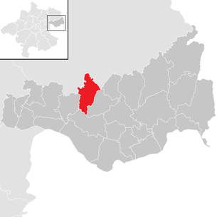
| Location of Allerheiligen in the Mühlkreis in the Perg district | ||
  |
||
 Pilgrimage Church of All Saints in the Mühlkreis |
||
| Source: Municipal data from Statistics Austria | ||

The nature park community of Allerheiligen im Mühlkreis is a municipality and a place of pilgrimage in the Perg district in the lower Mühlviertel , Upper Austria with 1267 inhabitants (as of January 1, 2020). The current expansion of the community area extends to the cadastral communities of Allerheiligen and Lebing and was created in 1938 through the incorporation of the community of Lebing.
The place in the judicial district of Perg is six kilometers north of the district capital Perg , where the seat of the responsible district court is also located, and 10 km northeast of the Danube. Part of the municipality in the Naar valley is part of the Mühlviertel nature park and a designated landscape protection area .
The early baroque organ from the 17th century in the pilgrimage church of All Saints first mentioned in documents in 1454 is one of the oldest and rarest instruments in Austria.
The kaolin deposit in the village of Kriechbaum has been known for centuries, was first documented in 1803 and is the only mining deposit in Austria. The mining is carried out by the KAMIG - Austrian kaolin and mining industry in opencast and underground mining, founded in 1922 . Since 2009 the association Kaolinum - Knowledge Network Mining has been preparing the establishment of a mining museum and a theme park.
geography
Location and surroundings
Allerheiligen extends over an altitude range of 340 to 568 m above sea level. A. on a foothill of the granite mountain country between the valleys of the Naarn and the Kettenbach . Like the neighboring communities, it is located in the so-called Aist-Naarn-Kuppenland . The extension of the municipality is 5 kilometers from north to south and 8.6 kilometers from west to east. The total area is 20.1 square kilometers, of which 37.3 percent is forested and 55.2 percent is used for agriculture. The church and the town center are located at the highest point in the municipality.
geology
The community is located in the Untermühlviertel Schollenland, an extension of the granite and gneiss plateau . From a geological and geomorphological point of view as well as from the point of view of the use of space, the municipality of Allerheiligen is located entirely in the Upper Austrian spatial unit Aist-Naarn-Kuppenland .
Austria's largest kaolin mining site is located in Kriechbaum and the neighboring communities of Perg ( Weinzierl ), Schwertberg and Tragwein .
Landscape protection, natural monuments, water

The eastern border to Windhaag forms from the Aschermühle to the Kuchlmühle over a length of about ten kilometers by the Naarn river . The part of the Naar valley belonging to the municipal area, with its wooded slopes, is part of the FFH area Waldaist-Naarn , which also belongs to the Mühlviertel nature reserve .
The Gänsebach in the south forms the border with Perg and the Lebingerbach in the west the border with Schwertberg. The Kettenbach separates Allerheiligen from the neighboring municipality of Tragwein and the Haizenbach is the north-eastern boundary to Bad Zell. All of these streams flow to the Aist . The ridge above the Naarn valley forms the watershed between Aist and Naarn. But the way into the Naarn valley is usually too short for the formation of streams of any appreciable size. The only well-known stream in the municipality that flows into the Naarn is the Auerbach in Oberlebing.
The Falkenstein , a granite tower that rises almost vertically one hundred meters and was declared a natural monument by the Upper Austrian provincial government in 1982, is located in the Naarn valley on Naarntallandesstraße .
Community structure
The municipality includes the following seven localities (population in brackets as of January 1, 2020):
- All Saints' Day in the Mühlkreis (358) including Dörfl
- Baumgarten (62)
- Hennberg (96) and the mountain of the same name
- Judenleiten (127)
- Creep tree (134)
- Niederlebing (111) including Lebing
- Oberlebing (379) including Riegl and Sölling
The community consists of the cadastral parishes of Allerheiligen and Lebing.
Neighboring communities, traffic
In the north-west, Allerheiligen borders on Tragwein , in the north-east on Bad Zell , both of which belong to the Freistadt district . In the west, the municipality of Schwertberg and in the east the municipality of Windhaag near Perg extends to the municipality. The neighboring municipality to the south is Perg .
Coming from the south of Perg, the state road L1424 crosses Judenleiten, Niederlebing, Oberlebing and the center of Allerheiligen and then leaves the municipality for Baumgarten. In Oberlebing, the L1419 road coming from the direction of Tragwein or Kriechbaum joins the L1424. From the northern municipality boundary, both the L1424 and the L1417 branching off to the left lead to Königswiesener Straße ( B 124 ), which runs a short distance on the northern border of Allerheiligen. In addition, the municipal area is opened up by municipal roads and freight roads .
climate
|
Average monthly temperatures and rainfall for All Saints' Day
|
|||||||||||||||||||||||||||||||||||||||||||||||||||||||||||||||||||||||||||||||||||||||||||||||||||||||||||||||||||||||||||||||||||||||||||||||||||||||||||||||||||||||||
history
Traces of a Neolithic settlement can be found in Niederlebing near the Seisenbecker farmhouse. There were finds in the form of flat and hole axes in Judenleiten, Ober- and Unterlebing. For etymological reasons, a burial ground from the Bronze Age is suspected in Lebing, but has not yet been found.
During Roman times , the area around Allerheiligen was only a few kilometers north of the border of the Noricum province , which was formed in this area by the Limes and the Danube , already outside the 7.5 kilometers wide buffer zone between Romans and barbarians . The Roman fort Adiuvense ( Wallsee ) and the Roman military camp Lauriacum ( Enns / Lorch ) were within sight. There are no traces of settlement from this period in the area of the Allerheiligen community.
The linguistic influence of the Slavic and Baier settlement activity in the 7th and 8th centuries has been preserved in the names of farms and places. The area around Allerheiligen was originally located in the eastern part of the Duchy of Bavaria and belonged to the Avarmark from the 9th century .
At the time of the Babenbergs , the later cadastral communities of Allerheiligen and Lebing were located in the margraviate and later in the Duchy of Austria in the border area between Riedmark and Machland and in the area of the Lords of Perg .
The area belonged to the original parish of Naarn. Several old farms were spread over what is now the municipality. Starting from Staffling, an old mule track led from Machland via Perg, Sandweg, Judenleiten, Lebing, Tragwein to Bohemia .
From the 12th century, the Öder von Geiersberg ruled in the area of Lebing , servants of the Hochfrei von Lengenbach and later the Lords von Kuenring, with the headquarters in a small castle in Oberlebing (near the Reifegger farm) and later also with a seat in Kriechbaum ( Klinger farm).
The oldest documentary mention of a church was in 1454 as a subsidiary church of Tragwein. Individual farmsteads were mentioned in documents much earlier. Later the area belonged to the Schwertberg rule. For the municipal coat of arms, the coat of arms of the Tschernembl family was adopted, in whose territory the town and parish were located for a long time.
In 1848 the communities of Allerheiligen with an area of 11.37 square kilometers and Lebing with an area of 8.84 square kilometers were established in the areas of the cadastral communities of the same name.
The two communities have belonged to the federal state of Upper Austria since 1918. At the beginning of the 1920s, the parishes of Allerheiligen and Lebing issued emergency money. After the annexation of Austria to the German Reich on March 13, 1938, the place belonged to the Gau Oberdonau . In 1938 the community Lebing (409 inhabitants) was incorporated into the community of Allerheiligen (572 inhabitants).
In 1945 Upper Austria was restored and All Saints belonged to the Soviet zone of occupation until 1955 . After the war efforts were made to rebuild the Lebing community. In a referendum in 1945, 52 percent of the residents, with a turnout of 80 percent, were in favor of an independent community in Lebing. However, the request was not granted. In 1951, Allerheiligen was to be named to better distinguish it from the parishes of the same name in the Machland. At the well-founded request of the community council, the place was finally called All Saints' Day in the Mühlkreis.
At the end of the 20th century, the place established itself as a nature park and residential community.
politics
City council and mayor
Berthold Baumgartner of the ÖVP has been mayor since 2008. He received 63.7 percent of the valid votes in the direct mayor election in 2009.
The ÖVP has had an absolute majority of votes and mandates in municipal council elections since 1945, with the proportion of votes ranging between 73.1 percent (1949) and 50.5 percent (1961) of the votes cast. The proportion of votes in the SPÖ ranged between 49.5 percent (1961) and 22.3 percent (1949). The FPÖ has been a candidate since 1973 and scored between 6.4 (2003) and 13.9 percent (1979). Only in 1945 did the KPÖ also stand as a candidate and garner 7.4 percent of the vote.
|
|
Composition of the municipal council (2015)
Eligible to vote: 984, valid votes: 833, invalid votes: 34, turnout: 88.11%
| Political party | percent | be right | Mandates | |||
|---|---|---|---|---|---|---|
| ÖVP | 57.14% | -5.91% | 476 | −36 | 11 | +3 |
| SPÖ | 42.86% | +5.91% | 357 | +57 | 8th | +3 |
coat of arms
The 1978 awarded by the Upper Austrian government Gemeindewappen officially as follows described :
- In a silver red, crowned Adler , occupied with one of black and red in two rows geschachten oblique links bar .
- The community colors are red and white.
It is taking over the nobility of arms of Krain originating noble family Tschernembl whose dominion is the 16th and extended in the second half in the first decades of the 17th century to today's municipality and the local church.
population
| Population development | |||||||||||||||||||||||||||||||||||||||||||||||||||||||||||||||||||||
|---|---|---|---|---|---|---|---|---|---|---|---|---|---|---|---|---|---|---|---|---|---|---|---|---|---|---|---|---|---|---|---|---|---|---|---|---|---|---|---|---|---|---|---|---|---|---|---|---|---|---|---|---|---|---|---|---|---|---|---|---|---|---|---|---|---|---|---|---|---|
|
|
||||||||||||||||||||||||||||||||||||||||||||||||||||||||||||||||||||
Population development
The population of the municipality fluctuates unusually, was lowest in the observation period in 1880 with 917 people and in 2019 highest with 1,280 people and has only increased again in recent years. After more than a thousand people lived in Allerheiligen for the first time in 1900, the value was below this mark in 1923, 1939 and 1971.
Population structure by gender, age and education
On January 1st, 2009 the community of All Saints had 1,173 inhabitants, 596 men and 577 women.
The rough age structure of the population of All Saints as of January 1st, 2009 shows that 67.3% of All Saints are over 15 and under 65 years old. At 18.5%, a little less than a fifth of the population is younger and, at 14.2%, around a seventh of the population is older. The proportion of women in the main group, at 46.4%, is lower than in the overall value, while it is significantly higher in the younger and older people at 53.9% and 56.3%, respectively.
Of the 892 people living in Allerheiligen who were over 15 years old in 2001, 427 or 47.9% are women. 24 All Saints' Day, that is 2.7% of those over fifteen, have graduated from a university , technical college or academy ; the proportion of women here, at 41.7%, is significantly below that of the population group as a whole. Another 60 All Saints' Day, that is 6.7% of the relevant population group, have the Matura , while the proportion of women at 36.7% is also significantly below that of the population group concerned. 425 All Saints' Day, with 47.6% almost half of those over fifteen, have completed an apprenticeship or vocational secondary school , with 35.8% women. 383 or 42.9% of All Saints' Day have only completed compulsory schooling . More than three fifths of them are women.
Origin and language
99.3% of the residents of Allerheiligen were Austrian citizens on January 1, 2009 and 98.0% were born in Austria. 3 Allerheiligener come from other EU countries, 5 from non-EU countries or other continents.
The Middle or Danube Bavarian dialect is a Bavarian dialect form that is widespread throughout Upper Austria . The ostösterreichische branch of the middle Bairischen goes to the dialect of the created by the Bavarian Ostsiedlung Babenberg dominion Ostarrichi back.
In the 2001 census, 1,081 people (98.4%) stated German as a colloquial language, 18 (1.6%) another language.
religion
In the 2001 census, 1053 people (95.8%) stated that they were Roman Catholics , 24 (2.2%) Protestants , 22 (2.0%) of All Saints did not profess any religion.
Economy and Infrastructure

Commercial enterprises
Only a few commercial enterprises have their headquarters in Allerheiligen, including a car dealership just outside the town center, a construction company and the Kriechbaum-Weinzierl plant of the Austrian kaolin and mining industry in Kriechbaum, where kaolin is mined.
The municipality of Allerheiligen is one of 18 municipalities in the LEADER region of Strudengau .
Employment situation
On January 1, 2001, 136 people were employed in Allerheiligen. Of the 514 employed people living in Allerheiligen, 428 commuted to their jobs outside the community, while at the same time 50 people commuted to their workplace in Allerheiligen.
253 jobs for Allerheiligener are in another municipality in the Perg district, 138 outside the Perg district in Upper Austria. The remaining jobs are located in other federal states, and a few abroad. 15 people from the Perg district work in Allerheiligen, the rest of the inbound commuters come from other districts of Upper Austria or other Austrian federal states.
In 2001, 8.2 percent of the Allerheiligen people worked in agriculture and forestry, 44.5 percent in industry, trade and construction and 46.5 percent in the service sector. In 1981, the proportion of All Saints active in agriculture and forestry was 26.2 percent. 30.9 percent of the jobs in Allerheiligen were in agriculture, 9.6 percent in industry, trade and construction and 59.6 percent in the service sector. In 1981, 50.9 percent of jobs were in agriculture and forestry.
Traffic situation
The next stops and train stations for the Donauuferbahn are in Perg, around eight kilometers away. Only buses are available for public transport directly in Allerheiligen, with connections from Bad Zell to the district capital.
A large number of inbound and outbound commuters depend on their own vehicle. The next motorway connections are in the west in Sankt Valentin , Enns and Asten with a journey time of 30 to 45 minutes and in the east in Amstetten and in Ybbs with a journey time of around one hour.
Infrastructure

The power supply for the municipality of Windhaag is mainly provided by the Perg electricity company . There is the local volunteer fire brigade , which was founded in 1911 for Allerheiligen and Lebing.
In the municipality of Allerheiligen there is a kindergarten established in 1974 for children who are not yet of compulsory schooling, and an elementary school that has existed since 1782 . The possibility of visiting secondary schools , a lower grade school , the Polytechnic or vocational middle or secondary schools is possible in the district of Perg, most notably the city Perg acts as a college town.
The local Raiffeisenkasse was founded as an advance fund association for the parish of Allerheiligen and the local parish of Lebing in 1900 and was run on Sundays until 1972. Since 1972 it has been a bank branch of Raiffeisenbank Perg, which is open on weekdays, and in 1991 the newly built business premises were opened on the village square.
Culture and sights

- Catholic pilgrimage church of All Saints in the Mühlkreis Our Lady Queen of All Saints
- Heiligenstein Chapel
- There are several in the municipality pitch oil stones of granite that were once used in the pitch oil burning.
- Falkenstein natural monument
sport and freetime
In Allerheiligen there are a number of associations that meet the cultural needs of the regional population, including a gold bonnet group and the music association with the Allerheiligen traditional costume band , which was founded in 1890.
The All Saints UNION was founded in 1974. Sections are or were table tennis (since 1982), cycling (since 1991), women's football (1983 to 1988), women's gymnastics , skiing (since 1979).
The ASKÖ Allerheiligen was founded in 1978. Sections are or were stick shooting , hiking (since 1981), gymnastics. In 1988 a club house and two years later an asphalt track with modern floodlights was opened in Kriechbaum.
The Allerheiligen ice rifle club was founded in 1983 and takes part in tournaments and championships.
In Allerheiligen a ski lift goes into operation when the snow conditions allow. A snowcat was purchased to create optimal slope conditions.
Personalities
- Honorary Citizen of All Saints' Day
- Josef Radgeb († 1980), pastor from 1929 to 1970
- Rudolf Dückelmann †, community doctor
- Karl Öhlinger († 1975), mayor from 1946 to 1967
- Johann Fraundorfer (* 1933; † 2005), mayor from 1971 to 1989, holder of the Golden Medal of Merit of the Republic of Austria
- Alois Öhlinger (* 1942), retired deputy mayor D.
- Johann Aistleitner (* 1953), Mayor from 1989 to 2008, holder of the Golden Medal of Merit of the Republic of Austria
- Honorary citizen of Lebing
- Franz X. Bohdanowicz (* 1836; † 1892), pastor of All Saints from 1866 to 1892
- Persons connected with All Saints Day
- Harald Ambros (* 1980), successful Austrian eventing rider with national and international success, Olympic participant in 2004 and 2008
- Josef Perndl (* 1905 in Allerheiligen), pastor and educator, pastor of Sankt Johann am Wimberg
- Johann Lugmayr († March 23, 1974), pastor of Sankt Anna in Steyr, comes from Allerheiligen
- Johann Nirnberger (born February 23, 1912 in Tragwein; † June 21, 1993) was an employee of the Kamig (1947 to 1972) and local painter who lived in the village of Kriechbaum and made pictures with motifs from the farmers and hunters, portraits, landscapes from closer home, painted Stations of the Cross, fairy tale pictures , theater sets, etc., wrote poems, modeled figures out of clay and sandstone, designed Marterl, wayside shrines and chapels as well as frescoed houses. The frescoes in the Heiligenstein Chapel in Allerheiligen are also among his works. The Barbara pictures that Kamig employees received after 25 years of service came from his hand.
- Alois Stöger (* 1960), trade unionist ( FSG ), former Minister of Health, Transport and Social Affairs ( SPÖ ), grew up in Allerheiligen
literature
- Alois Aumayr, Roland Huber, Josef Kiesenhofer, Karl Kitzmüller, Leopold Josef Mayböck , Martin Lehner, Municipal Office of All Saints in the Mühlkreis (editor and publisher): All Saints in the Mühlkreis 1492 to 1992 - A home book for the parish and parish of Allerheiligen in the Mühlkreis - 500 years of pilgrimage church. All Saints' Day 1992
- Heinz Steinkellner, Erwin Hölzl, Martin Lehner, Erwin Kastner: Our home, the district of Perg. Association for the publication of a district homeland book Perg - communities of the district of Perg (publisher), Linz 1995 and 1996
Web links
- Entry on All Saints' Day in the Mühlkreis in the Austria Forum (in the AEIOU Austria Lexicon )
- 41101 - All Saints' Day in the Mühlkreis. Community data, Statistics Austria .
- More information about the community of Allerheiligen in the Mühlkreis on the geographic information system of the federal state of Upper Austria .
- Map in the Digital Upper Austrian Room Information System ( DORIS )
- Community website
Individual evidence
- ↑ Statistics Austria - Population at the beginning of 2002–2020 by municipalities (area status 01/01/2020)
- ↑ Hermann Kohl: The lifeless nature. In: Land Oberösterreich (Ed.): The Mühlviertel, nature-culture-life, contributions to the state exhibition in 1988 in Weinberg Castle near Kefermarkt. Linz 1988, p. 41ff.
- ^ Office of the Upper Austrian state government, nature conservation department (ed.): Volume 16: Aist-Naarn-Kuppenland area. Linz, 2007 (Download as pdf; 5.4 MB) ( Memento of the original from December 8, 2015 in the Internet Archive ) Info: The archive link has been inserted automatically and has not yet been checked. Please check the original and archive link according to the instructions and then remove this notice.
- ↑ Statistics Austria: Population on January 1st, 2020 by locality (area status on January 1st, 2020) , ( CSV )
- ↑ Southern half of Allerheiligen in the Mühlkreis
- ↑ Northern half of Allerheiligen in the Mühlkreis
- ↑ a b c d e f g h i j k l m n STAT Federal Statistical Office Austria (PDF).
- ↑ a b c d e f g h i j k l m n o p q r statistik.at p. 19.
- ↑ Statistics Austria: A look at the community of Allerheiligen population status and structure PDF
- ↑ Statistics Austria: A look at the community of All Saints Education PDF
- ↑ a b c Statistics Austria table: A look at the community of Allerheiligen Demographic data PDF
- ↑ Strudengau region
- ↑ View of the community of Allerheiligen, commuters by commuter destination , (PDF)
- ↑ Province of Upper Austria, regional database (PDF) ( Memento from December 15, 2012 in the web archive archive.today )
- ↑ Allerheiligen ski lift set up again. In: My district Perg, district circular. No. 45, November 10, 2011.

All Saints' Day in the Mühlkreis | Arbing | Bad Kreuzen | Baumgartenberg | Dimbach | Grein | Katsdorf | Klam | Langenstein | Luftenberg on the Danube | Mauthausen | Mitterkirchen im Machland | Münzbach | Naarn im Machlande | Pabneukirchen | Perg | Rechberg | Ried in der Riedmark | St. Georgen am Walde | St. Georgen an der Gusen | St. Nikola on the Danube | St. Thomas on the bladder stone | Saxen | Schwertberg | Waldhausen im Strudengau | Windhaag near Perg
Cadastral parishes: All Saints' Day | Lebing
Locations: All Saints' Day in the Mühlkreis | Baumgarten | Hennberg | Judenleiten | Creep tree | Niederlebing | Oberlebing
Villages: All Saints' Day in the Mühlkreis · Kriechbaum | Hamlet: Lebing Sölling | Scattered houses: Baumgarten · Dörfl · Hennberg · Judenleiten · Niederlebing · Oberlebing · Riegl | Other locations: Kriechbaum kaolin mine
Counting district: All Saints' Day in Mühlkr.

All Saints' Day | Arbing | Bad Kreuzen | Baumgartenberg | Dimbach | Grein | Klam | Mitterkirchen | Münzbach | Naarn Pabneukirchen | Perg | Rechberg | Saxen | St. Nikola | St. Thomas | Waldhausen | Windhaag