Sint-Amands
| Sint-Amands | ||
|---|---|---|

|

|
|
|
|
||
| State : |
|
|
| Region : | Flanders | |
| Province : | Antwerp | |
| District : | Mechelen | |
| Municipality : | Puurs-Sint-Amands | |
| Coordinates : | 51 ° 3 ' N , 4 ° 12' E | |
| Area : | 15.58 km² | |
| Residents: | 8,480 pop. | |
| Population density: | 544 inhabitants per km² | |
| Post Code: | 2890 | |
| Prefix: | 052, 03 | |
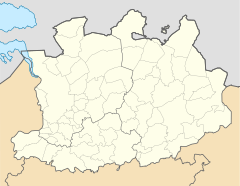
Sint-Amands is a district of the municipality of Puurs-Sint-Amands in the Mechelen district of the Belgian province of Antwerp , on the right bank of the Scheldt . Until January 1, 2019, Sint-Amands was an independent municipality and had 8,480 inhabitants (as of January 1, 2018). The villages Lippelo and Oppuurs belonged to the municipality.
Sons and daughters of the church
- Émile Verhaeren (1855-1916), poet
- Marthe Massin-Verhaeren (1860–1931), painter, wife of Émile
Web links
Commons : Sint-Amands - collection of images, videos and audio files
