Sippenaeken
| Sippenaeken | ||
|---|---|---|
|
|
||
| State : |
|
|
| Region : | Wallonia | |
| Province : | Liege | |
| District : | Verviers | |
| Coordinates : | 50 ° 45 ′ N , 5 ° 56 ′ E | |
| Post Code: | 4851 | |
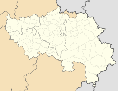
Sippenaeken (pronunciation with Dehnungs-e ) is a village in northeast Belgium that belongs to the municipality of Plombières (dt. Bleyberg ) - and thus to the Low German municipalities . The place is located on the Göhl , about two kilometers northwest of Plombières on the road from Gemmenich to Teuven .
population
Sippenaeken has around 200 inhabitants. In the village, which is officially in the French-speaking area, the local population traditionally speaks a transitional dialect ( Plattdütsch ) between German and Dutch with both Limburg and Ripuarian influences.
The results of the language censuses therefore changed somewhat: in 1846, 49% of the population described themselves as Dutch-speaking, 38% as German and 13% as French-speaking. In 1910, before the First World War , 61.9% said they spoke German, 21.2% French and 16.9% Dutch. In 1947, after the Second World War, 82% French, 15% Dutch and 3% German were suddenly given. In fact, there had been no significant population exchange. The information provided by the population was thus strongly colored by current political events and arbitrariness. A large part of the population of Sippenaeken is still multilingual today.
Worth seeing
To the west of Sippenaeken is Beusdaal Castle, which is surrounded by a moat and has an imposing keep from the 13th century.
Web links
Individual evidence
- ↑ Three Borders Tourist Office : Sippenaeken , accessed on April 8, 2014
- ↑ José Cajot, Hartmut Beckers, 1979: On the diatopy of the German dialects in Belgium


