Southern Ports Highway
| Southern Ports Highway | |||||||||||||||||||||||||||||||
|---|---|---|---|---|---|---|---|---|---|---|---|---|---|---|---|---|---|---|---|---|---|---|---|---|---|---|---|---|---|---|---|

|
|||||||||||||||||||||||||||||||
| map | |||||||||||||||||||||||||||||||
| Basic data | |||||||||||||||||||||||||||||||
| Operator: | Transport SA | ||||||||||||||||||||||||||||||
| Start of the street: |
Kingston SE ( SA ) ( 36 ° 50 ′ S , 139 ° 52 ′ E ) |
||||||||||||||||||||||||||||||
| End of street: |
Millicent ( SA ) ( 37 ° 36 ′ S , 140 ° 21 ′ E ) |
||||||||||||||||||||||||||||||
| Overall length: | 117 km | ||||||||||||||||||||||||||||||
|
States : |
|||||||||||||||||||||||||||||||
|
Course of the road
|
|||||||||||||||||||||||||||||||
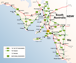
The Southern Ports Highway is a trunk road in the southeast of the Australian state of South Australia . It is a coastal bypass of the Princes Highway , from which it branches off in Kingston SE and into which it joins again in Millicent , 50 km northwest of Mount Gambier .
course
Coming from the north, the Princes Highway (B1) runs along the coast between Lake Albert and Lacepede Bay . At Kingston SE (Kingston South East, in contrast to Kingston-on-Murray) it turns east inland, while the Southern Ports Highway continues south, along the coast, to Robe . From there, the road runs east of the Lake Robe, Lake Eliza, Lake St. Clair and Lake George lagoons to the southeast to Beachport .
The Southern Ports Highway continues along Rivoli Bay to the north end of Canunda National Park and finally meets the Princes Highway again at Millicent .
Road conditions
The road, popular with tourists, is paved throughout and is in good condition.
source
Steve Parish: Australian Touring Atlas . Steve Parish Publishing. Archerfield QLD 2007. ISBN 978-1-74193-232-4 . P. 69
