St. Lewis Inlet
| St. Lewis Inlet | ||
|---|---|---|
|
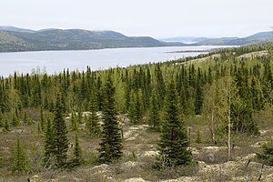
View of St. Lewis Inlet |
||
| Waters | Labrador Sea | |
| Land mass | Labrador Peninsula | |
| Geographical location | 52 ° 23 ′ N , 56 ° 0 ′ W | |
|
|
||
| width | 2.6 km | |
| length | 35 km | |
| surface | 52 km² | |
| Islands | Wood Island | |
| Tributaries | St. Lewis River | |
|
View from Route 510 of St. Lewis Inlet |
||
The St. Lewis Inlet is a fjord -like Bay on the east coast of Labrador in the Canadian province of Newfoundland and Labrador .
The bay is located in the extreme southeast of the Labrador Peninsula . The narrow bay has a length of 35 km in WNW-ESE direction. The maximum width is 2.6 km. The St. Lewis River flows into the head of the bay. Wood Island is 7 miles from the head end . The Trans-Labrador Highway ( Route 510 ) crosses the bay at this point. At the exit of the bay is the island of Captain Jack's Island . The St. Lewis Sound forms the transition area between the bay and the open sea. To the south of the bay exit is the community of Mary's Harbor .
Web links
Commons : St. Lewis Inlet - collection of images, videos and audio files
- St. Lewis Inlet at Natural Resources Canada


