Mary's Harbor
| Mary's Harbor | ||
|---|---|---|
 |
||
| Location in Newfoundland and Labrador | ||
|
|
||
| State : |
|
|
| Province : | Newfoundland and Labrador | |
| Region: | Census Division No. 10 | |
| Coordinates : | 52 ° 18 ′ N , 55 ° 50 ′ W | |
| Height : | 10 m | |
| Area : | 38.16 km² | |
| Residents : | 341 (as of 2016) | |
| Population density : | 8.9 inhabitants / km² | |
Mary's Harbor is a municipality ( town ) in the Canadian province of Newfoundland and Labrador .
location
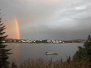
The community is located on the southeastern Labrador Coast . The settlement is located on the small bay of the same name, into which the St. Marys River flows. The bay opens to the northeast towards St. Lewis Sound . Further north extends the St. Lewis Inlet , a narrow bay that extends deep inland.
Mary's Harbor has a small airfield. The Trans-Labrador Highway runs south past Mary's Harbor. 8.5 km further south is the Lodge Bay settlement on the trunk road. About 13 km northeast on the north coast of St. Lewis Sound is the parish of St. Lewis .
history
Salmon have been caught on the St. Marys River since the 1780s . It was not until after a fire in 1930 in Battle Harbor , located just under 18 km to the east, that Mary's Harbor became a permanent settlement. The most important branch of the economy is fishing and fish processing. Cod was caught in the Labrador Sea until the early 1990s . After the fish stocks collapsed, more crabs and other crustaceans were caught.
population
In the 2016 census, the community had a population of 341. Five years earlier it was 383. Thus, the population has decreased in recent years. About half of the population consists of Métis .
Web links
- Mary's Harbor at Natural Resources Canada
Individual evidence
- ↑ a b c Mary's Harbor, Census 2016. Statistics Canada, accessed December 2, 2018 .
