Stacking gate
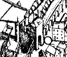
The stacking gate was one of the four main gates of the city of Duisburg , as they are handed down in the city map of Johannes Corputius from 1566. Today the name of the Stapeltor square between Springwall and Kuhlenwall in the old town still reminds of its former location. The eastern gate of the city was secured with a forecourt , which was flanked by two round towers. Like the other gates of the city fortifications, the stacking gate was demolished in the first half of the 19th century.
Within the medieval city, the area between Stapeltor and Burgplatz is assumed to be Duisburg's merchant quarter. The old Ruhr estuary , which met an arm of the old Rhine in front of the stacking gate, was probably used as a port in the Middle Ages. A service park was set up in this area at the end of the 1990s as part of the IBA Emscherpark .
In addition to the stacking gate, the names of five other Duisburg city gates have been handed down, which can be seen in the Corputius plan : Schwanentor , Kuhtor and Marientor ; in addition the Liebfrauentor ( Liefkenporte ) in the 13th century and the fish gate from the 14th century.
swell
- ↑ Günter Krause: Duisburg as a trading and port location in the Middle Ages and early modern times, online ( memento of the original from May 26, 2015 in the Internet Archive ) Info: The archive link was automatically inserted and not yet checked. Please check the original and archive link according to the instructions and then remove this notice. (April 29, 2013; PDF; 231 kB)
Coordinates: 51 ° 26 ′ 14 ″ N , 6 ° 46 ′ 0 ″ E
