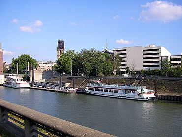
Swan gate

The Swan Gate was one of the four main gates of Duisburg , as shown on the map of Johannes Corputius from 1566. It existed at least with the city wall since the 13th century. In 1815 the Schwanentor was the first of the Duisburg city gates to be demolished. Its former location of the gate is today's Calaisplatz. His name is still present in the area around the former city gate. Remnants of the tower at the Schwanentor are still preserved from the medieval city fortifications.
Already in the Middle Ages there was an arm of the old Rhine in front of the Schwanentor , created after a shift in the Rhine that took place before 1000. In the 19th century, the Duisburg inner harbor was built in the area of this medieval and a Roman course of the Rhine . This means that the area around the Schwanentor is once again located directly on the water. The Schwanentorbrücke clearly marks this with its four pylons. Below the bridge is the Steiger Schwanentor , a pier for passenger ships.
photos
Web links
- Duisburg 1566 3D , Duisburg city center in the 16th century as an animation with a ride through the Schwanentor
Coordinates: 51 ° 26 ′ 7.4 " N , 6 ° 45 ′ 30.5" E

