Sulphide Creek Falls
| Sulphide Creek Falls | ||
|---|---|---|
| Coordinates | 48 ° 47 '47.29 " N , 121 ° 34' 32.27" W | |
|
|
||
| place | North Cascades National Park , Whatcom County , Washington | |
| height | 665 m | |
| width | 15.2 m | |
| flow | Sulphide Creek | |
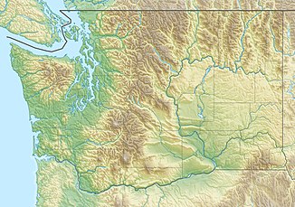
The Sulphide Creek Falls are a tall waterfall with a moderately high flow rate (14.3 m³ / s) in the North Cascades National Park in the US state of Washington . The outflow of Sulphide Lake plunges as a waterfall on the southeast side of Mount Shuksan at 48 ° 47 '47 " N , 121 ° 34' 32" W through a gorge-like canyon into a wide basin. Because of the narrow and winding course of the canyon, the waterfall is extremely difficult to see from below. The height of fall is between 2,100 ft (640 m) and 2,200 ft (671 m), but has not yet been precisely measured. If you want to reach the foot of the waterfall on foot, you have to accept a 2.5 mi (4 km) hike off the beaten track. The area is extremely bushy and there are several potentially dangerous fords through a large stream to be accepted.
More waterfalls
Another waterfall found on the opposite side of the valley that joins Sulphide Creek Falls at its base should not be confused with Sulphide Creek Falls. This other fall is much more visible, but only half the height of Sulphide Creek Falls. It is occasionally called Sulphide Valley Falls .
Above Sulphide Lake, there are additional cascades (1,000 ft (305 m) high), unofficially known as Sulphide Basin Falls , that tumble from the Sulphide and Crystal glaciers and provide most of the water that drains over Sulphide Creek Falls. Despite their geographical proximity to Sulphide Creek Falls and their location on the same tributary, these cascades should not be confused with these.
Access
There is no trail to Sulphide Creek Falls. The closest hiking trail is the Baker River Trail , which runs parallel to the Baker River (into which Sulphide Creek flows). The trail crosses Sulphide Creek at its mouth. From there, one must hike upstream through the wide, rocky river bed that extends to about a mile (1.6 km) from the base of the falls. Mighty avalanche cones prevent any approach.
Individual evidence
- ↑ a b Sulphide Creek Falls . Northwest Waterfall Survey. Retrieved March 9, 2009.
- ^ Sulphide Valley Falls . Northwest Waterfall Survey. Retrieved March 15, 2009.
- ^ Sulphide Basin Falls . Northwest Waterfall Survey. Retrieved March 9, 2009.
