Sumatra earthquake of March 2007
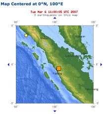
The March 2007 Sumatran earthquakes were two powerful earthquakes that occurred within two hours on March 6, 2007 at the north end of Lake Singkarak in Sumatra .
earthquake
The first quake occurred at 10:49 a.m. local time (UTC + 7) and reached M W = 6.4 on the moment magnitude scale . The second quake at 12.49 p.m. local time had a magnitude of M W = 6.3. The effects of the quakes were felt as far as Singapore and Malaysia , which prompted the evacuation of some buildings there.
Effects
More than 60 people were killed and 460 seriously injured in numerous places and settlements in western Sumatra. Over 43,000 houses were damaged, more than 12,000 of them seriously. The serious damage to property also affected other structures: 130 public institutions, 310 mosques, 60 government administration buildings, 370 schools and 230 shops. According to the governor of West Sumatra, Agam is the hardest hit area, with other areas such as Solok and Tanah Datar also badly hit. The total property damage is estimated at approximately 1.4 trillion Indonesian rupees (about 160 million US dollars ).
Tectonic summary
The earthquake of March 6, 2007 occurred in a 1900 km long strip that runs parallel to the southwest coast of the island of Sumatra. In the area where the earthquake had its epicenter, the annual rate of movement is about 20 mm. Two earlier earthquakes, which occurred on June 28, 1926 within three hours and whose magnitudes were 6.1 and 6.3, occurred at the same place. On June 8 and 9, 1943, two earthquakes within seven hours with magnitudes of 7.2 and 7.5 and epicentres directly southeast of the epicenter of the earthquake of March 6, which with a magnitude of 7.5 were among the strongest earthquakes heard at the Sunda Trench since the late 19th century.
The tectonics of the western center of Sumatra is determined by the northward movement of the Australian plate of 50 mm per year. The plate boundary runs roughly along the Sunda Trench, but the zone where deformation occurs extends hundreds of kilometers from the trench. The movement perpendicular to the plate boundary is compensated for by the Australian plate under Sumatra derived . In the west of Java , seismic activity is registered by debris from the faults to a depth of more than 200 kilometers. This movement is pushing Sumatra a little to the east. The component of relative plate motion parallel to the plate boundary causes shear fractures along the Sumatra Fault, which is approximately 300 km from the Sunda Trench.
Individual evidence
- ↑ a b Magnitude 6.4 - SOUTHERN SUMATRA, INDONESIA . United States Geological Survey . March 7, 2007. Archived from the original on March 8, 2007. Info: The archive link was inserted automatically and has not yet been checked. Please check the original and archive link according to the instructions and then remove this notice. Retrieved March 7, 2007.
- ↑ a b Magnitude 6.3 - SOUTHERN SUMATRA, INDONESIA . United States Geological Survey . March 7, 2007. Retrieved on March 7, 2007. ( Page no longer available , search in web archives ) Info: The link was automatically marked as defective. Please check the link according to the instructions and then remove this notice.
- ^ Quakes kill 82 in Indonesia , The Age . March 6, 2007. Retrieved March 6, 2007.
- ↑ Indonesia: Earthquakes West Sumatra Province OCHA Situation Report No. 6 . United Nations Office for the Coordination of Humanitarian Affairs . March 16, 2007. Retrieved February 17, 2011.
- ^ A b c West Sumatra Earthquake, March 13,2007: 5:00 PM , West Sumatra Provincial Government. March 13, 2007. Archived from the original on September 27, 2007 Info: The archive link was inserted automatically and has not yet been checked. Please check the original and archive link according to the instructions and then remove this notice. . Retrieved March 16, 2007.
- ↑ Indonesia: Earthquakes West Sumatra Province OCHA Situation Report No. 5 , United Nations Office for the Coordination of Humanitarian Affairs . March 12, 2007. Retrieved March 14, 2007.
Coordinates: 0 ° 32 ′ 10.5 ″ S , 100 ° 29 ′ 54.5 ″ E
