
Svartifoss
| Svartifoss | ||
|---|---|---|
 The Svartifoss |
||
| Coordinates | 64 ° 1 '52.7 " N , 16 ° 58' 21" W | |
|
||
| place | Vatnajokull National Park , Iceland | |
| height | 12 m | |
| flow | Stórilækur → Skaftafellsá | |

The Svartifoss [ 'svar̥tɪˌfɔsː ] ( black waterfall , according to the color of the surrounding rock) is in Skaftafell National Park in the southeast Islands . It is located in the municipality of Hornafjörður .
The Stórilækur ( large stream ) falls over a cliff edge, which is framed by basalt columns like organ pipes , and flows further into the Vestragil ( west gorge ). Down the river follow the Magnúsarfoss , Hundafoss and Þjófafoss. As the name of the river suggests, it is not a mighty, water-rich waterfall .
The waterfall is a half-hour walk from the Skaftafell campsite and information center. The remains of a small power station can still be seen below the waterfall. The nearby farms were supplied from here.
photos

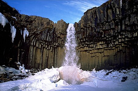
Svartifoss in winter

Svartifoss in summer
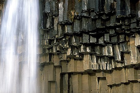
Basalt columns at Svartifoss

Long exposure


