Swartz Covered Bridge
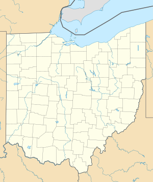
Coordinates: 40 ° 46 ′ 15 ″ N , 83 ° 10 ′ 9 ″ W.
| Swartz Covered Bridge | ||
|---|---|---|
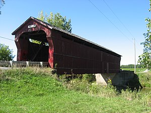
| Swartz Covered Bridge (2009) | ||
| use | Road bridge | |
| Crossing of | Brokensword Creek | |
| place | in Wyandot County ( Ohio ) | |
| completion | 1878 or 1880 | |
| location | ||
|
|
||
| Bridge base (2009) | ||
The Swartz Covered Bridge is a covered wooden bridge northwest of Wyandot , Ohio . The bridge, built in 1878 (or 1880) by Moses Weymouth , is located on Ohio State Route 130A , spans Brokensword Creek and is passable. The bridge was designed using the Howe Truss construction technique. The foundation is made of stone, the walls are clad in wood , the roof is laid with shingles. Another building material is concrete . Its span is 28.7 meters, the total length 30.8 meters, the inner width 3.9 meters and the ceiling height 3.96 meters. It was renovated in 1994 (or 1992/93).
The Swartz Covered Bridge was added to the National Register of Historic Places on October 8, 1976 under number 76001553 .
Web links
- USGS topographic map: Nevada, OH
- Image of the bridge at bridges-covered.com
- Swartz Bridge in the United States Geological Survey's Geographic Names Information System
Individual evidence
- ↑ NRIS
- ^ National Register of Historical Places - OHIO (OH), Wyandot County
- ↑ The Covered Bridges of Wyandot County ( Memento of the original from October 20, 2011 in the Internet Archive ) Info: The archive link was inserted automatically and has not yet been checked. Please check the original and archive link according to the instructions and then remove this notice.
- ↑ Swartz Covered Bridge - Harpster, Ohio - Covered Bridges on Waymarking.com


