Tahoma glacier
| Tahoma glacier
( Tahoma Glacier )
|
||
|---|---|---|
|
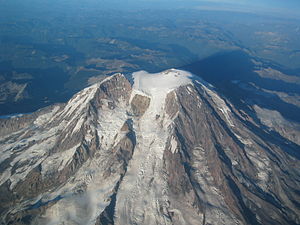
The Tahoma Glacier flows from the ice cap at the summit between St Andrews Rock and Puyallup Cleaver (left) and the Tahoma Cleaver (right) |
||
| location | Pierce County , Washington , USA | |
| Mountains | Cascade chain | |
| Type | Kar glacier | |
| surface | 3.1 km² (1983) | |
| Altitude range | 4328 m - 1676 m | |
| Ice volume | 0.12 km³ | |
| Coordinates | 46 ° 50 ′ 23 " N , 121 ° 48 ′ 33" W | |
|
|
||
| drainage | South Puyallup River / Tahoma Creek → Nisqually River | |
The Tahoma Glacier is a long glacier , most of which is located on the western flank of Mount Rainier in Washington state . In 1983 it covered about 3.1 km² and contained 120 million m³ of ice. The glacier begins near the top of the volcano at over 14,200 ft (4,328 m) altitude. The glacier flows west southwest of the summit area down and passes a steep rock face by a Eissturz ft between 13,200 ft (4,023 m) and 11,000 forms (3,353 m) altitude, where he met the South Mowich Glacier to the north in the Sunset Amphitheater is connected . When the glacier drops below 10,000 ft (3,048 m), it widens and merges with the smaller South Tahoma Glacier . After the ice expands to over 8,000 ft (2,438 m), it narrows as soon as it passes rocky Glacier Island at 7,690 ft (2,344 m) , a sub-peak of Rainier that was once completely separated from South Tahoma and Tahoma. Glacier was enclosed. After passing the bottleneck, the glacier divides; the larger and longer northern arm flows west-southwest and ends at about 5,500 ft (1,676 m) altitude. The southern arm flows south towards an arm of the South Tahoma Glacier, but this arm ends due to the retreat since 1850 before it can reunite with the South Tahoma at 5,700 ft (1,737 m) altitude. The meltwater from the glacier is the source of the South Puyallup River and Tahoma Creek, a tributary of the Nisqually River .
Individual evidence
- ↑ a b c DESCRIPTION: Mount Rainier Glaciers and Glaciations - Mount Rainier Glacier Hazards and Glacial Outburst Floods . USGS . Retrieved November 19, 2007.
- ↑ a b c USGS Mount Rainier West (WA) Topo Map . In: USGS Quad maps . TopoQuest.com. Retrieved May 15, 2008.

