
Touch pad
Tastrupfeld ( Danish Tostrupmark ) is a district of the municipality of Tastrup .
location
Tastrupfeld is located southeast of the Südstadt district of Flensburg . On the western edge of Tasrupfeld, still in the city of Flensburg, there is a waste management center at Eckernförder Landstrasse 300. About the local " roundabout of Tastrupfeld" the two streets of the district are Tastrupfeld namely to reach the streets "Hummelroi" and "Tasttrupfeld". Zweihunderfünzig meters north of Tastrupfeld is Kleintastrup . Tastrup is actually about seven hundred meters to the northeast. The municipality of Freienwill is also located directly southwest of Tastrupfeld . Incidentally, the farm Tsstrupfeld 1 is a bit away from the Tastupfeld settlement, about 500 meters east of the road.
background
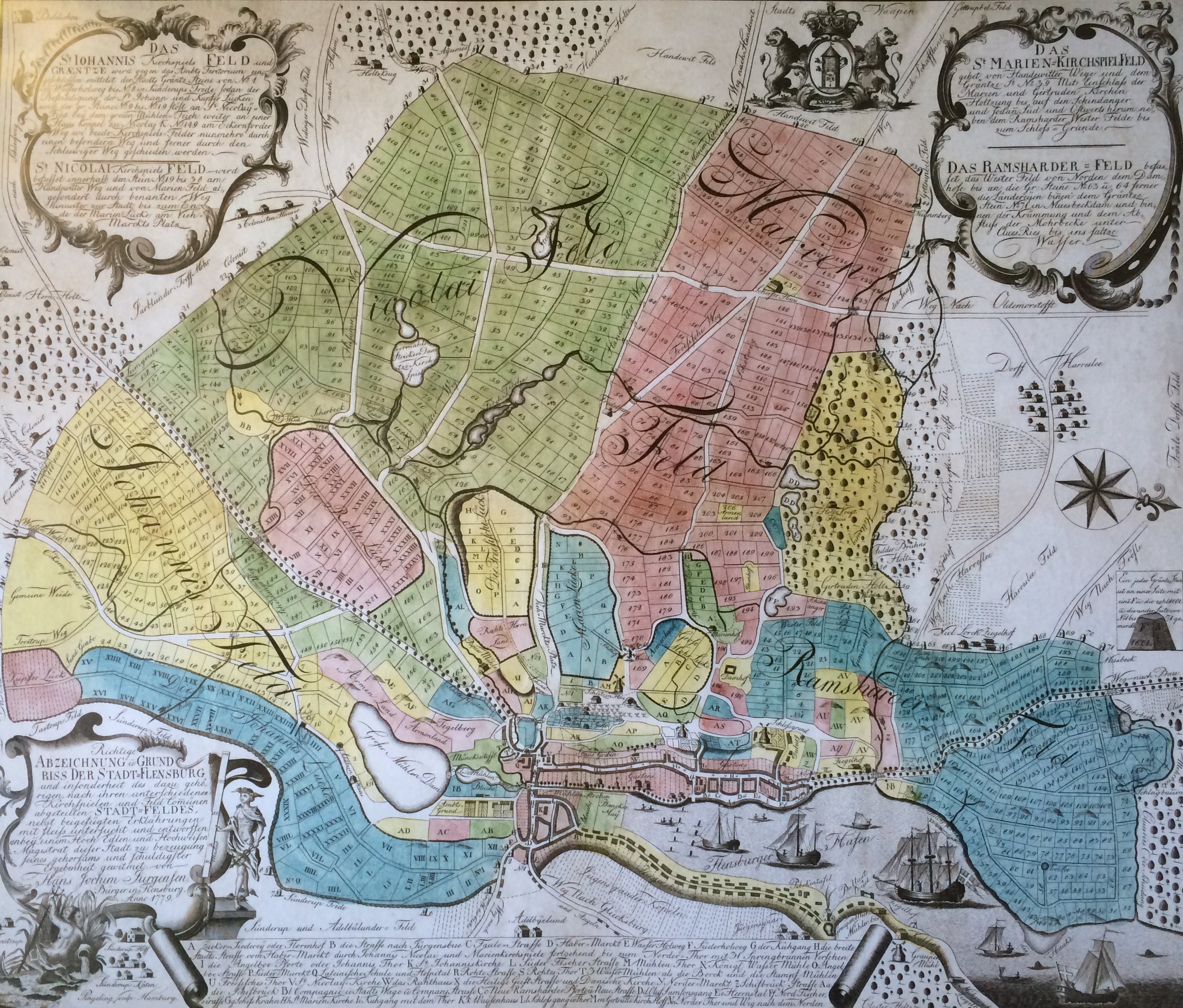
On the Jürgensen map of Flensburg and the surrounding area from 1779, the note "Tastrup Feld" was to be found on the edge of the Flensburg city field. The note had obviously on fields of Tastrup there, but called probably the location is not right today Tastrupfeld, but according to the location on the map, rather the area Kleintastrup . On a rather detailed Danish map from 1857/58, “Tastrupfeld” was obviously not yet entered. In contrast to Kleintastrup, Tastrupfeld was also not noted by name on the map of the Prussian Land Survey around 1879. Apparently the name Tastrupfeld first appeared by name on the maps of Flensburg and its surroundings in the 1930s. Nowadays Tastrupfeld is one of the districts of the municipality of Tastrup. It has its own bus stop. For example, the Flensburg ZOB can be reached via the bus that stops there .
Individual evidence
- ↑ Office Hürup. Trastrup. More information on Tastrup , accessed on: March 30, 2020
- ↑ BGK. Attachment: Flensburg , accessed on: June 7, 2020
- ↑ Flensburg. Eckernförder Landstrasse 300 Flensburg 24941 Germany , accessed on: June 7, 2020
- ↑ Flensburger Tageblatt : Freienwill: Hauptstraße is finally being renovated , from: October 19, 2017; accessed on: June 7, 2020
- ↑ Office Hürup. Trastrup. More information on Tastrup , accessed on: June 7, 2020
- ↑ Michelin. Tastrupfeld map , accessed on: May 25, 2020
- ↑ Jürgensen map of Flensburg and the surrounding area 1779
- ↑ Danish Royal Library : Slesvigs Fastland og Als, Generalstaben Videnskabernes Selskab 1857/58 (or Google translation: there )
- ^ Prussian land survey around 1879 , accessed on: June 8, 2020
- ↑ In the mid-1920s, Tastrupfeld was obviously not yet indicated by name on the previous city map. See map of Flensburg Süd 1926 ; But it can be found on the map from 1936. See map of Flensburg (south) from 1936
- ↑ Timetable bus-train. Tastrup Tastrupfeld stop, Flensburg , accessed on: June 7, 2020
Coordinates: 54 ° 45 ′ 16 " N , 9 ° 27 ′ 41.5" E