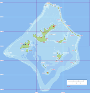
Teohootepohatu
This article was due to content flaws on the quality assurance side of Geosciences portal entered. This is done to increase the quality of the articles in the geosciences topic. Please help to correct the deficiencies or take part in the discussion . ( + )
Reason: Perhaps someone can provide a few more details, for example size of the island, highest point, fauna, flora etc. - Wikinger08 ( discussion ) 08:03, 12 Sep. 2016 (CEST)
| Teohootepohatu | ||
|---|---|---|
| Waters | Pacific Ocean | |
| Archipelago | Gambier Islands | |
| Geographical location | 23 ° 11 ′ S , 134 ° 54 ′ W | |
|
|
||
| Residents | uninhabited | |
Teohootepohatu is an uninhabited island northeast of Akamaru within the reef of the Gambier Islands in French Polynesia .
