
French Polynesia
| French Polynesie | |||||
| French Polynesia | |||||
|
|||||
|
Motto : Tahiti Nui Mare'are'a ( Tahitian for "Great Tahiti of the golden haze") |
|||||
| Official language | French | ||||
| Capital | Papeete | ||||
| Head of state , also head of government |
President Emmanuel Macron President of French Polynesia Édouard Fritch (since 2014) |
||||
| area | 4,167 km² | ||||
| population | 283,007 (2017) | ||||
| Population density | 69 inhabitants per km² | ||||
| currency | CFP Franc (XPF) | ||||
| Time zone | UTC − 9 to UTC − 10 | ||||
| ISO 3166 | PF | ||||
| Internet TLD | .pf | ||||
| Telephone code | +689 | ||||
 _(small_islands_magnified)_(Polynesia_centered).svg) |
|||||
 |
|||||


French Polynesia ( Tahitian Porinetia Farani , French Polynésie française ), originally French Oceania , is a French overseas territory in Polynesia . French Polynesia has its own parliamentary constitution (with the Assemblée de la Polynésie française ) and its own flag and is not part of the European Union .
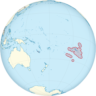
French Polynesia consists of a collection of smaller islands , atolls and archipelagos in the southern Pacific at around 15 ° south and 140 ° west. The most famous and most populous island is Tahiti ; the Mururoa atoll , where the French nuclear force carried out nuclear weapons tests, is also part of French Polynesia.
geography
French Polynesia consists of a total of 118 islands and atolls belonging to five archipelagos :
|
|

|
Society Islands | 14 islands | 1647 km² | 235,295 inhabitants |
|
|
|
Tuamotu Archipelago | 76 atolls | 850 km² | 15,410 inhabitants |
|
|

|
Marquesas Islands | 12 islands | 1274 km² | 9261 inhabitants |
|
|

|
Austral Islands | 6 islands | 148 km² | 6820 inhabitants |
|
|

|
Gambier Islands | 26 islands | 31 km² | 1421 inhabitants |
The islands are spread over a water area of around 4,000,000 km² with a land area of just over 4,000 km². The highest point is the Mont Orohena with 2241 m.
population
people
About 78% of the population are Polynesians who are organized into different ethnic groups. The largest minority with 12% are Chinese , who have a great influence especially in the economy. Formerly immigrant French settlers make up 6% and French people who were not born in French Polynesia but in France now make up 4% of the total population. A certain proportion of the population is of mixed ethnicity.
development
| year | population |
|---|---|
| 1950 | 60,266 |
| 1960 | 78.076 |
| 1970 | 110,495 |
| 1980 | 151,708 |
| 1990 | 198,375 |
| 2000 | 237.258 |
| 2010 | 267,820 |
| 2017 | 283.007 |
Source: UN
languages
Although many different languages are spoken in French Polynesia, French is the only official language in the area. A constitutional law of April 12, 1996 states that French is the official language, Tahitian and other Polynesian languages can be used regionally. The French language policy is very rigid as in all French regions and aims, the Francophonie to promote. As a result, native Polynesian languages are given poor social status by the government and are used less and less, even by native speakers. Numerous Polynesian languages are therefore threatened with extinction.
According to the 2007 census, 68.5% of the population over 15 normally speak French at home and only 29.9% still speak one of the Polynesian languages at home, four fifths of them Tahitian. 1% speak one of the Chinese languages at home , half of them Hakka , and 0.6% another language.
Overall, 94.7% of those over 15 can now speak, read and write French, while only 2% have no knowledge of French. In contrast, only 74.6% can speak, write and read one of the Polynesian languages, while 13.6% no longer have any knowledge of any Polynesian language.
religion
A majority of 54% of the population belong to Protestant religious communities, 30% are Roman Catholic Christians , 1% are Jehovah's Witnesses, and 10% profess other denominations and faith communities. After all, 6% do not belong to any religious community.
History of the archipelagos
Society Islands
The Society Islands were founded around 200 BC. Populated from Tonga and Samoa.
The Society Islands record begins when Ferdinand Magellan discovered the Tuamotu Archipelago in 1521.
Together with the Marquesas, they formed the Polynesian heartland and thus the stepping stone to colonization of Hawaii , New Zealand , the Gambier Islands and Easter Island .
Favored by the geography of the islands with their closed valleys opening towards the sea, nine independent tribal principalities soon developed. This led to a strictly stratified social model, society was divided into several separate social levels.
There were essentially three sets :
- The nobility, in Polynesian ari'i or ariki : they were at the head of society and represented the great landowners. At the top were the ariki rahi (German: the great ariki), the sovereigns who were recruited from the old noble families. In Tahiti there were eight of them, each headed a tribe. These families also provided the highest priests, usually later sons.
- The free, Polynesian raatira , were essentially the small landowners, craftsmen, boat builders, tattooists and artists. During the war they were the closest followers of the Ariki. The boundaries between the Raatira and the lowest levels of the small nobility were fluid.
- The serfs , Polynesian manahune : They tilled the fields depending on the landlords. Most of the products had to be taken away.
The system of rule in Tahiti included features of medieval European feudal society as well as the Hindu caste society . Religious and secular power were closely interlinked and partly united in the same people.
A special role within the Polynesian society of Tahiti was taken by the secret society of the Arioi , which had both religious and power-political importance, the latter through representation and display of splendor to the glory of the ruling houses.
At the time of cultivation before the European discovery in the 18th century, Tahiti probably had 35,000 inhabitants. A sophisticated system of land use was created to feed the population, and the artfully irrigated and drained cultivation terraces for taro are still archaeologically verifiable in places today. Other important crops were the breadfruit , the coconut palm and the Tahitian chestnut ( Inocarpus fagifer from the Fabaceae family ).
In contrast to its current importance, Tahiti was not the political and religious center of the Society Islands before the European occupation. Raiatea soon became the spiritual and religious center of the Society Islands. Jacques Antoine Moerenhout (1796–1879, businessman, ethnologist and consul of France for Tahiti) describes this very clearly:
“The three islands of Raiatea , Tahaa and Bora Bora even dominated Tahiti, this is especially true for Raiatea, which developed into the actual seat of the Polynesian theocracy . This is where the Grand Master of the twelve Arioi lodges lived, from there came the oracles and prophecies reported in the annals, as well as the taboos and religious rites that were valid in all regions of Polynesia.
The most important religious site of Raiatea, and indeed of the entire Society Islands, was the Marae Taputapuatea in the Opoa Valley on the east coast. It was initially dedicated to the cult of Ta'aroa (or Tangaloa, Tangaroa), the god of the sea and fishing. The Ta'aroa ceremony was very complex and included - initially only a few - human sacrifices. From around the 15th century, Oro , the god of war, took the place of Ta'aroa and increasingly demanded human sacrifices. The cult spread to the neighboring islands, especially Tahiti. However, this did not prevent constant acts of war between the tribes, which also served to procure human sacrifices and are glorified in numerous chants that are still recited today. "
The Opoa Valley is considered the birthplace of Oro, so the importance of the Marae Taputapuatea increased with the emergence of the secret society of the Arioi in the 17th century.
With the importance of Taputapuatea, the influence of the Tamatoa dynasty from Opoa, which eventually dominated the other tribal principalities, also grew.
The balance of power in the Society Islands was largely balanced until the Europeans intervened, and initially no tribe succeeded in gaining supremacy in Tahiti.
In the closed valleys of Moorea , nine tribal principalities emerged, which in turn were subdivided into individual clans. The stratified society was characterized by a hierarchical leadership, whose elite united both political and religious power. Moorea's leading families remained connected to those of the neighboring island of Tahiti through marriage and kinship for centuries. These connections led to important alliances, but at other times they were also the source of bloody disputes.
The intensive exploration of the Opunohu Valley, which continues to this day, beginning with Kenneth P. Emory (1897–1992) in the 1920s and continued in the 1960s by the archaeologist Roger C. Green of the University of Auckland, provides an exemplary picture of the development of Mooreas society. The interaction between increasing population density and the modification of the environment by humans led to significant changes in the form of society.
The so-called Pre-Atiro'o phase, before 1000 AD, is characterized by extensive clearing and the cultivation of the slopes downhill, which at the end of the period already resulted in erosion and the formation of alluvial soils . Society was not yet stratified, but rather homogeneous.
In the Atiro'o period (1000 to 1650 AD), artificial cultivated terraces and simple stone structures, for example the Marae Tapauruuru, were built on the slopes. Remains of rectangular houses (fare haupape) and those with an elongated-oval floor plan (fare pote'e), which were reserved for the power elite, indicate a strictly stratified, hierarchical form of society.
The subsequent Marama period (1650 to 1788 AD) is marked by the conquest of the Opunohu Valley by the chiefs (ariki) of the Marama tribe originally living on the coast, who succeeded in bringing all the other clans of the valley under theirs To unite supremacy. In addition to a further increase in the population, a brisk construction activity of representative cult buildings - large marae in the manner of a step pyramid - can be observed in this phase. Towards the end of this period, the Opunohu Valley became a refuge for Ariki who opposed European influence.
The first to discover Maupiti Island for Europe was the Dutchman Jakob Roggeveen in 1722.
It has not been conclusively clarified which Europeans can be considered the “discoverers” of Tahiti. The Portuguese Pedro Fernández de Quirós sighted an inhabited island on February 10, 1606, which he named Sagittaria and which could have been Tahiti. However, there is no confirmation of this. Today the Englishman Samuel Wallis is considered to be the first European to set foot in Tahiti on June 21, 1767. He also set foot on the island of Moorea at that time and named it York Island . Remnants of the discovery village of the Scilly atoll still exist on the northern part of the island. The atoll Maupihaa with the neighboring atolls Motu One and Manuae were discovered by him at this time. In some sources Motu One is also called Bellingshausen or Bellinghausen. This name goes back to Otto von Kotzebue , who named the atoll after the Baltic German explorer Fabian Gottlieb von Bellingshausen .
Samuel Wallis named the main island, today's Tahiti, after the client and sponsor of his circumnavigation. From then on the island was called King George Island. In the following year, on April 6, 1768, the Frenchman Louis Antoine de Bougainville landed , stayed for nine days and euphorically referred to Tahiti as “La Nouvelle Cythère” (the new Kythera ; the island of love of Aphrodite).
The visits of James Cook in particular have remained in the minds of Europeans . On April 13, 1769, he anchored his ship Endeavor in Matavai Bay , about 10 km north of today's Papeete . He was commissioned to observe the transit of Venus and for this purpose he set up an observatory. Today the Pointe Vénus lighthouse is located here. He discovered Raiatea on July 20, 1769 during his first voyage. Coming from Tahiti, he drove with the Endeavor through the Avamo'a reef passage, which is sacred to the Polynesians, anchored in Opoa Bay and went ashore near the Marae Taputapuatea. He hoisted the " Union Jack " and took possession of the island in a brief ceremony for the English crown.
The botanist Joseph Banks traveled with Cook, who carried out extensive botanical studies during the three-month stay. The knowledge he gained led to the fateful voyage of the Bounty to Tahiti in 1787, with which the British Admiralty commissioned William Bligh . In this bloody conflict, Pouni (or Puni), an Ariki from Bora Bora , raided the neighboring islands of Raiatea and Tahaa. He managed to rise to the rank of overlord for a few years.
To expand the Spanish sphere of influence, King Charles III ordered. Expeditions to the South Pacific. The governor of Chile and viceroy of Peru, Manuel d'Amat i de Junyent, anchored off the Society Islands in 1772 with the Spanish frigate El Águila in the Baie de Tautira. He named the island Isla de Amat after his client . He also reached Raiatea and named the island Princess and took possession of it for Spain.
On August 17, 1773, James Cook returned to Tahiti. He was accompanied by the two scientifically educated Germans Johann Reinhold Forster and Georg Forster . The reports of the early explorers determined the image of the Europeans of the South Seas for a long time (and partly still today).
The islands were reliably mapped by James Cook on his third South Sea voyage in 1777, who gave them the name Society Islands (during his first South Sea voyage in 1769) in recognition of the services of the Royal Society . This name forms the basis for the German-language name Society Islands , as well as for the French name Îles de la Société .
James Cook anchored with the ships Resolution and Discovery not in the Cook's Bay named after him, but in the neighboring Baye d'Opunohu. A minor theft led to a conflict with the residents, in which Cook's marines destroyed some canoes and houses in retaliation. The European ships usually headed for Matavai Bay. The bay - Wallis forwardly named it Royal Bay - belonged to the tribal principality of Pare, whose Ariki was Pomaré I. He was therefore regarded by the Europeans as the "king" of the entire island, although he was only one of eight independent tribal chiefs. Since it was also useful for the European visitors to have only one contact person, they supported the Pomaré dynasty in their tribal rivalries also militarily, so that around 1780 Pomaré I was able to subjugate the entire island to his rule. Pomaré's wars of conquest and the diseases brought in by the Europeans led to a dramatic decline in population.
On April 6, 1768, the French explorer Louis Antoine de Bougainville reached Tahiti, took possession of the Society Islands for France and thus founded what is now French Polynesia.
In 1804, missionaries estimated Tahiti's population to be only 6,000.
In 1796 the "London Missionary Society" decided to equip the ship Duff under the command of Captain James Wilson to send missionaries to Tahiti, Tonga , the Marquesas , Hawaii and Palau . There were 30 missionaries on board , four of whom were ordained ministers. A report sent eight years later to the headquarters of the Society describes the successes of “civilizing” and proselytizing the natives of Tahiti as rather minor.
In the meantime deserted sailors, whalers, traders and adventurers had settled on the island, selling alcohol and firearms to the residents. This gave the traditional tribal wars a new and particularly disastrous dimension, which led to a further decline in population.
From 1803 Pomaré II continued the wars to consolidate his rule, but was defeated in 1808 and fled to Moorea. As a result, the mission station had to be abandoned. In 1811 Pomaré II returned to Tahiti - and with him the missionaries. He was baptized in 1812 and other leading Ariki converted to Christianity in the years that followed .
With the support of the Europeans, King Pomaré II of Tahiti was able to declare himself sovereign of the entire archipelago. On November 12, 1815, the opponents of Pomarés, the adherents of the old faith, were decisively defeated in the battle of Feipi.
In 1819 he introduced a catalog of penalties written by the missionaries, which provided for drastic penalties for all practices that were contrary to Christian teaching. For example, “blasphemy, idolatry and a return to idolatry” were subject to the death penalty, and “fornication (ie extramarital sexual relations) committed, concealed or hidden from missionaries” was subject to several years of forced labor.
In 1828 the Marae Taputapuatea was destroyed. In 1831 the Mamaia sect, the successor to the now banned Arioi, was once again able to drive out the missionaries from Raiatea. In 1832 the Mamaia were finally defeated and banished. The missionaries returned and France increasingly tried to gain influence.
On the Gambier Islands , the French Catholic mission was established under the order of "Pères et religieuses des Sacrés-Cœurs de Picpus" (short: Picpusiens). They watched the Protestant mission in Tahiti with suspicion and concern. In 1836, the French missionaries Honoré Laval and François d'Assise Caret landed on Tahiti to preach the Catholic faith. Not unsuccessful, missionary and acting British consul George Pritchard ordered their expulsion. This measure led to the dispatch of two French warships.
On November 15, 1836, Charles Darwin set foot on Tahiti during his world tour from 1831 to 1836. The Beagle anchored in Mataiva Bay.
On September 10, 1839, Charles Wilkes reached Tahiti as part of the United States Exploring Expedition . He set up his portable observatories at Pointe Vénus in memory of James Cook. The scientists accompanying him carried out anthropological, ethnological and botanical studies in particular. The diary of Chief Officer William Reynolds gives us an interesting indication of the population's relationship to Christianity:
"The only evidence of religion that I was able to discover among the natives was the observance of outward forms and the fear of the missionaries."
The island of Moorea remained under the influence of Tahiti.
In 1842 there was another French intervention, whose commander Abel Aubert Du Petit-Thouars announced the provisional French protectorate on September 9, 1842. The Raiatea clans put up strong resistance to the annexation efforts. However, the Christian missionaries managed to gain increasing influence, which led to religious wars between the followers of the traditional and Christian faith.
Aubert Du Petit-Thouars cleverly took advantage of the British Consul Pritchard's temporary absence. In November 1843, the protectorate was contractually confirmed by agreements between the French and Queen Pomaré Vahine IV , and in 1844 it was also formally recognized by France. Since Tahiti was friendly to England and more closely related to the Protestant missionaries, in this unclear situation she was brought to Raiatea in 1844 and ruled from there until 1847.
The writer Herman Melville was imprisoned in Papeete in 1842 on suspicion of participating in a mutiny on the Australian whaler Lucy Ann . But he managed to escape from prison. He later processed these experiences in the novel Omoo .
Her son Pomaré V. abdicated on June 29, 1880. As a result, the entire archipelago fell to France as a colony in March 1888 . However, riots continued on Raiatea. The tribal chief Teraupo holed himself up in the Avera Valley on the east coast and resisted the French intervention. Pomaré V was the last king of Tahiti; he died in 1891 as a result of his drunkenness. Teraupo was not taken prisoner until 1897.
The painter Paul Gauguin lived in Tahiti from 1891 to 1893 . During this time, numerous paintings were created that further strengthened the image of the “South Seas Paradise” in Europe. In 1895 he returned to Tahiti. He messed with the colonial administration and the missionaries and had to move to Atuona on the island of Hiva Oa in 1901, where he died in 1903.
In 1904 the Tahitian royal family bequeathed Tetiaroa Island to the dentist Johnston Walter Williams. The private island changed hands a few times up to 1965. After filming the film Mutiny on the Bounty , Marlon Brando leased the island of Tetiaroa from its owner for 99 years.
Shortly after the outbreak of World War I , the German armored cruisers SMS Scharnhorst and SMS Gneisenau anchored off Papeete to pick up coal. When they were refused and the French commander opened fire with a coastal battery, the naval artillery shot at Papeete and destroyed several houses in the process. During the war the legendary "sea devil" Felix Graf von Luckner visited Tahiti several times with his auxiliary cruiser Seeadler . One of the ship's cannons is now in a small park in front of the Papeete post office.
During the Second World War , the island of Bora Bora became an important supply base for the USA in the South Pacific after the attack on Pearl Harbor on December 7, 1941 . The US military built a tank farm, a runway and a base for seaplanes. Several strategically important areas were secured with coastal batteries and anti-aircraft cannons. Some of the rusted cannons can still be seen today. However, the US base was not attacked during the war and abandoned in 1946.
Between 1966 and 1996, France carried out several nuclear weapons tests on the Mururoa Atoll and caused irreparable damage to the surrounding waters. Tourists are still advised to take iodine tablets today, as the fish they eat can still be contaminated with harmful levels of radioactivity .
On October 23, 1987 riots broke out in some suburbs of Papeete, triggered by a dock workers' strike, when unemployed young people rebelled against the French administration because of their lack of prospects and poor educational and professional opportunities. Specially flown in forces of the national gendarmerie ended the unrest quickly.
The “Compagnie Française de Tahiti”, the owner of the Scilly Atoll , planted around 57,000 coconut trees around 1920. Up to 70 tons of copra were produced per year. The plantation no longer exists. Scilly Atoll is not inhabited all year round these days, but it is regularly visited by fishermen from Raiatea. The lagoon was declared a nature reserve in 1992.
Tuamotu Islands
The early history of the Tuamotu Islands is largely in the dark. Ethnological findings allow the conclusion that the Society Islands were settled from the west, probably very early, around 700 AD . On the islands of Rangiroa , Manihi and Mataiva there are flat ceremonial platforms built from coral blocks (Polynesian: marae ), the exact age of which is unknown.

For Europe, the Tuamotus were discovered by Ferdinand Magellan in 1521 during his famous circumnavigation when he visited Puka Puka and possibly also Fakahina and Angatau . This was followed by the Spaniard Pedro Fernández de Quirós in 1606 , the Dutch Willem Cornelisz Schouten , Jakob Le Maire in 1616 and Jakob Roggeveen , the discoverer of Easter Island in 1722 , John Byron in 1765 and Samuel Wallis in 1767 . In early April 1769, James Cook passed some islands of the Tuamotu Archipelago with his ship Endeavor , but although he found that they were inhabited, Cook did not anchor, but sailed on to Tahiti to watch the transit of Venus . It was followed in 1768 by the French Louis Antoine de Bougainville and in 1815 by the German Otto von Kotzebue, who served the Russian tsars . Initially, these discoveries had no political consequences. The islands were still under the influence of the Pomare royal dynasty of Tahiti .
The first missionaries appeared at the beginning of the 18th century. As a result, news of the islands' abundance of pearls penetrated Europe and made them a popular destination for the colonization of European empires.
After Queen Pomare Vahine IV of Tahiti had to give in to the threats of Admiral Dupetit-Thouars , who was sent from France, and had to recognize the French protectorate over her domain, her son and successor Arijane, who as Pomare V only led a sham government, resigned in 1880 any claim to the throne. As a result, the Tuamotu Islands were annexed by France.
The Tuamotus hit the headlines of the world press when in 1947 Thor Heyerdahl reached the Raroia atoll with his Kon-Tiki raft from South America .
In September 1995, when France resumed nuclear tests on Fangataufa and the Mururoa Atoll after a three-year stoppage, a wave of protests worldwide sparked off. The tests were canceled in January 1996. To this day, the French government is of the opinion that the nuclear tests did not radioactively contaminate the environment or people. There are no official data on radiation or damage to people.
Marquesas Islands

Finds of later Lapita pottery ( plainware ) on Nuku Hiva by the anthropologist Harry Lionel Shapiro of the American Museum of Natural History during excavations in 1956 prove a relatively early colonization of the Marquesas by Protopolynesians, although the exact time is disputed. The American archaeologist Robert Suggs assumes an initial settlement between 100 BC. Chr. To 150 AD, but newer publications do not assume first colonization before 300 AD. The Polynesian colonization of the Marquesas came from the west, probably from Samoa or Tonga , as part of the Polynesian expansion . More recent findings, however, tend to support the multiple settlement thesis in the form of multiple settlement waves. The Marquesas later settled Hawaii , New Zealand , the Society Islands and Easter Island .
Based on the research of Suggs, the island's history up to the European discovery is divided into four periods:
- Settlement period (from the beginning of settlement to approx. 600 AD)
- Development period (from 600 to 1200 AD)
- Expansion (from 1200 to 1600 AD)
- Classical period (from 1600 to the influence of Europeans in the late 18th century).
In the earliest period following the initial settlement, people settled in small, compact settlements or under rock overhangs in the immediate coastal area. Their main source of food was inshore fishing, as evidenced by the findings of numerous fishhooks made from mussel shells.
This settlement phase was followed by a period of cultural development and stabilization. From the middle of the 1st millennium AD, agriculture (taro, yams) and the use of cultivated, fruit-bearing trees (breadfruit, coconut) became increasingly important. The technique of deep-sea fishing was refined, as can be seen from the further development of the fish hook , and pigs and dogs were probably also kept as food animals. Advances in canoe construction made it possible to exchange goods extensively with other islands. There is evidence of journeys to Rarotonga - at least 2,500 kilometers away - to trade in the bright red, highly sought-after Kura feathers (from a subspecies of the Kaka ( Nestor meridionalis )) for the chief jewelry. Towards the end of this period there was a noticeable change in the food supply. Archaeological studies of rubbish heaps showed a drastic decrease in the remains of wild animals (land and sea birds, turtles and marine mammals). Locally there was a significant increase in population density, combined with overexploitation of the surrounding nature and the extermination of individual species.
The further population growth and the decline of natural food sources made expansion and the development of new agricultural techniques necessary from the 2nd millennium AD. The settlements moved away from the coast and grew up the steep valleys. Cultivation terraces for the taro with sophisticated irrigation systems were created. Occasional periods of drought and natural disasters, which reduced the yield, were bridged by means of elaborately designed, huge storage pits for the fermented porridge made from the breadfruit ( ma ). One of these storage pits in the Taipivai Valley on Nuku Hiva had a capacity of 216 m³. In the deeply cut valleys separated by steep rocky ridges, independent tribal principalities with a stratified social order developed. At the top were the tribal chiefs, who were able to trace their genealogy back to their deified, mythical ancestors and were supported by the nobility and the priesthood. They owned all the resources and secured the complicated social structure through a sophisticated system of dependencies, rights and tapus (prohibitions, inviolability), which granted each individual a certain right to have a say and influence, but carefully differentiated the possibilities of influence according to age, gender and social level .

The center of the settlement was the tohua , an extensive place for festivals, dances and ceremonies, around which numerous stone platforms accumulated. On it were the houses built from perishable materials - e.g. For example: temples, the chief's residence, houses for the nobility and the priesthood, assembly halls, a tattoo house, a house for the warriors, etc. a. - which are no longer preserved today. Mountain fortresses made of a cleverly constructed system of trenches, palisades and platforms covered the inaccessible mountain ridges and prove a warlike society with frequent, ritualized tribal wars.

In the classical period, starting around the 17th century, the settlements continued to grow up the valleys, but the beaches were avoided, the archaeologist Suggs suspected, in order to evade increasing attacks from the sea. The architecture was heading towards a climax. Huge, multilevel temple platforms ( me'ae ) with colossal, anthropomorphic stone figures were built. House platforms ( paepae ) were now built in megalithic stone setting . The artistic creation shifted to experts ( tohunga ), who led the culture to a new bloom and produced gifted tattoo artists , wood and bone carvers, stone sculptors and canoe builders. Their products are now scattered around the world in ethnographic museums. Little of it remains on the Marquesas themselves.
One of the downsides was the increasing influence of the warrior caste ( toa ), which led to the intensification of the conflicts. The elitist warrior order of the Kaioi was formed , roughly comparable to the Arioi in Tahiti , but more aggressive in expression.
This period of rich cultural growth ended when the Europeans - especially the missionaries - began to exert increasing influence from the mid-18th century.
The Marquesas were discovered for Europe by the Spaniard Alvaro Mendana de Neira . He drove with four ships from Peru to the Solomon Islands to establish a Spanish base there. First he sighted the island of Tahuata and named the archipelago after Marques de Mendoza, the viceroy of Peru at the time: "Las Islas Marquesas Don García Hurtado de Mendoza y Canete", shortened to "Marquesas". On July 21, 1595, he landed on Fatu Hiva. After a friendly greeting and the exchange of gifts, the islanders committed some minor thefts. In the ensuing battle, 8 locals, including a venerable old chief, were killed. From July 27 to August 5, 1595 Mendana stayed on the island of Hiva Oa. There, too, there were conflicts and the plan to conquer and settle failed due to the fierce resistance of the islanders. Fernandes de Quiros , one of the captains, writes that a total of 200 locals were killed in these clashes.
Due to the inaccurate position and a shift in interests of the Spaniards away from the Pacific, the islands were soon forgotten. It was not until nearly two hundred years later that they were rediscovered by James Cook , who was on the Marquesas from April 7th to 11th, 1774 during his second South Sea expedition.
In 1791 the American Joseph Ingraham , who sailed with his trading brig Hope from Boston to the South Seas , discovered the northwest group of the Marquesas with the largest island Eiao, which he named "Washington Island" after the American president.
Lieutenant Richard Hergest of the Daedalus , the supply ship for the Vancouver expedition , drew the first complete map of the Marquesas in March / April 1792.
In May 1804 Adam Johann von Krusenstern anchored on his circumnavigation with the ships Nadeshda and Neva in the Bay of Taiohae on the island of Nuku Hiva. During his ten-day stay he studied the everyday life and customs of the islanders. He was also able to identify clear signs of ritual cannibalism .
In the years that followed, the islands were occasionally visited by traders, adventurers, runaway sailors and whalers who brought venereal diseases, firearms and alcohol with them, completely unbalancing the old island society.
“There were the wild adventurers, little conquistadors who, in possession of shotguns and ammunition, ruled one or a few valley tribes, led the natives in their wars and possibly instigated them to pirate the beach. They were the terrors of the missionaries. As "educators" of the natives, they donated the gift of coconut palm wine. "
In 1813 Commodore David Porter reached Nuku Hiva with the frigate USS Essex , took possession of the island for the United States on November 19, 1813 and named it "Madison Island". However, the United States Congress has not ratified the occupation.
From August 18 to September 2, 1814, the warships HMS Briton and HMS Targus anchored off Nuku Hiva and Tahuata. From there they drove to Pitcairn , where the crew met John Adams , the last survivor of the mutiny on the Bounty .
In 1838 the Frenchman Abel Aubert Du Petit-Thouars (* August 7, 1793 in Turquant , † March 16, 1864 in Paris ) reached the Marquesas Islands with his frigate Venus and brought Catholic missionaries with him. According to a report by Jules Dumont d'Urville , who a few weeks later anchored off Taiohae with his ships Astrolabe and Zélee , four Americans, two Spaniards and an Englishman had settled in Taiohae among the locals.
On his second trip to the Pacific, Du Petit-Thouars, now Rear Admiral , took possession of the Marquesas for France . The annexation took place in two stages:
- on May 1, 1842 in Vaitahu, Tahuata for the southeastern group. Chief Iotete (different spelling: Lotete) accepted French rule by contract. In gratitude, the French supported him in the tribal conflicts so that Iotete could rise to the rank of king of the entire archipelago.
- on June 2, 1842 at Taiohae on Nuku Hiva for the northwest group. The French built a fort and a settlement there to make their claim clear.
The writer Herman Melville stayed for four months on the island of Nuku Hiva in June 1842. In his novel “ Typee ” he describes - romantically exaggerated, but by no means unrealistic - his life with a clan of the Marquesas. The successful novel was published by John Murray in London in 1846 . The criticism of colonization and proselytizing contained in the book led to violent attacks by conservative circles. Nevertheless, the novel influenced many later authors who wrote about the South Seas, for example Robert Louis Stevenson , Jack London or Robert Dean Frisbie .
In 1860 a three-year raid by Peruvian slave traders began , who abducted numerous residents to the Guano Islands off the Peruvian coast. The few returnees caused an epidemic of smallpox in 1863 , which killed many residents of the Marquesas.
In 1888 the writer Robert Louis Stevenson stayed for several months in the Marquesas, on the Tuamotu Archipelago and on Tahiti .
In 1897/98 the German doctor and ethnologist Karl von den Steinen visited the Marquesas. We owe him u. a. a meticulous description of the tattoos. Without this work, the ornate patterns would be lost forever.
The first missionaries who came from England to the Marquesas via Tahiti in 1797 were the Baptists William Pascoe Crook and John Harris. Harris couldn't cope with the circumstances at all and returned to Tahiti a few months later (a contemporary report says he was found desperate, naked and looted on the beach). Crook stayed until 1799.
The American-Hawaiian mission was no longer successful. William Patterson Alexander, Benjamin Parker and Richard Armstrong arrived in the Marquesas in 1834 with their wives and a three-month-old baby from Hawaii. They returned in the same year. In 1835 two more Reverends came to Fatu Hiva with their wives from Hawaii, but could not hold on there and later went to Hiva Oa. At least James Bicknell, originally from Hawaii, managed to translate the Gospel of John into Marquesan in 1857 .
From 1838/39 onwards, the Catholic mission, supported by the French order “Pères et religieuses des Sacrés-Cœurs de Picpus” (or “Picpusiens”, named after the order's seat on Picpus Street in Paris ), was founded in 1800 . The missionaries spread from Mangareva to Tahuata, Ua Pou and Nuku Hiva. Unlike their evangelical co-religionists, they suffered the same hostile reception and tribal wars. With the support of the French authorities, however, they were able to hold their own in the long run - despite all the obstacles. They even managed to baptize King Moana of Nuku Hiva, who, however, died of smallpox in 1863.
The missionaries of every faith did their best to eradicate the traditional culture with kava drinking, fertility and manhood rites, tattoos, skull preparations, dance and traditional music, but they also tried - and ultimately with success - cannibalism and the constant tribal wars prevent.
Austral Islands
Tubuai Islands:
- Ilôts Maria or Hull (uninhabited)
- Raivavae
- Rimatara
- Rurutu
- Tubuai
Bass Islands:
Gambier Islands
The ethnologist Kenneth P. Emory of the Bishop Museum in Honolulu assumed that the Gambier Islands, like the other East Polynesian islands, were settled from the Marquesas . In the meantime, however, it is assumed that settlement originated in the Society Islands , around 1000 AD.
There are archaeological findings that the islands of Mangareva, Taravai, Angakauitai, Akamaru, Aukena and Kamaka were inhabited by Polynesians in the protohistoric period. The form of society was a strictly stratified tribal society , which got itself into constant wars between the clans , in which there was a temporary shortage of food and in which cannibalism was not unknown. There are indications that shortly before the European influence began, a radical change was underway that led to upheaval and civil war between the social classes. This social change should have made the conquest of the archipelago by King Pomaré II of Tahiti much easier at the beginning of the 19th century. Until the second half of the 19th century, the archipelago remained under the influence of the Pomaré royal dynasty of Tahiti.

The Gambier Islands were discovered for Europe in 1797 by James Wilson , captain of the Duff ship of the London Missionary Society, which set out from Great Britain to do missionary work in Tahiti, Tonga and the Marquesas. He named the islands after his model, the Huguenot James Gambier , who had financially supported the expedition.
In 1825 the Briton Frederick William Beechey reached the Gambier Islands with his ship HMS Blossom during an extensive research trip to the Pacific and arctic North America. He describes the residents as very friendly but thieving and describes them as follows:
“The natives were tall and beautifully built, with thick black hair and beards, and tattoos everywhere […] They had no weapons other than long clubs and were completely naked, with the exception of a banana leaf cut into strips, which they wore around their hips had bound. One or two men wore white turbans. "

With the expansion of the French sphere of influence in the South Pacific, the Catholic missionary work in Polynesia began. The Gambier Islands were one of the few islands whose inhabitants had not already been converted by the ( Methodist ) London Missionary Society. In 1834 the Fathers Honoré Laval and François d'Assise Caret of the order "Pères et religieuses des Sacrés-Cœurs de Picpus" (short: Picpusiens), founded in 1800, arrived on the ship Peruviana on the island of Akamaru . At first King Maputeoa, the last king of Mangareva, resisted, but after he attributed the recovery from a serious illness to the new god, he came more and more under the influence of the Christian missionaries and was baptized in 1836. First with the toleration and later with the active support of the ruler, the Picpusiens developed an extensive development program for the islands. This included extensive construction activity with numerous church and other public buildings on all islands, the cultivation and processing of cotton, pearl and mother-of-pearl fishing (which brought the order considerable prosperity) and the creation of plantations and kitchen gardens. Large numbers of workers were shipped from Mangreva to Tahiti to build Papeete Cathedral in 1856 .
The forced employment of workers for the major projects depopulated the smaller Gambier Islands and led to famine , as the daily food procurement was neglected. This and the spread of previously unknown infectious diseases resulted in impoverishment and a drastic population decline. On the other hand, the missionaries suppressed the constant tribal wars and human sacrifice and fought cannibalism.
The French governor of Tahiti watched Father Laval's goings-on for many years. It was only when complaints from businessmen and merchant ships were mounting that he intervened. Père Laval had to leave Mangareva in 1871 at the behest of the Bishop of Tahiti, Florentin Etienne "Tepano" Jaussen. He died poor and bitter on November 1st, 1880 and was buried in Tahiti.
In 1881 France took over the administration of the islands. Today they are part of the overseas territory of French Polynesia.

The stationing of military personnel on the Gambier Islands for the French nuclear weapons tests on the Mururoa Atoll, about 400 km away , led to a temporary economic boom in the 1960s to 80s. The runway on the Motu Totegie in front of Mangareva (ICAO ID: NTGY; just as long as that of Dortmund Airport) was built in 1967/68 by the French Armée de l'air .
The experiments probably also had unpleasant side effects. The radioactive fallout likely increased cancer rates among residents of the Gambier Islands. Data on this was collected, but has so far remained under lock and key. The French military built a bunker-like shelter on Mangareva, in which the inhabitants were supposed to get to safety during the nuclear weapon tests. The bunker is still standing today. Until the end of the 1980s, the Gambier Islands could only be visited with a special permit from the French military authorities.
politics

In 2004 and 2005, the country's political situation changed dramatically. In February 2004 a new statute of autonomy for French Polynesia was passed in the French capital Paris . Among other things, the official status of the area changed as French overseas territory ( TOM = Territoire d'outre-mer ) to Overseas Zealand ( POM = Pays d'outre-mer ). The position of the local government and the local president has been strengthened. In future, France will only be responsible for foreign policy , justice , defense , internal security and money .
In May 2005, Gaston Flosse , who had been ruling France for many years, was replaced as President by the independentist Oscar Temaru . The composition of the local parliament , the Assemblée de la Polynésie française (Te âpooraa rahi o te fenua Māòhi), which now consists of 57 instead of 49 parliamentarians, has also changed. The strongest list in the elections automatically receives 30% of the seats in addition to the proportional share of the vote. The entry barrier to parliament has been lowered from 5% to 3% of the votes cast. The number of constituencies was increased from 5 to 6.
The relationship with the European Union is divided. French Polynesia is not part of the European Union, but its citizens are French citizens, including Union citizens , and they are entitled to vote in elections to the European Parliament . On the other hand, the basic features of the European Union, such as free choice of job, are not applicable in French Polynesia.
From 1946 to 1947 the territory was on the UN list of territories without self-government . The Independence Party in French Polynesia ( Tavini Huiraatira ) seeks full sovereignty over the islands. In April and May 2013, however, the party lost the election against the conservative Flosses party (Tahoera'a Huiraatira), which advocates autonomy but opposes independence. Notwithstanding this, the Solomon Islands and other Pacific states sympathetic to the Independence Party brought a resolution to the United Nations (UN) calling for the separation of French Polynesia from France. On May 17, 2013, the UN General Assembly unanimously passed a resolution that put the French overseas territory back on the decolonization list. France boycotted the meeting and spoke of "undisguised interference".
The parliament that met after the parliamentary elections in French Polynesia in 2013 elected Gaston Flosse, co-founder of the Tahoera'a Huiraatira party , as President of French Polynesia on May 16, 2013, chaired by Parliament President Édouard Fritch , who will take office on May 17 In 2013. Nuihau Laurey became vice president . After Gaston Flosse lost his right to stand as a candidate due to the legal force of his conviction for corruption, he had to resign as president on September 5, 2014. His son-in-law, Édouard Fritch, has been President of French Polynesia since September 12, 2014 . Gaston Flosse remained party chairman of Tahoeraa huiraatira . Édouard Fritch left Tahoeraa huiraatira and founded Tapura Huiraatira on February 20, 2016 , a party that wants to expand political autonomy within the French Republic, but does not strive for complete independence. Fritch was able to prevail against Flosse and Temaru in the parliamentary elections in French Polynesia in 2018 .
Culture
There are three TV channels in French Polynesia: RFO Tempo Polynésie, RFO Télé Polynésie from Réseau France outre-mer and TNTV (Tahiti Nui TV).
On the food culture: The Polyneses prefer fish dishes. There are also many other dishes that are prepared with seafood on the menu. Usually a few different types of vegetables are also served. Fruit is almost always eaten as dessert. Nudibranchs from the sea are regarded as a special specialty / delicacy among the local population. They are often collected while diving for langoustines and then eaten raw. The mucus that this snail secretes is poisonous and is therefore removed before consumption.
See also
- List of municipalities in French Polynesia
- Honotua , submarine cable
literature
- Robert Aldrich : The French Presence in the South Pacific, 1842-1940. University of Hawaii Press, Honolulu 1990, ISBN 0-8248-1268-9 .
- Robert Aldrich, John Connell: France's Overseas Frontier. Départements et Territoires d'Outre-Mer. Cambridge University Press, Cambridge 1992, ISBN 0-521-39061-3 .
- Robert Aldrich: France and the South Pacific since 1940. University of Hawaii Press, Honolulu 1993, ISBN 0-8248-1558-0 .
- Jean-François Dupon: Atlas de la Polynésie Française, ORSTOM, Paris 1993, ISBN 2-7099-1147-7 ( online )
Web links
- TNTV website of TNTV (French)
- Encyclopédie collaborative du patrimoine culturel et naturel polynésien
Individual evidence
- ^ Tahiti Tourisme - Head Office
- ^ Tahiti Tourisme - Head Office
- ^ Tahiti Tourisme - Head Office
- ^ A b CIA World Fact Book French Polynesia. Retrieved October 10, 2011 .
- ↑ World Population Prospects - Population Division - United Nations. Retrieved July 2, 2018 .
- ↑ LANGUES. Le tahitien reste interdit à l'Assemblée de Polynésie ( Memento of March 16, 2012 in the Internet Archive ), RFO (French, accessed on May 18, 2013).
- ^ A b Institut de la statistique de la Polynésie française (ISPF): Langues. Rencensement 2007 ( Memento from November 13, 2012 in the Internet Archive ) (PDF; 396 kB).
- ↑ RC Suggs: Archeology of Nuku Hiva, Marquesas Islands, French Polynesia ; Anthropological Papers of the American Museum of Natural History, New York 1961, p. 181
- ↑ M. Spriggs and A. Anderson: Late Colonization of East Polynesia in Antiquity Vol. 67, p. 210
- ^ PV Kirch: The evolution of the Polynesian chiefdoms , Cambridge, Mass., 1996, p. 78
- ↑ F. Leach et al .: The fishermen of Anapua Rock Shelter, Ua Pou, Marquesas Islands in Asian Perspectives - the Journal of Archeology for Asia and the Pacific, Vol. 36, 1997, p. 51-66
- ^ PV Kirch 1996, p. 158
- ^ PV Kirch: On the Road of the Winds - An Archaeological History of the Pacific Islands before European Contact , Berkeley and Los Angeles 2002, pp. 258/59
- ^ BV Rollett: Colonization and cultural change in the Marquesas in J. Davidson et al: Oceanic Culture History: Essays in Honor of Roger Green, Dunedin (New Zealand) 1996, p. 538 ff.
- ^ R. Linton: Archeology of the Marquesas Islands , Honolulu 1925, p. 103
- ↑ RC Suggs 1961, p. 185
- ↑ Ivan Fedorovich Kruzenshtern, Journey around the world in 1803, 1804, 1805 and 1806 on the orders of his emperors. Majesty Alexander the First, on the ships Nadezhda and Neva, under the command of the captain von der Kaiserl. Marine, AJ von Krusenstern, Berlin 1811
- ↑ Quotation from: Karl von den Steinen, The Marquesans and their art (Volume 1), Berlin, 1925–1928, p. 38
- ^ Eugène Caillot, Histoire de la Polinésie Orientale, Paris 1910, p. 344
- ↑ KP Emory & YH Sinoto: Preliminary Report on the Archaeological Investigations in Polynesia , Honolulu 1965
- ^ PV Kirch: On the Road of the Winds - An Archaeological History of the Pacific Islands before European Contact, Berkeley – Los Angeles – London, 2000
- ↑ MI Weisler: An Archaeological Survey of Mangareva: Implications for Regional Settlement Models and Interaction Studies in Man and Culture in Oceania , Volume 12, 1996, pp. 61-85
- ↑ TR Hiroa: Ethnology of Mangareva , Berenice P. Bishop Museum Bulletin No. 157, Honolulu 1938
- ^ PV Kirch: On the Road of the Winds - An Archaeological History of the Pacific Islands before European Contact, Berkeley – Los Angeles – London, 2000, p. 267
- ↑ Quoting from: Captain FW Beechey, RN, Narrative of a Voyage to the Pacific an the Beering's Strait, London 1831
- ^ UN General Assembly: Independence for French Polynesia ; The press, May 17, 2013

Member States of the United Nations
Australia |
Fiji |
Indonesia 1 |
Kiribati |
Marshall Islands |
Micronesia |
Nauru |
New Zealand |
Palau |
Papua New Guinea |
Solomon Islands |
Samoa |
Tonga |
Tuvalu |
Vanuatu
Other areas
American Samoa (US) |
Baker Island (US) |
Cook Islands (NZ) |
French Polynesia (FR) |
Guam (US) |
Hawaii (US) |
Howland Island (US) |
Jarvis Island (US) |
Johnston Island (US) |
Kingman attack (US) |
Coral Sea Islands (AU) |
Midway Islands (US) |
New Caledonia (FR) |
Niue (NZ) |
Northern Mariana Islands (US) |
Norfolk Island (AU) |
Easter Island (CL) |
Palmyra (US) |
Pitcairn Islands (UK) |
Tokelau (NZ) |
Wake (US) |
Wallis and Futuna (FR) |
Western New Guinea (ID)
1 Mostly located in Asia .
Full members:
Australia |
Cook Islands |
Fiji |
French Polynesia |
Kiribati |
Marshall Islands |
Micronesia |
Nauru |
New Caledonia |
New Zealand |
Niue |
Palau |
Papua New Guinea |
Solomon Islands |
Samoa |
Tonga |
Tuvalu |
Vanuatu
Associate members:
Tokelau
Observer:
American Samoa |
Guam |
Northern Mariana Islands |
East Timor |
Wallis and Futuna
Observer organizations:
United Nations |
ACP group |
Asian Development Bank |
Commonwealth Secretariat |
International Organization for Migration |
World Bank |
Western and Central Pacific Fisheries Commission
Dialogue partner:
Germany |
European Union |
France |
India |
Indonesia |
Italy |
Japan |
Canada |
Cuba |
Malaysia |
Philippines |
Spain |
South Korea |
Thailand |
Turkey |
United Kingdom |
United States |
People's Republic of China
Coordinates: 18 ° S , 150 ° W