Manuae (Society Islands)
| Manuae | ||
|---|---|---|
| Astronaut photo from Manuae | ||
| Waters | Pacific Ocean | |
| archipelago | Society Islands | |
| Geographical location | 16 ° 32 ′ S , 154 ° 41 ′ W | |
|
|
||
| Number of islands | 4th | |
| length | 11 km | |
| Land area | 4 km² | |
| Lagoon area | 90 km² | |
| Residents | 24 | |
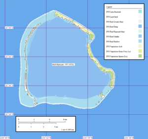
| Detailed map of Manuae | ||
Manuae (also known as Scilly , Putai , or Fenua ura ) is an atoll of the Society Islands in French Polynesia and politically belongs to the municipality of Maupiti . It is the westernmost of the Windward Islands , a subset of the Society Islands. It is located 550 km west of Papeete and 350 km west of Bora Bora . The atoll has a diameter of about 11 km. The area of the dry land is 4 km².
The first European to discover the island was the British Samuel Wallis in 1767. The remnants of the village founded at that time still exist on the northern part of the island. According to the 2007 census, the atoll has 24 inhabitants, 8 of them women. There are no ship or air connections to French Polynesia.
The “Compagnie Française de Tahiti”, the owner of the atoll, planted around 57,000 coconut trees around 1920 . Up to 70 tons of copra were produced per year. The plantation no longer exists. The lagoon was declared a nature reserve in 1992.
Many species of turtles are native to Scilly Atoll . They come to the beach annually to spawn. Since the coral reef of the atoll ring is closed, exchanges between the lagoon and the ocean are limited. A number of rare species live in the lagoon. There are also huge mussel beds (3-4 million oysters alone ).
Individual evidence
- ↑ Institut Statistique de Polynésie Française (ISPF) - Recensement de la population 2007 ( Memento of February 22, 2011 in the Internet Archive ) (French)


